Stil eropuit
Nederland Onder Je Voeten
Back to map

Province

Remarkable and historic places in North Holland

North Holland is far more than Amsterdam, the coast and a familiar list of day-trip destinations. Behind dikes, in old village centres, between dunes and peatlands and even beneath modern neighbourhoods lie traces of a province in constant transformation. Here you will find historic places, lesser-known sights and nature reserves where water, trade, belief, war, engineering and vanished settlement can still be read in the landscape. Those who explore North Holland slowly discover how closely different worlds sit beside one another. A vanished castle may lie next to a housing estate, a medieval church between roads and railways, and a quiet nature reserve only a short distance from a harbour or industrial zone. That proximity is precisely what makes the province so rich: the modern landscape did not erase the past, but placed new layers over it.

97 places

A province shaped by water

Few places in the Netherlands show the relationship between land and water as clearly as North Holland. The province consists of former islands, reclaimed lakes, peatlands, sea dikes, locks, pumping stations and polders that could survive only through centuries of intervention. The Afsluitdijk, the North Holland Canal, the reclamation of Haarlemmermeer and the IJmuiden locks tell the grand story of engineering and organisation. Smaller sites reveal the same struggle on a human scale: a dike storehouse, an old lock, a breach pond or a settlement lost beneath the water.

Travelling through North Holland therefore means moving through a working landscape rather than a static backdrop. Water is drained, retained, admitted and resisted. Levels are measured, pumps start operating and locks connect waters of different heights. Even where engineering is barely visible, it determines the form of villages, roads, farmland and nature reserves.

Failure is part of this history as well. Storm surges removed land, dike breaches created deep ponds and military inundations deliberately flooded large areas. Such sites show that safety was never self-evident. They reveal why North Holland is both a historic water landscape and a continuing feat of modern engineering.

Old traces beside modern cities

The urban belt around Amsterdam, Haarlem, Alkmaar and the North Sea Canal appears thoroughly modern, yet it contains many unexpected remains. A church that once formed the centre of a village now stands between roads or railway lines. A vanished castle survives only as a subtle change in ground level. Old cemeteries, boundary stones, country estates and industrial sites reveal how cities repeatedly absorbed and reshaped their surroundings.

Those looking for lesser-known sights near Amsterdam or Haarlem therefore need not travel far. The edges of the cities contain places that show how quickly landscapes changed function. A polder became a residential district, a shipyard became a cultural quarter and a defence line became a recreational landscape.

These places need no spectacular reconstruction. Their power lies in the contrast between what is visible today and what once occupied the site. A bend in a road, an empty field or an unusual line of trees may be enough to reveal an older structure. Those who pause for a moment discover that the modern province is built from many earlier landscapes.

Places to discover

The Adelbertus spring on the Adelbertusakker in Egmond-Binnen

Photo: Gmhogervorst

Credit: Photo: Gmhogervorst, via Wikimedia Commons, CC BY-SA 4.0

Licence: CC BY-SA 4.0

Changes: No changes.

Source ↗

Sacred places

Adelbertusakker near Egmond-Binnen

Bergen

On the edge of Egmond-Binnen lies the Adelbertusakker: a small, quiet site centred on the Adelbertus spring, the outlines of a vanished chapel and the memory of Saint Adelbert. According to tradition, Adelbert…

View this place
Dune landscape with water, sand and vegetation in the Amsterdam Water Supply Dunes

Photo: Willem Reinier de Jong

Credit: Photo: Willem Reinier de Jong / Nederland Onder Je Voeten

Licence: All rights reserved

Changes: No changes.

Special nature

Amsterdam Water Supply Dunes

Zandvoort, Bloemendaal and Noordwijk

Between Zandvoort and Noordwijk lie the Amsterdam Water Supply Dunes: an extensive dune landscape of open sand, flower-rich grasslands, wet valleys, scrub, woodland and long water channels. Water for Amsterdam…

View this place
Assumburg Castle in Heemskerk, seen across the moat.

Photo: Johan Bakker

Credit: Photo: Johan Bakker, via Wikimedia Commons, CC BY-SA 3.0 NL

Licence: CC BY-SA 3.0 NL

Changes: No changes.

Source ↗

See something ancient

Assumburg Castle

Heemskerk

On the eastern edge of Heemskerk, Assumburg Castle stands behind a broad moat, with brick wings, towers, bridges and a formal garden. It looks like a defensible medieval stronghold, but the place mainly shows…

View this place
View from the Amstelmeer area across Balgzand and the Wadden Sea

Photo: Michielverbeek

Credit: Photo: Michielverbeek, via Wikimedia Commons, CC BY-SA 3.0

Licence: CC BY-SA 3.0

Changes: No changes.

Source ↗

Special nature

Balgzand

Den Helder and Hollands Kroon

Between Den Helder and the former island of Wieringen lies Balgzand, an extensive landscape of tidal flats, channels, salt marshes and saline grasslands. At low tide, thousands of birds spread across the expos…

View this place
The Begijnhof in Amsterdam with houses around the quiet courtyard

Photo: Bert K.

Credit: Photo: Bert K., via Wikimedia Commons, CC BY 2.0

Licence: CC BY 2.0

Changes: No changes.

Source ↗

Sacred places

Begijnhof Amsterdam

Amsterdam

Behind gates in Amsterdam’s busy city centre lies the Begijnhof: an enclosed courtyard where Catholic women lived, prayed and worked for centuries without being nuns in the strict sense. Around the quiet lawn…

View this place
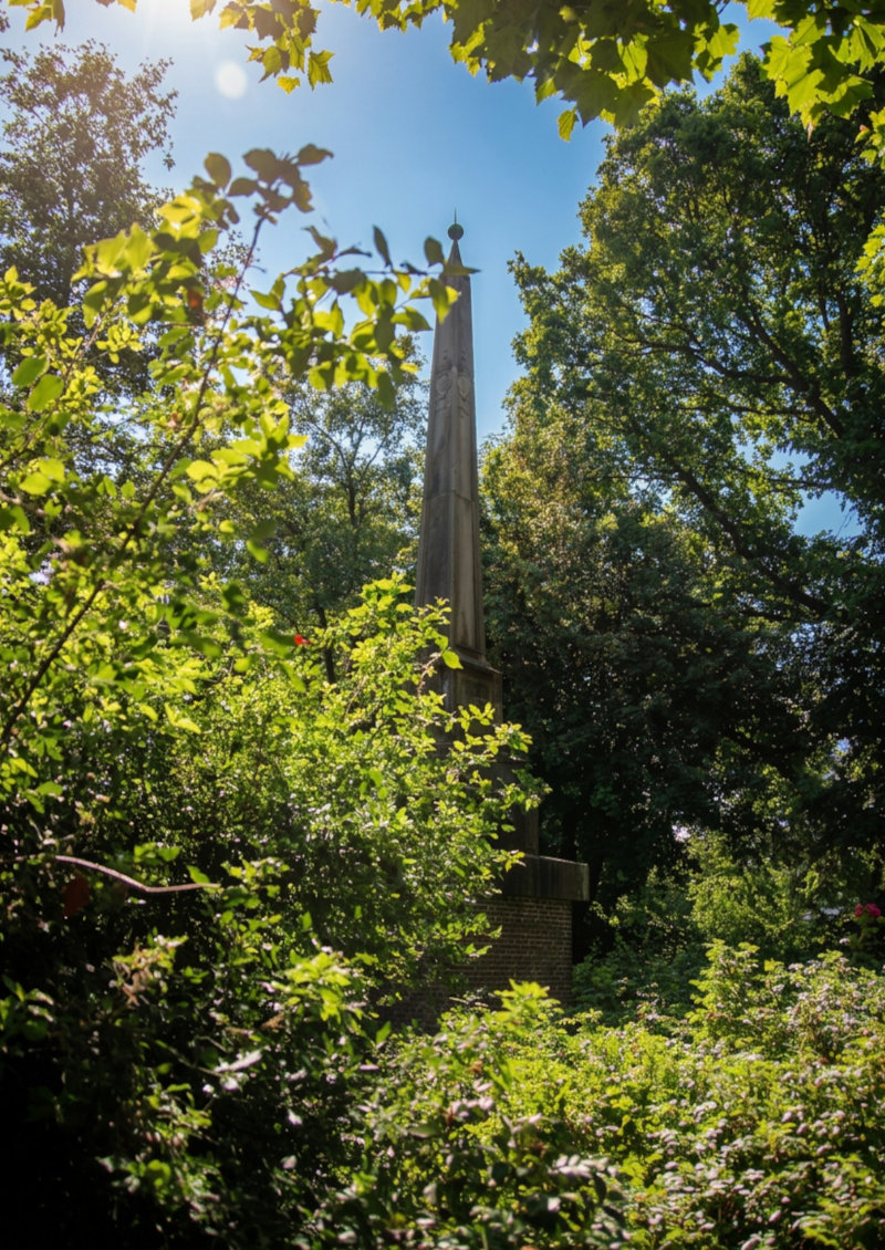
Obelisk on a lunette of the Beverwijk Defence Line

Photo: Marcelmulder68

Credit: Photo: Marcelmulder68, via Wikimedia Commons, CC BY-SA 3.0 NL

Licence: CC BY-SA 3.0 NL

Changes: No changes.

Source ↗

Almost forgotten

Beverwijk Defence Line

Beverwijk

On the northern edge of Beverwijk lies an almost hidden defensive landscape from 1800. Low earthen lunettes, a memorial obelisk and subtle height differences recall the hurried defence of Holland after the Ang…

View this place
Casemate at the Den Oever defensive position near the Stevin locks

Photo: Paul van Galen

Credit: Photo: Paul van Galen. Source: Rijksdienst voor het Cultureel Erfgoed, via Wikimedia Commons, CC BY-SA 4.0

Licence: CC BY-SA 4.0

Changes: No changes.

Source ↗

Almost forgotten

Casemates near Den Oever

Hollands Kroon

Near the Stevin locks and the start of the Afsluitdijk lie the casemates of Den Oever: low concrete defensive works that almost merge with dike, grass and hydraulic engineering. They recall a time when the Afs…

View this place
Village view in Velsen-Zuid, in the vicinity of the Roman archaeological sites

Photo: Gerard Hogervorst (Gmhogervorst)

Credit: Photo: Gerard Hogervorst, username Gmhogervorst on Dutch Wikipedia, via Wikimedia Commons, CC BY 1.0 NL

Licence: CC BY 1.0 NL

Changes: No changes.

Source ↗

Vanished places

Castellum Flevum, the Lost Roman Fort near Velsen

Velsen

At the beginning of the first century, a Roman harbour fort with ramparts, ditches, barracks, workshops, jetties and other harbour structures stood near Velsen. This fort, now known as Velsen 1, was built besi…

View this place
The Chapel of Grace of Our Lady in Need in Heiloo

Photo: M.arjon

Credit: Photo: M.arjon, via Wikimedia Commons, CC BY-SA 3.0 NL

Licence: CC BY-SA 3.0 NL

Changes: No changes.

Source ↗

Sacred places

Chapel of Our Lady in Need, Heiloo

Heiloo

On the Kapellaan in Heiloo lies the shrine of Our Lady in Need, the largest Marian pilgrimage site in the Netherlands. Around the Chapel of Grace, the Runxput well and the procession park, medieval Marian devo…

View this place
De Eenhoorn bell-jar farm beside the straight Middenweg in the De Beemster polder

Photo: A. J. van der Wal (Ton van der Wal)

Credit: Photo: A. J. van der Wal. Source: Rijksdienst voor het Cultureel Erfgoed, via Wikimedia Commons, CC BY-SA 4.0

Licence: CC BY-SA 4.0

Changes: No changes.

Source ↗

The Netherlands and water

De Beemster Reclaimed Polder

Purmerend

Within the ring dyke of De Beemster lies not a naturally evolved countryside, but a landscape projected from the drawing board across the bed of a drained lake. Between 1607 and 1612, Amsterdam merchants had t…

View this place
Rolling landscape of De Hoge Berg on Texel with grassland and open view

Photo: Txllxt TxllxT

Credit: Photo: Txllxt TxllxT, via Wikimedia Commons, CC BY-SA 4.0

Licence: CC BY-SA 4.0

Changes: No changes.

Source ↗

See something ancient

De Hoge Berg on Texel

Texel

De Hoge Berg is the oldest and highest part of Texel. This gently rolling landscape between Den Burg and Oudeschild is not a dune, but an old boulder-clay rise from the Ice Age. Turf walls, sheep barns, drinki…

View this place
Extensive dune landscape of De Muy on Texel with a low valley, grassland and high dune ridges

Photo: Txllxt TxllxT

Credit: Photo: Txllxt TxllxT, via Wikimedia Commons, CC BY-SA 4.0

Licence: CC BY-SA 4.0

Changes: No changes.

Source ↗

Special nature

De Muy

Texel

Between De Koog and De Slufter lies De Muy: a young dune landscape with steep slopes, an elongated wet valley, grasslands, the Muy lake and the dark pine copse known as Oorlogsschip. Unlike De Slufter, the inf…

View this place
The landscape of De Nollen near Den Helder with grass, water, dune relief and artworks by R.W. van de Wint

Photo: Lars van der Heide

Credit: Photo: Lars van der Heide, via Wikimedia Commons, CC BY-SA 4.0

Licence: CC BY-SA 4.0

Changes: No changes.

Source ↗

Almost forgotten

De Nollen near Den Helder

Den Helder

On the edge of Den Helder lies an inland dune landscape that for a long time fell between the cracks. There were bunkers, rough vegetation, storage areas, water features and pieces of ground the city barely lo…

View this place
View from the Hoeckelingsdam across the IJmeer, with De Vijfhoek and the power station in the distance

Photo: Milliped

Credit: Photo: Milliped, via Wikimedia Commons, CC BY-SA 4.0

Licence: CC BY-SA 4.0

Changes: No changes.

Source ↗

Special nature

De Vijfhoek

Diemen

On the eastern edge of Amsterdam lies De Vijfhoek, also known as the Diemer Vijfhoek or PEN Island. The nature area developed around 1970 on dredged and reclaimed material in the IJmeer. Within a few decades…

View this place
Former Diamantbuurt Bathhouse on Diamantstraat near Smaragdplein in Amsterdam-Zuid

Photo: Ceinturion

Credit: Photo: Ceinturion, via Wikimedia Commons, CC BY-SA 3.0 NL

Licence: CC BY-SA 3.0 NL

Changes: No changes.

Source ↗

Almost forgotten

Diamantbuurt Bathhouse

Amsterdam

On Diamantstraat, near Smaragdplein, stands a round former municipal bathhouse from 1925–1926. Today the building may first appear as a striking Amsterdam School object, but it tells a much more everyday story…

View this place
The Gemeenschapsmolen beside the Gaasp near Driemond

Photo: Quistnix

Credit: Photo: Quistnix, via Wikimedia Commons, CC BY-SA 2.5

Licence: CC BY-SA 2.5

Changes: No changes.

Source ↗

The Netherlands and water

Driemond and the Gaaspermolen on the Gaasp

Amsterdam

Driemond lies where the Gaasp, Gein and Smal Weesp meet. The village was formerly known as Geinbrug, but its present name refers both to this junction of waterways and to a vanished seventeenth-century country…

View this place
Historical map of Marken from 1793 showing the island’s former outline and dykes

Photo: Jan Peereboom

Credit: Image: Jan Peereboom, Noord-Hollands Archief, via Wikimedia Commons, public domain

Licence: Public domain

Changes: No changes.

Source ↗

Vanished places

Drowned Land near Marken

Waterland

Along the southern side of Marken, the island now ends at the dyke, but the land once extended farther. Thamiswerf, Houtemanswerf and Kraaienwerf stood on raised dwelling mounds: small neighbourhoods lost duri…

View this place
Former main building of Duin en Bosch near Castricum

Photo: Gerard Dukker

Credit: Photo: Gerard Dukker. Source: Rijksdienst voor het Cultureel Erfgoed, via Wikimedia Commons, CC BY-SA 4.0

Licence: CC BY-SA 4.0

Changes: No changes.

Source ↗

Almost forgotten

Duin en Bosch

Castricum

In the woods and dunes near Bakkum lies Duin en Bosch, a former provincial psychiatric hospital opened in 1909. The site was once a world of its own, with pavilions, water tower, church, tram depot, workshops…

View this place
Eierland Lighthouse on the northern tip of Texel, with the red tower above dunes and coastal landscape.

Photo: Alias 0591 (Rene Mensen)

Credit: Photo: Alias 0591 (Rene Mensen), via Wikimedia Commons, CC BY 2.0

Licence: CC BY 2.0

Changes: No changes.

See something ancient

Eierland Lighthouse

Texel

On the northern tip of Texel, Eierland Lighthouse stands as a red beacon above dunes, beach and sea. The tower was built in 1863-1864 because the Eierland Grounds were notorious for shipwrecks and the distance…

View this place
Open peat-meadow landscape with ditches and grasslands in the Eilandspolder near Noordeinde

Photo: Dqfn13

Credit: Photo: Dqfn13, via Wikimedia Commons, CC BY-SA 4.0

Licence: CC BY-SA 4.0

Changes: No changes.

Source ↗

Special nature

Eilandspolder

Alkmaar

Between De Rijp, Schermerhorn, Grootschermer and Noordeinde lies the Eilandspolder: a centuries-old low-peat landscape of narrow grasslands, ditches, reed fringes and small lakes. The old peat island lies high…

View this place
M 272 gun bunker belonging to the Heerenduin coastal battery near IJmuiden

Photo: Janericloebe

Credit: Photo: Janericloebe, via Wikimedia Commons, public domain

Licence: Public domain

Changes: No changes.

Source ↗

Almost forgotten

Festung IJmuiden and the Atlantic Wall

Velsen

During the Second World War, the German occupiers constructed one of the most heavily fortified areas in the Netherlands around the mouth of the North Sea Canal. Festung IJmuiden was intended to protect the ha…

View this place
Fort near Edam with earth-covered buildings, grass, water and fort grounds.

Photo: Kenneth Stamp

Credit: Photo: Kenneth Stamp / Hippolytushoef, commissioned by the Province of North Holland, via Wikimedia Commons, CC BY 2.0

Licence: CC BY 2.0

Changes: No changes.

Source ↗

See something ancient

Fort near Edam

Edam-Volendam

Fort near Edam lies north of the Edam sea lock, on the edge of the Zeevang polder and close to the old Zuiderzee dyke. The fort was built as a northern link in the Defence Line of Amsterdam and was meant to pr…

View this place
Great Saint Lawrence Church in Alkmaar seen from the church square

Photo: G.Lanting

Credit: Photo: G.Lanting, via Wikimedia Commons, CC BY-SA 3.0

Licence: CC BY-SA 3.0

Changes: No changes.

Source ↗

Sacred places

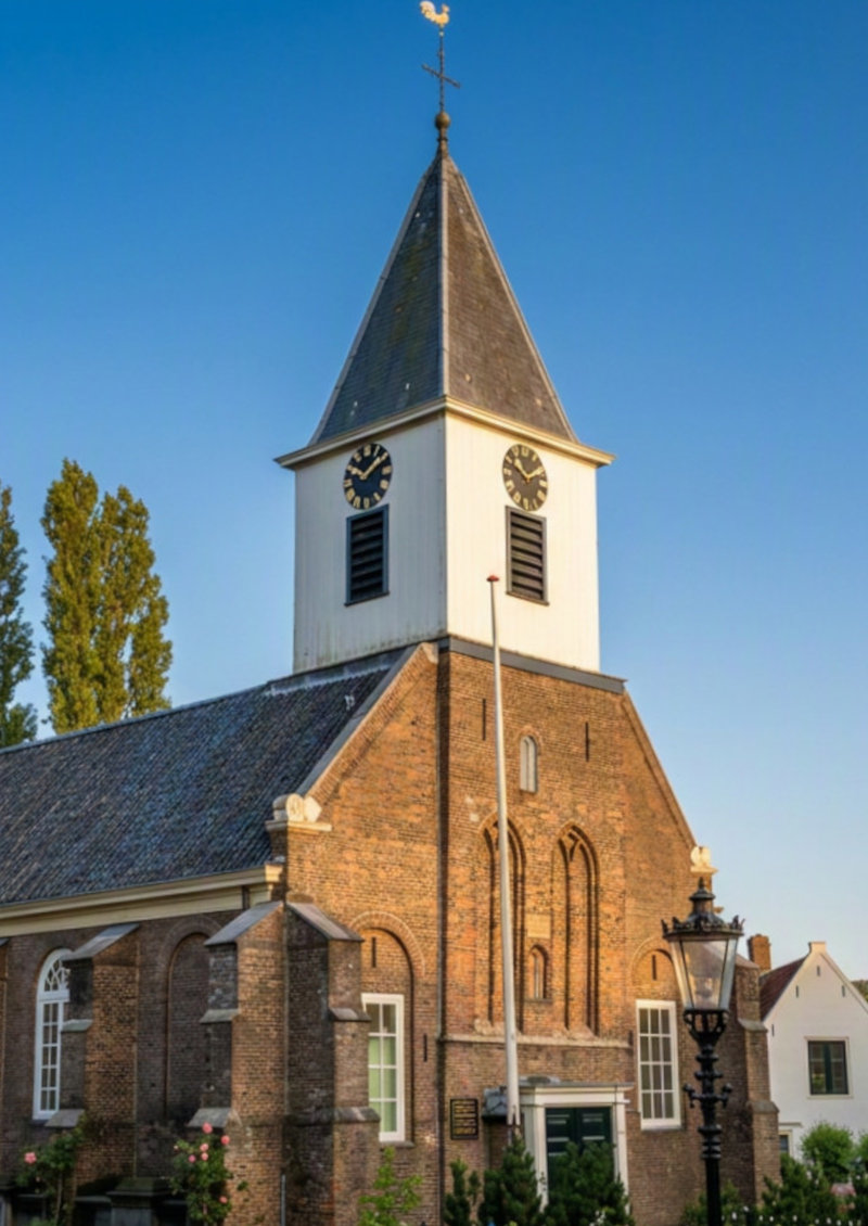
Great Church of Alkmaar

Alkmaar

In the heart of Alkmaar stands the Great Church, also known as the Great Saint Lawrence Church: a monumental late-medieval church that for centuries formed the religious, civic and musical heart of the city. O…

View this place
The Great or Saint Nicholas Church of Monnickendam, seen from the outside

Photo: Gouwenaar

Credit: Photo: Gouwenaar, via Wikimedia Commons, CC0 1.0

Licence: CC0 1.0

Changes: No changes.

Source ↗

Sacred places

Great Church of Monnickendam

Waterland

On De Zarken, just beyond the busiest part of the old town, stands the Great or Saint Nicholas Church of Monnickendam. This large late-Gothic hall church grew from the fifteenth century onward with a harbour t…

View this place
The Great or Saint Bavo Church in Haarlem, seen from the south side

Photo: Dosseman / Dick Osseman

Credit: Photo: Dosseman / Dick Osseman, via Wikimedia Commons, CC BY-SA 4.0

Licence: CC BY-SA 4.0

Changes: No changes.

Source ↗

Sacred places

Great or Saint Bavo Church, Haarlem

Haarlem

In the middle of Haarlem’s Grote Markt stands the Great or Saint Bavo Church: one of the most impressive medieval city churches in the Netherlands. Beneath the high wooden vault lie hundreds of gravestones, ol…

View this place
Former industrial building on the Hembrug site in Zaandam

Photo: Rosemoon

Credit: Photo: Rosemoon, via Wikimedia Commons, CC BY-SA 4.0

Licence: CC BY-SA 4.0

Changes: No changes.

Source ↗

Almost forgotten

Hembrug Site, Zaandam

Zaanstad

On the edge of Zaandam lies a site that for more than a century was hidden behind fences, security and secrecy. From 1895, weapons, ammunition and military equipment for the Dutch army were made on the Hembrug…

View this place
Hilde’s House in Castricum, the archaeology centre of North Holland.

Photo: Dqfn13

Credit: Photo: Dqfn13, via Wikimedia Commons, CC BY-SA 4.0

Licence: CC BY-SA 4.0

Changes: No changes.

Source ↗

See something ancient

Hilde’s House

Castricum

Next to Castricum station stands Hilde’s House, the archaeological home of North Holland. Inside, the old layers of the province do not appear as a ruin in the field, but as finds from the soil: pottery fragme…

View this place
Painting of the Miracle of Amsterdam, showing a woman retrieving the unburned host from the hearth fire

Photo: Unknown artist

Credit: Image: unknown artist, via Wikimedia Commons, public domain

Licence: Public domain

Changes: No changes.

Source ↗

Sacred places

Holy Site and the Miracle of Amsterdam

Amsterdam

According to tradition, the Miracle of Amsterdam took place in a house on Kalverstraat in March 1345: a consecrated host was vomited up, thrown into the hearth fire, yet remained intact. On this site arose the…

View this place
The lagoon, beach and young Hondsbossche Dunes at Camperduin

Photo: dronepicr

Credit: Photo: dronepicr, via Wikimedia Commons, CC BY 2.0

Licence: CC BY 2.0

Changes: No changes.

Source ↗

The Netherlands and water

Hondsbossche Dunes

Bergen

For centuries, the North Holland dune ridge was interrupted between Camperduin and Petten. Here the North Sea was held back not by natural dunes, but by the hard Hondsbossche and Pettemer sea dyke. When this b…

View this place
House of Nuwendoorn near Krabbendam with visible wall remains and a modern lookout tower.

Photo: EdwinH

Credit: Photo: EdwinH, via Wikimedia Commons, CC BY-SA 4.0

Licence: CC BY-SA 4.0

Changes: No changes.

Source ↗

See something ancient

House of Nuwendoorn

Schagen

Near Krabbendam lie the marked remains of the House of Nuwendoorn, a medieval stronghold associated with Count Floris V. Wall outlines, traces of the moat, open polder land and a modern tower show how Holland’…

View this place
Rough vegetation and water in the Lange Bretten nature area in Amsterdam

Photo: Marion Golsteijn

Credit: Photo: Marion Golsteijn, via Wikimedia Commons, CC BY-SA 4.0

Licence: CC BY-SA 4.0

Changes: No changes.

Source ↗

Vanished places

Huis te Bretten

Amsterdam

Huis te Bretten stood between the Haarlemmertrekvaart and the old Spaarndammerdijk from the seventeenth century onward. It became best known as an inn, tavern and eating house for travellers using the canal an…

View this place
The entrance to Huis te Vraag cemetery on the Rijnsburgstraat in Amsterdam

Photo: Marion Golsteijn

Credit: Photo: Marion Golsteijn, via Wikimedia Commons, CC BY-SA 3.0

Licence: CC BY-SA 3.0

Changes: No changes.

Source ↗

Vanished places

Huis te Vraag

Amsterdam

On the Rijnsburgstraat lies Huis te Vraag, an old cemetery established on the grounds of a vanished country house. Its name predates the cemetery and survived after the house was demolished in 1890. Among grav…

View this place
Ice cellar on Elswout Estate near Overveen

Photo: Martinklumper.nl

Credit: Photo: Martinklumper.nl, via Wikimedia Commons, CC BY-SA 4.0

Licence: CC BY-SA 4.0

Changes: No changes.

Source ↗

Almost forgotten

Ice Cellar of Elswout Estate

Bloemendaal

Hidden on Elswout Estate lies a nineteenth-century ice cellar: a quiet reminder of the time before electric refrigeration. Winter ice was stored here to keep food, drink and luxury goods cool in summer. The sm…

View this place
Open peat-meadow landscape with water and reeds in the Ilperveld.

Photo: Maarten Sepp

Credit: Photo: Maarten Sepp, via Wikimedia Commons, CC BY-SA 3.0

Licence: CC BY-SA 3.0

Changes: No changes.

Source ↗

Special nature

Ilperveld

Landsmeer

Between Landsmeer, Den Ilp, Ilpendam and the North Holland Canal lies the Ilperveld: a watery low-peat landscape with long ditches, reed beds, wet meadows, quaking bogs and hundreds of narrow peat islands. Clo…

View this place
Burial fields of the Jewish cemetery Beth Haim in Ouderkerk aan de Amstel

Photo: Rokus C

Credit: Photo: Rokus C, via Wikimedia Commons, CC BY 3.0

Licence: CC BY 3.0

Changes: No changes.

Source ↗

Almost forgotten

Jewish Cemetery of Ouderkerk aan de Amstel

Ouder-Amstel

Along the Amstel lies Beth Haim, the Portuguese-Jewish cemetery of Ouderkerk aan de Amstel. Since 1614, members of the Sephardic Jewish community have been buried here. Among horizontal slabs, marble graveston…

View this place
Green wooden houses in a densely built historic residential area in Marken

Photo: Rene Cortin

Credit: Photo: Rene Cortin, via Wikimedia Commons, CC BY-SA 4.0

Licence: CC BY-SA 4.0

Changes: No changes.

Source ↗

The Netherlands and water

Marken: Living with the Zuiderzee

Waterland

Marken became separated from Waterland during the Middle Ages and remained a low island in the Zuiderzee for centuries. Because dikes could not always keep the water out, residents concentrated their houses on…

View this place
Open water, reeds and marsh landscape in the Naardermeer

Photo: Rijkswaterstaat

Credit: Source: Rijkswaterstaat Image Bank, Rijkswaterstaat, via Wikimedia Commons. Attribution to Rijkswaterstaat is mandatory.

Licence: Attribution only – Rijkswaterstaat

Changes: No changes.

Source ↗

Special nature

Naardermeer

Gooise Meren

Between Amsterdam, Hilversum, Weesp and Naarden lies the Naardermeer: a natural lake with clear water, extensive reed beds, swamp woodland and waterlogged grasslands. The area faced repeated attempts at draina…

View this place
Motor tanker Dione on slipway 5 at the NDSM shipyard in September 1966

Photo: Unknown photographer / Anefo

Credit: Anefo Photo Collection, Dutch National Archives, via Wikimedia Commons, CC0 1.0

Licence: CC0 1.0

Changes: No changes.

Source ↗

Almost forgotten

NDSM Wharf and the Lost Shipbuilding Industry

Amsterdam

Thousands of workers built passenger ships, freighters, tankers and naval vessels at the NDSM shipyard in Amsterdam North. The yard developed from companies that shaped Amsterdam’s modern shipbuilding industry…

View this place
Zeesluis IJmuiden seen from the freshwater side of the North Sea Canal

Photo: Dronewar79

Credit: Photo: Dronewar79, via Wikimedia Commons, CC BY-SA 4.0

Licence: CC BY-SA 4.0

Changes: No changes.

Source ↗

The Netherlands and water

North Sea Canal and the IJmuiden Locks

Velsen

Where the dunes and broad Breesaap valley once lay, a direct shipping route has connected Amsterdam with the North Sea since 1876. The North Sea Canal replaced the long detour through the Noordhollandsch Kanaa…

View this place
View of the Old Church or Maartenskerk in the centre of Oosterend on Texel

Photo: Txllxt TxllxT

Credit: Photo: Txllxt TxllxT, via Wikimedia Commons, CC BY-SA 4.0

Licence: CC BY-SA 4.0

Changes: No changes.

Source ↗

See something ancient

Old Church of Oosterend

Texel

The Old Church of Oosterend, also known as the Maartenskerk, is the oldest church on Texel. The origins of the building go back to the 11th century. The church and the village centre around it bring together e…

View this place

Almost forgotten

Old General Cemetery of Huizen

Huizen

On the edge of old Huizen lies a cemetery from 1828 that tells far more than its quiet paths first reveal. Sober burial fields, cast-iron number markers, simple stones and an old funeral hall preserve the ment…

View this place
Interior of the hidden church of Our Lord in the Attic in Amsterdam

Photo: Remi Mathis

Credit: Photo: Remi Mathis, via Wikimedia Commons, CC BY-SA 3.0

Licence: CC BY-SA 3.0

Changes: No changes.

Source ↗

Sacred places

Our Lord in the Attic Amsterdam

Amsterdam

On the Oudezijds Voorburgwal, Our Lord in the Attic looks from the outside like an Amsterdam canal house, but hidden at the top is a complete Catholic clandestine church. In the seventeenth century, merchant J…

View this place
The Petrus Church in Old Sloterdijk, between old village buildings and the modern city

Photo: Willem Reinier de Jong

Credit: Photo: Willem Reinier de Jong / Nederland Onder Je Voeten

Licence: All rights reserved

Changes: No changes.

Almost forgotten

Petrus Church and Old Sloterdijk

Amsterdam

Between railways, motorway, offices and high-rise buildings, an unexpected remnant of the old village of Sloterdijk survives around the Petrus Church. Church, churchyard, dike and a few houses form a historic…

View this place
Interior of the Portuguese Synagogue in Amsterdam with wooden barrel vault, brass candle chandeliers and hechal

Photo: Sergé Technau / Cultural Heritage Agency of the Netherlands

Credit: Photo: Sergé Technau / Cultural Heritage Agency of the Netherlands, via Wikimedia Commons, CC BY-SA 4.0

Licence: CC BY-SA 4.0

Changes: No changes.

Source ↗

Sacred places

Portuguese Synagogue Amsterdam

Amsterdam

On Mr. Visserplein stands the Portuguese Synagogue, also known as the Esnoga or Snoge: an impressive seventeenth-century house of prayer of Amsterdam’s Sephardic Jewish community. Built between 1671 and 1675…

View this place
The Hoorneboegse Heide near Hilversum, where prehistoric Celtic fields survive as subtle relief traces in the landscape.

Photo: Globe-trotter

Credit: Photo: Globe-trotter, originally published as user (WT-shared) Globe-trotter on Wikivoyage, via Wikimedia Commons, CC BY-SA 4.0

Licence: CC BY-SA 4.0

Changes: No changes.

Source ↗

See something ancient

Prehistoric Celtic fields on the Hoorneboegse Heide

Hilversum

On the Hoorneboegse Heide south of Hilversum, a prehistoric Celtic field complex lies hidden in the relief of the heathland. The low banks and square field patterns are not always clearly visible to the naked…

View this place
Radboud Castle in Medemblik seen from the castle moat.

Photo: IJsbrand Heins

Credit: Photo: IJsbrand Heins. Source: Rijksdienst voor het Cultureel Erfgoed, via Wikimedia Commons, CC BY-SA 4.0

Licence: CC BY-SA 4.0

Changes: No changes.

Source ↗

See something ancient

Radboud Castle

Medemblik

Radboud Castle stands on the eastern side of Medemblik, close to the harbour, town and IJsselmeer. The castle was built around 1288 on the orders of Count Floris V of Holland, as a stone anchor of power in rec…

View this place
Radboud Castle in Medemblik, seen from the moat.

Photo: Gouwenaar

Credit: Photo: Gouwenaar, via Wikimedia Commons, CC0 1.0

Licence: CC0 1.0

Changes: No changes.

Source ↗

Strange stories

Radboud’s Treasure

Medemblik

Beneath Radboud Castle in Medemblik, memory is said to linger of an older fortress, a pagan king and a treasure that never entirely disappeared from the story. The name Radboud pulls the castle back to a time…

View this place
Village view of Ransdorp with the blunt church tower in the flat Waterland landscape

Photo: Michielverbeek

Credit: Photo: Michielverbeek, via Wikimedia Commons, CC BY-SA 4.0

Licence: CC BY-SA 4.0

Changes: No changes.

Source ↗

Almost forgotten

Ransdorp Church and Tower

Amsterdam

In the flat landscape of Waterland, the blunt tower of Ransdorp stands as the remnant of a village that was once far more important than its quiet street now suggests. The church site goes back to the Middle A…

View this place
Demolition of the church tower in the village of Rijk during the expansion of Schiphol in 1959

Photo: Harry Pot / Anefo

Credit: Photo: Harry Pot / Anefo, Dutch National Archives, via Wikimedia Commons, CC0

Licence: CC0 1.0

Changes: No changes.

Source ↗

Vanished places

Rijk, the Village Lost to Schiphol

Haarlemmermeer

Until 1959, the village of Rijk occupied part of the area now dominated by the Schiphol airport landscape. The settlement developed after the drainage of the Haarlemmermeer and grew along the Aalsmeerderweg, V…

View this place
View of the Ruined Church in Bergen, with the restored choir and the ruined walls of the vanished nave

Photo: Dqfn13

Credit: Photo: Dqfn13, via Wikimedia Commons, CC BY-SA 4.0

Licence: CC BY-SA 4.0

Changes: No changes.

Source ↗

Sacred places

Ruined Church of Bergen

Bergen

In the centre of Bergen stands the Ruined Church: at once church, ruin, churchyard and village heart. A chapel already stood here in the Middle Ages, later growing into a pilgrimage church after the Miracle of…

View this place
The Ruins of Brederode near Santpoort-Zuid with walls, towers and inner space of the medieval castle

Photo: Raimond Spekking

Credit: © Raimond Spekking / CC BY-SA 4.0, via Wikimedia Commons

Licence: CC BY-SA 4.0

Changes: No changes.

Source ↗

Almost forgotten

Ruins of Brederode

Velsen

On the edge of Santpoort-Zuid stand the broken-open remains of Brederode Castle. Walls, towers, moats and courtyards recall a noble power that once weighed heavily on Kennemerland. The castle was built in the…

View this place
Statue of Saint Cunera on the Cunera Church named after her in Nibbixwoud

Photo: Dqfn13

Credit: Photo: Dqfn13, via Wikimedia Commons, CC BY-SA 4.0

Licence: CC BY-SA 4.0

Changes: No changes.

Source ↗

Sacred places

Saint Cunera of Nibbixwoud

Medemblik

In Nibbixwoud, Saint Cunera was venerated from the thirteenth or fourteenth century as protector of livestock. On her feast day, 12 June, cattle were gathered around the church, blessed by priests and entruste…

View this place
Maria Magdalena Church on Dorpsstraat in Wormer

Photo: Gerard Dukker / Cultural Heritage Agency of the Netherlands

Credit: Photo: Gerard Dukker / Cultural Heritage Agency of the Netherlands, via Wikimedia Commons, CC BY-SA 4.0

Licence: CC BY-SA 4.0

Changes: No changes.

Source ↗

Sacred places

Saint Odulphus of Wormer

Wormerland

Before the Reformation, Saint Odulphus was especially venerated by sailors in Wormer. Around his feast day on 12 June, a procession moved through the village, carrying an image of Odulphus. The old devotion ha…

View this place
Panoramic view from Schellingwoude towards the Oranje Locks

Photo: Henk Monster

Credit: Photo: Henk Monster, via Wikimedia Commons, CC BY 3.0

Licence: CC BY 3.0

Changes: No changes.

Source ↗

The Netherlands and water

Schellingwoude and the Oranje Locks

Amsterdam

On the eastern side of Amsterdam-Noord, the old dike village of Schellingwoude stands beside the Oranje Locks. The Waterlandse Zeedijk made settlement along the IJ possible, while the lock complex has regulate…

View this place
Open sand, heath and dune landscape in the Schoorl Dunes

Photo: FrDr

Credit: Photo: FrDr, via Wikimedia Commons, CC BY-SA 4.0

Licence: CC BY-SA 4.0

Changes: No changes.

Source ↗

Special nature

Schoorl Dunes

Bergen

Near Schoorl lies one of the widest and highest dune areas in the Netherlands. The Schoorl Dunes contain open sand, steep dune ridges, heath, pine woodland and wet dune valleys. The transitions between these l…

View this place
Gable stones of the Fort of Sjako on the Elandsgracht in Amsterdam

Photo: Martin Alberts / Amsterdam City Archives

Credit: Photo: Martin Alberts / Amsterdam City Archives, via Wikimedia Commons, CC0 1.0

Licence: CC0 1.0

Changes: No changes.

Source ↗

Strange stories

Sjako’s Gang

Amsterdam

On Amsterdam’s Elandsgracht, gable stones recall Sjako, the notorious eighteenth-century thief around whom one of the city’s most persistent crime legends took shape. Jacob Frederik Muller, also known as Jaco…

View this place
Sluishuis beside Lake IJmeer on IJburg

Photo: Kleon3

Credit: Photo: Kleon3, via Wikimedia Commons, CC BY-SA 4.0

Licence: CC BY-SA 4.0

Changes: No changes.

Source ↗

The Netherlands and water

Sluishuis and the Made Land of IJburg

Amsterdam

Sluishuis stands at the western entrance to IJburg, an Amsterdam district developed from 1999 on artificial islands in Lake IJmeer. The residential building partly rises above the water and encloses a small in…

View this place
Entrance gate of Snouck van Loosen Park in Enkhuizen

Photo: Gouwenaar

Credit: Photo: Gouwenaar, via Wikimedia Commons, CC0 1.0

Licence: CC0 1.0

Changes: No changes.

Source ↗

Almost forgotten

Snouck van Loosen Park

Enkhuizen

Near Enkhuizen’s station and harbour lies Snouck van Loosen Park: a green residential park from 1895–1897 with workers’ houses, created from the legacy of Margaretha Maria Snouck van Loosen. What now looks mai…

View this place
The Doodweg toward Hilversum, seen as an old road through the Gooi landscape

Photo: Gerard Dukker / Cultural Heritage Agency of the Netherlands

Credit: Photo: Gerard Dukker / Cultural Heritage Agency of the Netherlands, via Wikimedia Commons, CC BY-SA 4.0

Licence: CC BY-SA 4.0

Changes: No changes.

Source ↗

Strange stories

Stories around the Death Road to Hilversum

Hilversum / Laren

Across the Westerheide between Laren and Hilversum run old straight roads connected with the Sint-Janskerkhof cemetery. One of them remained known in Hilversum as Doodweg, or Death Road. Such roads were associ…

View this place
The avenue of Ter Coulster Estate in Heiloo with the monumental gateposts and tree-lined drive

Photo: Bart van der Feen de Lille

Credit: Photo: Bart van der Feen de Lille, via Wikimedia Commons, CC BY-SA 4.0

Licence: CC BY-SA 4.0

Changes: No changes.

Source ↗

Almost forgotten

Ter Coulster, Heiloo

Heiloo

In the middle of Heiloo lies an old estate where the vanished castle of Ter Coulster still faintly shows through the landscape. Almost nothing remains of the house itself, but the avenue, the seventeenth-centu…

View this place
Ban post on the Amsterdamseweg near Amstelveen, close to Heempark De Braak

Photo: Willem Reinier de Jong

Credit: Photo: Willem Reinier de Jong / Nederland Onder Je Voeten

Licence: All rights reserved

Changes: No changes.

Strange stories

The Ban Posts and the Gambler of Nieuwer-Amstel

Amstelveen

On the Amsterdamseweg in Amstelveen stands an old ban post: a boundary marker that once indicated how close banished people from Amsterdam were allowed to come. Around such boundaries, a remarkable local legen…

View this place
Etersheimer Braakmolen windmill in the open polder landscape near Etersheim

Photo: Marjon

Credit: Photo: Marjon, via Wikimedia Commons, CC BY-SA 2.0

Licence: CC BY-SA 2.0

Changes: No changes.

Source ↗

Strange stories

The Bells of the Drowned Land

Edam-Volendam

Near Etersheim, an old story lies beneath the water. The earlier village stood closer to the Zuiderzee and eventually disappeared into what is now the Markermeer. Later tales lingered about church walls, treas…

View this place
Eighteenth-century print with a symbolic representation of the destruction of Vronen

Photo: Anonymous printmaker, after Reinier van Persijn

Credit: Image: anonymous printmaker after Reinier van Persijn, Rijksmuseum, via Wikimedia Commons, public domain

Licence: CC0 1.0

Changes: No changes.

Source ↗

Vanished places

The Destruction of Vronen

Dijk en Waard

Beneath present-day Sint Pancras lie the remains of Vronen, a medieval village on an ancient coastal ridge. On 27 March 1297, the rebellious West Frisians suffered a decisive defeat here against the army of th…

View this place
The Seven Pancakes in the Doolhof on the Hoge Berg on Texel.

Photo: Roepers

Credit: Photo: Roepers, via Wikimedia Commons, CC BY-SA 4.0

Licence: CC BY-SA 4.0

Changes: No changes.

Source ↗

Strange stories

The Devil’s Stone of Texel

Texel

Beneath the Seven Pancakes on the Hoge Berg, a stone was said to lie that refused to end. What rose above the ground was only its head; the rest was believed to vanish deep beneath Texel, under the sea, all th…

View this place
Historical painting of the courtyard of the East India House in Amsterdam, surrounded by tall wings with galleries and numerous windows

Photo: Anonymous

Credit: Painting: anonymous. Rijksmuseum collection, via Wikimedia Commons, CC0 1.0

Licence: CC0 1.0

Changes: No changes.

Source ↗

See something ancient

The East India House and the Government of the VOC

Amsterdam

Behind a sandstone gateway in Amsterdam’s Oude Hoogstraat stands the former administrative centre of the Amsterdam chamber of the Dutch East India Company. From 1606 onward, directors, accountants, mapmakers…

View this place
Historical map of the Hondsbossche sea defence, dunes and polders near Petten

Photo: Hendrik de Leth, after Jan Spruytenburgh

Credit: Map: Hendrik de Leth, after Jan Spruytenburgh, Rijksmuseum, via Wikimedia Commons, CC0

Licence: CC0 1.0

Changes: No changes.

Source ↗

Vanished places

The First Petten

Schagen

South of present-day Petten stood a medieval fishing village near the Hondsbosch dunes. It was known as Petten dat Hontsbosch hiet and is linked in some reconstructions with Petten in Nolmerban. During the St…

View this place
Ruins of Brederode Castle near Santpoort-Zuid, with brick walls and moat

Photo: Arch

Credit: Photo: Arch, via Wikimedia Commons, Public Domain

Licence: Public Domain

Changes: No changes.

Source ↗

Strange stories

The Ghost of Brederode

Velsen

Around the Ruins of Brederode near Santpoort-Zuid there has long been an atmosphere of decay, abandonment and nocturnal imagination. The late medieval castle was completed in 1318, suffered heavy damage throug…

View this place
Ships during a storm on the Zuiderzee, with a dark sky and rough water

Photo: Wenceslaus Hollar

Credit: Print: Wenceslaus Hollar, 1635 / Rijksmuseum, via Wikimedia Commons, CC0 1.0

Licence: CC0 1.0

Changes: No changes.

Source ↗

Strange stories

The Ghost Ship of the Zuiderzee

Enkhuizen

The Ghost Ship of the Zuiderzee belongs to the old water stories of storms, shipwrecks and omens on the former inland sea. In some traditions, a ship with full sails appeared during violent weather, sailing ag…

View this place
Front façade of the House with the Heads on the Keizersgracht in Amsterdam.

Photo: Michele Ahin

Credit: Photo: Michele Ahin, via Wikimedia Commons, CC BY-SA 3.0 NL

Licence: CC BY-SA 3.0 NL

Changes: No changes.

Source ↗

Strange stories

The House with the Heads

Amsterdam

On the Keizersgracht, six stone heads look down from an ornate seventeenth-century façade. Officially they are classical deities, but Amsterdam gave them a darker story: six robbers who entered the house and w…

View this place
Rough vegetation and open space in the Lange Bretten in Amsterdam-West

Photo: Marion Golsteijn

Credit: Photo: Marion Golsteijn, via Wikimedia Commons, CC BY-SA 4.0

Licence: CC BY-SA 4.0

Changes: No changes.

Source ↗

Special nature

The Lange Bretten

Amsterdam

Between Sloterdijk and Halfweg lies the Lange Bretten, an elongated urban wilderness of reeds, scrub, water, muddy paths and open grassland. Railway lines, harbour edges and residential districts remain close…

View this place
Eighteenth-century imaginative drawing of the lost castle of Wijdenes

Photo: Jacobus Stellingwerff

Credit: Drawing: Jacobus Stellingwerff, after Andries Schoemaker, Westfries Archives collection, via Wikimedia Commons, public domain

Licence: Public domain

Changes: No changes.

Source ↗

Vanished places

The Lost Castle of Wijdenes

Drechterland

A castle belonging to Count Floris V stood near the former shoreline at Wijdenes during the late thirteenth century. The fortress supported his authority in West Friesland and probably existed for fewer than f…

View this place
Drawing from 1730 showing the last ruins of Kronenburg Castle near Castricum

Photo: Abraham Rademaker

Credit: Image: Abraham Rademaker, Noord-Hollands Archief, via Wikimedia Commons, CC0

Licence: CC0 1.0

Changes: No changes.

Source ↗

Vanished places

The Lost Kronenburg Castle near Castricum

Castricum

Kronenburg Castle once stood in the meadows southeast of Castricum: an almost square moated stronghold with towers, ditches and a separate outer bailey. Destruction and prolonged decay erased it so thoroughly…

View this place
Gable stone with the Mermaid of Edam at Jan Nieuwenhuizenplein 15 in Edam

Photo: Gouwenaar

Credit: Photo: Gouwenaar, via Wikimedia Commons, CC0 1.0

Licence: CC0 1.0

Changes: No changes.

Source ↗

Strange stories

The Mermaid of Edam

Edam-Volendam

The Mermaid of Edam is a North Holland water legend about a strange sea woman who ended up in the former Purmermeer after a storm. According to the saga, she was captured by Edam milkmaids or local residents…

View this place
Muiderslot near the mouth of the Vecht in Muiden.

Photo: Ludovic Hirlimann

Credit: Photo: Ludovic Hirlimann, via Wikimedia Commons, CC BY-SA 2.0

Licence: CC BY-SA 2.0

Changes: No changes.

Source ↗

Strange stories

The Mermaid of Muiden

Gooise Meren

At the mouth of the Vecht, where Muiden looked out over the old Zuiderzee, a mermaid was once said to have been pulled from the water. What first seemed a wondrous catch soon became a threat: the sea grew furi…

View this place
The Noordhollandsch Kanaal seen from the bridge at Schoorldam

Photo: Gouwenaar

Credit: Photo: Gouwenaar, via Wikimedia Commons, CC0 1.0

Licence: CC0 1.0

Changes: No changes.

Source ↗

The Netherlands and water

The Noordhollandsch Kanaal

Alkmaar

Between Amsterdam and Den Helder runs a canal that ranked among the world’s largest shipping works when it opened in 1824. King William I ordered its construction because large sea-going vessels found it incre…

View this place
The Stump Tower of Spaarnwoude with the brick church on the old church site

Photo: Ron Pichel (Fotoburo de Boer)

Credit: Photo: Ron Pichel. Noord-Hollands Archief / Fotoburo de Boer, via Wikimedia Commons, CC0 1.0

Licence: CC0 1.0

Changes: No changes.

Source ↗

Almost forgotten

The Stump Tower of Spaarnwoude

Haarlemmermeer

On Kerkweg in Spaarnwoude stands a tower that carries its loss in its name. The Stump Tower is the remnant of a much older church site on an ancient beach ridge. The medieval tower was shortened in the ninetee…

View this place
De Slufter on Texel with dunes, a sandy plain, salt-marsh vegetation and a walking path

Photo: Rasbak

Credit: Photo: Rasbak, via Wikimedia Commons, CC BY-SA 3.0

Licence: CC BY-SA 3.0

Changes: No changes.

Source ↗

Special nature

The Texel Slufter

Texel

On the north-western side of Texel lies De Slufter, a rare salt marsh connected directly to the North Sea by a channel and a branching network of tidal creeks. At high water, seawater penetrates deep between t…

View this place
Historical ledger stones from Petten’s Dutch Reformed church, demolished in 1944

Photo: EdwinH

Credit: Photo: EdwinH, via Wikimedia Commons, CC BY-SA 4.0

Licence: CC BY-SA 4.0

Changes: No changes.

Source ↗

Vanished places

The Third Petten

Schagen

Until the Second World War, the third Petten stood around its church and old cemetery. The coastal village consisted of low houses, streets, a town hall, shops, schools, farms and a church behind the sea defen…

View this place
Historical photograph from 1959 showing the arched bridge and gateposts of the vanished Volgerwijck estate

Photo: Siebe Jan Bouma

Credit: Photo: Siebe Jan Bouma. Source: Rijksdienst voor het Cultureel Erfgoed, via Wikimedia Commons, CC BY-SA 4.0

Licence: CC BY-SA 4.0

Changes: No changes.

Source ↗

Vanished places

The Vanished Country Estates of the Beemster

Purmerend

During the seventeenth century, dozens of country estates belonging to Amsterdam merchants and administrators lined the straight roads of the Beemster. Ornamental gateways opened onto mansions, formal gardens…

View this place
Gemaal Monnickendam at the Nieuwendam, above the place where remains of an older wooden lock were found

Photo: Hobbema

Credit: Photo: Hobbema, via Wikimedia Commons, CC0 1.0

Licence: CC0 1.0

Changes: No changes.

Source ↗

Almost forgotten

The Vanished Lock near Monnickendam

Waterland

Just north of Monnickendam lies the Nieuwendam, where the Purmer Ee reaches the Gouwzee. Beneath road, dike and pumping station, a wooden lock lay hidden for centuries. The lock belonged to the water connectio…

View this place
Exterior of De Cruquius steam pumping station on the Ringvaart of the Haarlemmermeer polder.

Photo: Loek Tangel

Credit: Photo: Loek Tangel / Cultural Heritage Agency of the Netherlands, via Wikimedia Commons, CC BY-SA 4.0

Licence: CC BY-SA 4.0

Changes: No changes.

Source ↗

Strange stories

The Water Wolf of the Haarlemmermeer

Haarlemmermeer

Where roads, fields, villages and Schiphol now lie, there was once a lake that ate the land. The Haarlemmermeer was called the Water Wolf: not a creature of flesh and blood, but a monster of wind, waves and va…

View this place
Burial mounds on the Westerheide near Laren.

Photo: Jan dijkstra

Credit: Photo: Jan dijkstra, via Wikimedia Commons, CC BY-SA 4.0

Licence: CC BY-SA 4.0

Changes: No changes.

Source ↗

Strange stories

The White Ladies of the Gooi

Hilversum and Laren

On the Westerheide between Hilversum and Laren lie prehistoric burial mounds, old paths and traces of the dead beneath the sand. By day it is an open Gooi heathland, but in mist and evening light the silent mo…

View this place
The Hondsbossche sea defence and renewed coast near Petten and Camperduin.

Photo: Jan W.H. Werner

Credit: Photo: Jan W.H. Werner, via Wikimedia Commons, CC BY-SA 4.0

Licence: CC BY-SA 4.0

Changes: No changes.

Source ↗

Strange stories

The Witches of the Hondsbossche Sea Defence

Schagen and Bergen

On the coast near Petten and Camperduin, people fought the sea, wind and erosion for centuries. Dykes broke, land disappeared, livestock fell ill and storms could break a community in a single night. In such a…

View this place
The Oude Kerk on Oudekerksplein in Amsterdam, seen from the outside

Photo: Yair Haklai

Credit: Photo: Yair Haklai, via Wikimedia Commons, CC BY-SA 4.0

Licence: CC BY-SA 4.0

Changes: No changes.

Source ↗

Almost forgotten

Vanished Burial Ground on Oudekerksplein

Amsterdam

In the bustle of Amsterdam’s Red Light District lies a square that was once a churchyard. For centuries, the dead were buried around the Oude Kerk before the burial ground was cleared and the site gradually be…

View this place
The Oudorperpolder near Alkmaar with the Zeswielen mills, meadows and water

Photo: Joop Elsinga

Credit: Photo: Joop Elsinga, collection Regional Archive Alkmaar, via Wikimedia Commons, CC0 1.0

Licence: CC0 1.0

Changes: No changes.

Source ↗

Almost forgotten

Vanished Castles of the Oudorperpolder

Alkmaar

In the Oudorperpolder near Alkmaar, the remains of two medieval castles lie almost entirely beneath the grass. The Nieuwburg and the Middelburg were once powerful coercive castles in the struggle between Holla…

View this place
The Maartenskerk in Oosterend on Texel, seen from Kerkstraat

Photo: Txllxt TxllxT

Credit: Photo: Txllxt TxllxT, via Wikimedia Commons, CC BY-SA 4.0

Licence: CC BY-SA 4.0

Changes: No changes.

Source ↗

Sacred places

Village Church of Oosterend, Texel

Texel

In the centre of Oosterend stands the Maartenskerk, the oldest church on Texel. On a raised churchyard between old village streets, this church preserves layers of tuff stone, devotion to Saint Martin, the Ref…

View this place
The West Frisian Ring Dyke with grassy dyke, road and open polder landscape.

Photo: Vysotsky

Credit: Photo: Vysotsky (Wikimedia), CC BY-SA 4.0

Licence: CC BY-SA 4.0

Changes: No changes.

Source ↗

See something ancient

West Frisian Ring Dyke

Koggenland

The West Frisian Ring Dyke encloses the old West Frisian land with a dyke ring of more than 126 kilometres. In the Middle Ages, separate embankments and water defences gradually grew together into a protective…

View this place
The White Church of Heiloo with tower and white exterior walls

Photo: Dqfn13

Credit: Photo: Dqfn13, via Wikimedia Commons, CC BY-SA 3.0

Licence: CC BY-SA 3.0

Changes: No changes.

Source ↗

Sacred places

White Church of Heiloo

Heiloo

On Heerenweg in Heiloo, the White Church stands on one of the oldest church sites in North Holland. Its history goes back to an early church around the year 700, on the beach ridge where the village arose. The…

View this place
Large erratic boulder near Westerklief on Wieringen, marked as a geological monument

Photo: Linktoevoeger

Credit: Photo: Linktoevoeger, via Wikimedia Commons, CC0 1.0

Licence: CC0 1.0

Changes: No changes.

Source ↗

See something ancient

Wieringen and Westerklief

Hollands Kroon

Wieringen is not ordinary flat polder land, but an old moraine landscape in the north of North Holland. The former island was formed during the penultimate Ice Age and remained as a higher, firm core within th…

View this place
Topographical map from 1909 showing Wieringen as a complete island

Photo: Unknown creator

Credit: Image: unknown creator, via Wikimedia Commons, public domain

Licence: Public domain

Changes: No changes.

Source ↗

Vanished places

Wieringen’s Vanished Island World

Hollands Kroon

Wieringen remains in the same place, but the island world that existed here for centuries has disappeared. The raised land was surrounded by the Wadden Sea, the Amsteldiep and the Zuiderzee and developed its o…

View this place
Flooded streets and houses in Wieringerwerf after the April 1945 inundation

Photo: Willem van de Poll

Credit: Photo: Willem van de Poll / Nationaal Archief, via Wikimedia Commons, CC0 1.0

Licence: CC0 1.0

Changes: No changes.

Source ↗

The Netherlands and water

Wieringermeer and the 1945 Dyke Breach

Hollands Kroon

Wieringermeer had been dry for only fifteen years when the German occupying forces blew up the IJsselmeer dyke at two locations on 17 April 1945. Within two days, the young polder had become an inland sea agai…

View this place
Narrow grassland plots and waterways in the Wormer and Jisperveld

Photo: Wolk

Credit: Photo: Wolk, via Wikimedia Commons, public domain

Licence: Public domain

Changes: No changes.

Source ↗

Special nature

Wormer and Jisperveld

Wormerland

Between Wormer, Jisp, Neck and Oostknollendam lies the Wormer and Jisperveld: an extensive lowland peat landscape where waterways replace roads. Thousands of narrow grassland plots lie like green islands among…

View this place
Aerial photograph of De Woude and the surrounding water landscape

Photo: Milliped

Credit: Photo: Milliped, via Wikimedia Commons, CC BY-SA 4.0

Licence: CC BY-SA 4.0

Changes: No changes.

Source ↗

Vanished places

Wouthuyse, vanished hamlet near De Woude

Castricum / Alkmaar

Near De Woude, on the edge of the Alkmaardermeer and the Markervaart, lay the vanished hamlet of Wouthuyse. Archaeological research revealed traces of a seventeenth-century farmstead, including building remain…

View this place
A large dune lake with reed-fringed banks and dunes in Zwanenwater nature reserve near Callantsoog

Photo: MatsAlkmaar

Credit: Photo: MatsAlkmaar, via Wikimedia Commons, CC BY-SA 4.0

Licence: CC BY-SA 4.0

Changes: No changes.

Source ↗

Special nature

Zwanenwater near Callantsoog

Schagen

Behind the dunes south of Callantsoog lies Zwanenwater, an almost intact landscape with two large natural dune lakes, broad reed and marsh zones, wet valleys, heath and open sand. Spoonbills, cormorants and ma…

View this place

From dune valley to peat meadow

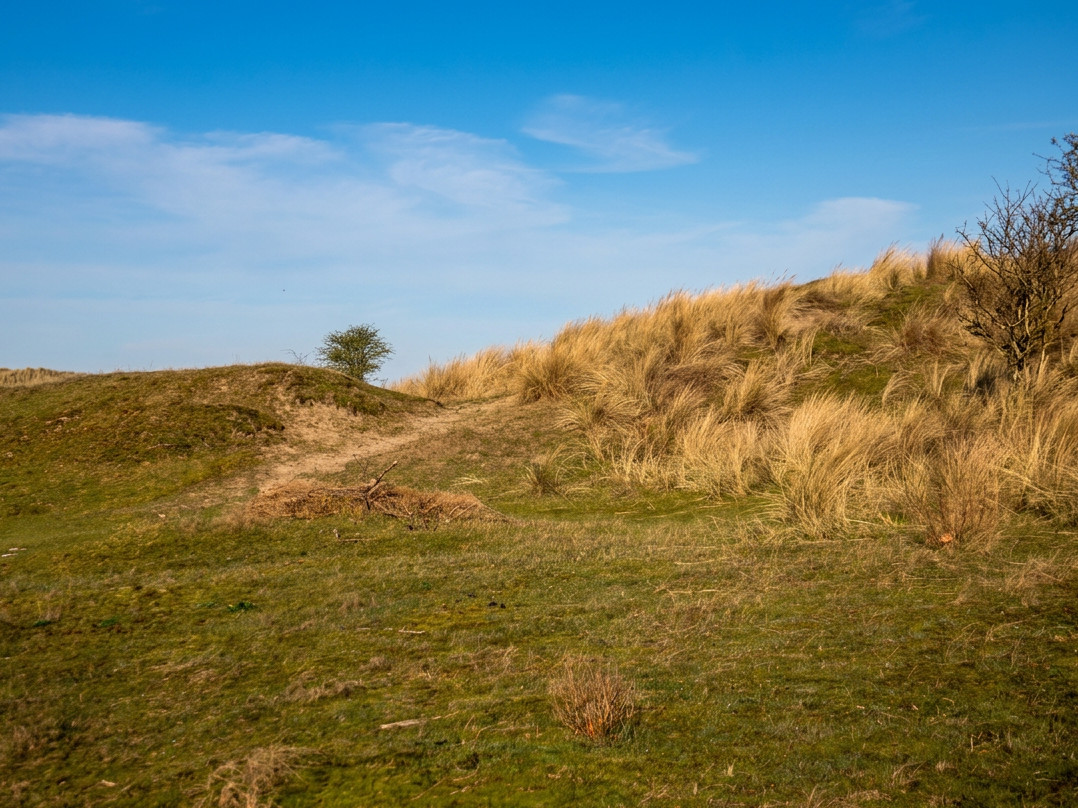
North Holland contains an exceptional variety of landscapes within short distances. Texel and the North Sea coast offer dunes, wet valleys, salt marshes, tidal flats and bird areas. Further inland lie peat meadows, lakes, reedbeds and old reclaimed landscapes. At De Muy, Balgzand, Naardermeer and Wormer- en Jisperveld, soil, water level, wind, salt and management visibly shape the species that can survive.

Nature here is rarely separate from human history. Dikes excluded salt water, drainage altered peatlands and grazing kept valleys open. In some places valuable habitats emerged precisely because human use changed or stopped. Conservation therefore does not always attempt to restore an untouched past, but to preserve the conditions on which vulnerable plants and animals depend.

Nature reserves in North Holland look different in every season. Spring birdsong, flowering orchids, breeding colonies, migrating birds and winter raptors each follow their own calendar. The same place can therefore reward repeated visits, provided that temporary closures and sensitive breeding areas are respected.

Castles, churches, industry and forgotten remains

The history of North Holland cannot be captured in a single type of monument. Medieval churches and castles stand beside forts, casemates, shipyards, warehouses, synagogues, cemeteries and country estates. Some places are well preserved, while others survive only as fragments or as a readable form in the landscape.

That variety is what makes a journey through the province so rewarding. An imposing building may tell a great deal, but a truncated tower, abandoned lock, icehouse or line of bunkers can be just as meaningful. Such almost forgotten places reveal which functions once mattered and why they later slipped from view.

Religious and social history also remain visible. Churches, pilgrimage sites, old burial grounds and care landscapes show how communities organised themselves and which places gained meaning through ritual, memory or daily use. Those who look only for famous monuments therefore miss a large part of the story.

How to explore North Holland beyond the familiar routes

Use this province page as a starting point for a day out in North Holland, but do not choose only by fame. Filter by theme, see which places lie close together and combine a major monument with a smaller remnant or nature reserve. This creates a route that is both varied and coherent.

On site, look beyond buildings. Relief, waterways, plot boundaries, sightlines, old trees and unexpected open spaces often reveal more than an information panel. Ask why a road bends, why a field remained empty or why a church stands in an unusual position. That is often where a story no longer visible at first glance begins.

Many locations lie in sensitive nature areas or in places still used every day. Respect temporary closures, opening hours and local rules. Here, slow observation is more rewarding than trying to tick off as many places as possible in a single day.

Explore further: