
The story of this place
A castle beneath the meadow
Southeast of Castricum, an old farmhouse named Cronenburg stands among meadows and drainage ditches. The building sits alone in open country, and nothing in the quiet surroundings immediately suggests that a medieval castle once occupied this site. No towers, gates or weathered walls remain. Yet the place is not empty. Foundations survive beneath the grass, while old waterways still trace parts of the former moat system.
The story probably begins with the Huis te Castricum. During the second half of the thirteenth century, Simon van Haerlem had a fortified residence built here. Its location was carefully chosen. The site occupies a raised sandy ridge in the former inner delta of the Oer-IJ, surrounded by lower and wetter ground. Roads and navigable waterways connected it with Castricum, Heemskerk, Uitgeest and the route towards Alkmaar. A fortified house here could serve both as an aristocratic residence and as a position from which land, traffic and water could be controlled.
Het Huis te Castricum
The Huis te Castricum was probably badly damaged during the Hook and Cod Wars at the end of the fourteenth or beginning of the fifteenth century. Archaeological investigation revealed masonry dated to around 1400–1450, indicating rebuilding. The name Cronenborch first appears in a feudal charter of 1441, when Willem van Cronenburg received the houses and lands belonging to the estate. The older name Huis te Castricum gradually gave way to Kronenburg, derived from the family that held the property.
The rebuilt castle stood slightly southwest of the probable earlier house. It had an almost rectangular outline measuring approximately 32 by 29 metres. Moats and enclosing banks surrounded it. Two round towers and one square tower probably stood at the corners, while living quarters lined the northeastern wall. An outer bailey containing service buildings, yards and access structures connected the defensible main building with the surrounding farmland.
From fortified house to Kronenburg
Kronenburg’s precise appearance while fully occupied is uncertain. An eighteenth-century drawing by Abraham Rademaker shows a substantial castle with tall residential wings, towers, a walled forecourt and an elaborate entrance. The image was copied from an older representation when the building itself had already largely disappeared. It cannot therefore be treated as a completely reliable record, but it preserves the image later generations held of the castle.
Kronenburg’s end cannot be reduced to one undisputed date either. It is often assumed that Spanish troops destroyed it in 1573 during the Eighty Years’ War. Other evidence suggests that it may already have been largely abandoned or demolished before the middle of the sixteenth century. What is certain is that it was not rebuilt. Unoccupied walls decayed, usable building material was removed and the site returned to agricultural use.
By the seventeenth century, Kronenburg lay in ruins. Written descriptions mention broken and decayed walls on raised ground. In 1727, a mound of rubble and low masonry from a collapsed tower remained. The owner, Lieve Geelvinck, ordered the remains to be investigated the following year. Surveyor Johannes Rollerus exposed parts of the foundations and recorded the outer walls. His plan shows a compact, nearly square castle with curved and straight wall sections inside a moated enclosure.
Decline, demolition and reuse
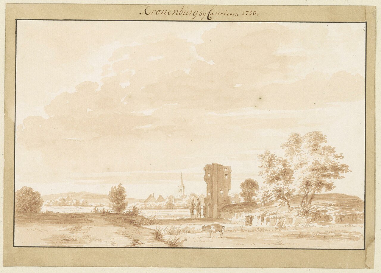
Drawings from the same period reveal how little remained standing. In 1730 Abraham Rademaker depicted a solitary tower fragment beside low buildings, trees and a mound of debris. By about 1740 only a low piece of masonry was visible. During the nineteenth century, even those last stones disappeared. The ruin surrendered its reusable material and merged into the meadows, ditches and farmyard.
The Cronenburg farmhouse inherited the castle’s name. The present main building dates from around the end of the seventeenth century and may contain bricks reused from the ruins. Old vaulted cellars and unusual structural elements have long encouraged the belief that parts of an outer building were incorporated into the farm. Not every connection can be proven without excavation, but the farmhouse remains the last visible bearer of the historic name.
Twentieth-century research demonstrated how much survives below ground level. Electrical and magnetic resistance surveys revealed the outlines of foundations and moats without opening the entire site. Within the known moat, the measured lines corresponded with the plan Rollerus had drawn in 1728. A second building area was detected closer to the Cronenburgervaart. This may mark the earlier Huis te Castricum that preceded Kronenburg.
What the landscape still preserves
The area received protection because of its geological and archaeological value. The medieval castle sites are not the only remains hidden here. The sandy ridge also contains evidence of settlement from the Late Iron Age, Roman period and later centuries. The soil is therefore not merely the site of a vanished castle but a layered archive of prolonged habitation in the Oer-IJ landscape. To preserve these remains, disturbance of the ground is deliberately kept to a minimum.
The vanished stronghold is best recognised by reading the shape of the land. Follow the ditches around the higher meadow, notice the gentle slopes and imagine the farmhouse not in an empty field but at the edge of a former castle complex. Where cattle now graze, moats, walls, courtyards and towers once stood. Kronenburg disappeared above ground stone by stone, but its outline survives as a faint relief in the landscape.