
The story of this place
Where land now lies, a lake once surged
Today, De Beemster appears to be a quiet agricultural area in North Holland. Straight roads run between meadows and fields, drainage ditches disappear into the distance and large bell-jar farms stand at regular intervals. Before the beginning of the seventeenth century, however, Lake Beemster lay here.
The lake had not always been so large. Cultivation and drainage of the surrounding peat caused the ground to subside. At the same time, storms and erosion enlarged small waterways and pools. Eventually, an open inland lake developed that threatened surrounding villages, towns and farmland during severe weather.
During the same period, demand for fertile land increased. Amsterdam merchants had accumulated considerable capital through trade and sought new investments. Draining the lake offered two opportunities at once: protection against expanding water and the creation of new agricultural land.
More than forty mills against the water
In 1607, the initiators received permission to drain the lake. From 1608, a ring dyke was constructed around the water. Beside it, workers dug a ring canal. Soil excavated from the canal was used for the dyke, while the canal carried away the pumped water.
The lake was too deep to be drained by a single mill. The mills were therefore arranged in successive stages. Each mill lifted the water a little higher and passed it on to the next level. In several pumping stages, more than forty windmills eventually moved the water step by step into the higher ring canal.
By 1610, the drainage appeared almost complete, but during a storm dykes in the surrounding area failed and water flowed back in. Much of the work had to be repeated. The ring dyke was raised and strengthened. On 19 May 1612, De Beemster was finally dry.
A landscape designed on the drawing board
The drained lake bed covered more than 7,200 hectares. The new land was not divided according to the irregular shape of the former lake. Surveyors laid a geometric grid across it that reflected Renaissance ideas of order, measurement and proportion.
The largest principal modules measure approximately 1,850 by 1,850 metres. Roads and main waterways divide these areas further into blocks of approximately 900 by 900 metres. Within these blocks lie elongated plots. Roads, waterways and plot boundaries run mainly from north to south and from east to west.
Along the ring dyke, the strict geometry had to adapt to the curved edge of the former lake. Angled connections and irregular plots developed there. The contrast between that irregular outer boundary and the straight interior grid shows how the mathematical plan was fitted into an existing landscape form.
Villages, country estates and stolp farmhouses
Middenbeemster was positioned at the crossing of Middenweg and Rijperweg. The village became the administrative, religious and economic centre of the reclamation. Other neighbourhoods and villages developed along the straight roads, usually as elongated ribbons within the grid.
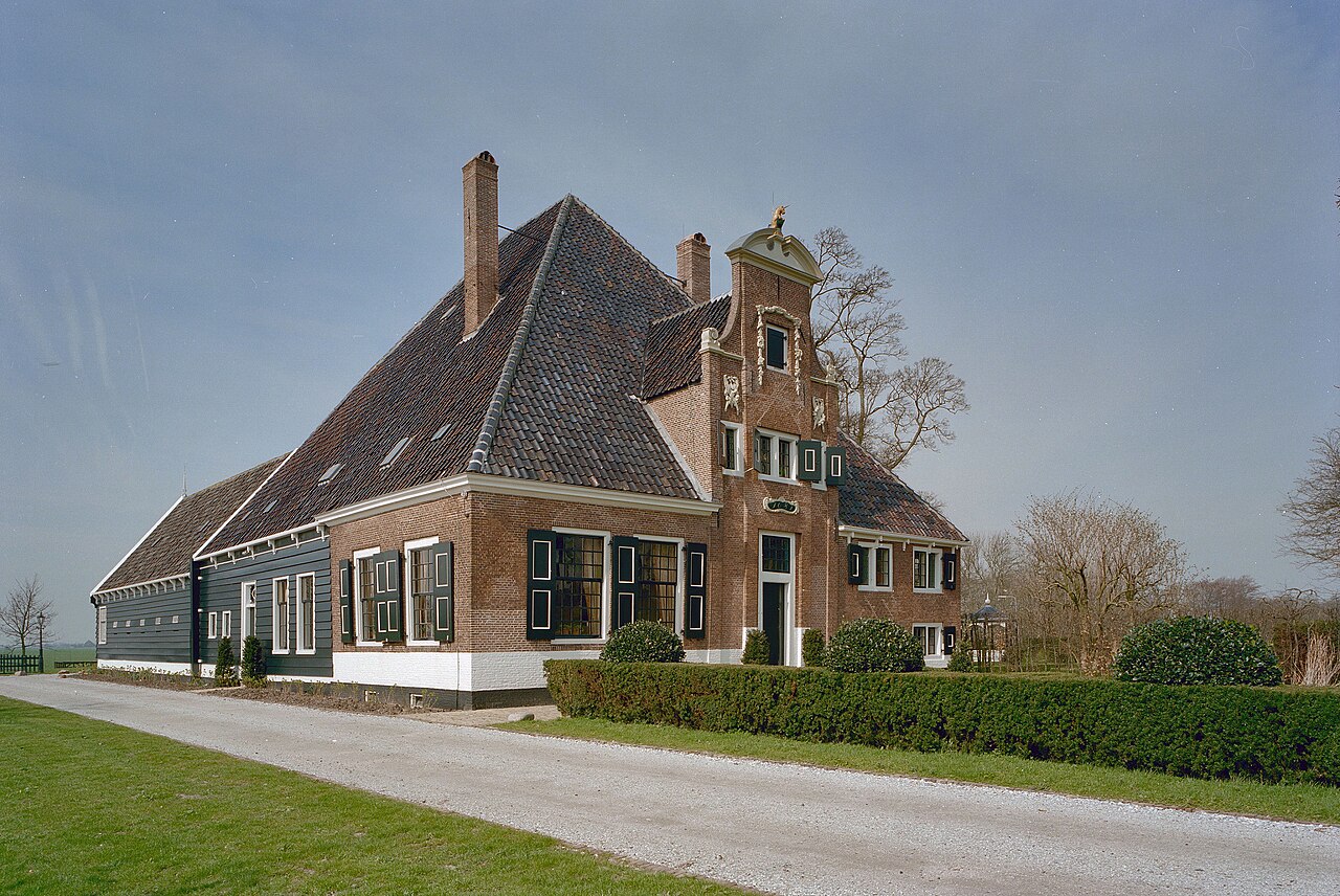
The farms also formed part of the ordering. Many farmsteads stand at fixed intervals along the roads. Characteristic of the area is the North Holland bell-jar farm: an almost square building with a high pyramidal roof. The square form of the farm fits strikingly well with the repeated squares of the polder design.
Wealthy investors used parts of the new land for more than agriculture. Country estates and mansions with formal gardens, gates, ponds and avenues appeared along the roads. Many later disappeared, but surviving buildings and entrance gates still recall De Beemster as a summer retreat for affluent townspeople.
A living water system and UNESCO landscape
The windmills that drained the lake remained necessary after 1612 to remove rainwater and seepage from the low polder. As the ground subsided, the pumping system later had to be expanded. At the end of the nineteenth century, steam pumping stations took over the work of the windmills. Diesel and electric installations followed.
De Beemster is therefore not an area that was reclaimed from the water only once in the past. Water still has to be removed continuously today. Without the ring dyke, drainage ditches, pumping stations and controlled water levels, the land would become wet again.
Despite later changes, the main structure has remained exceptionally well preserved. The ring dyke still encloses the shape of the former lake. Roads, ditches, rows of trees, plots, villages and farms largely follow the seventeenth-century pattern.
In 1999, the entire reclamation was inscribed on the UNESCO World Heritage List. No single building or individual windmill constitutes the World Heritage Site. Its value lies precisely in the complete relationship between the ring dyke, ring canal, pumping system, land division, roads, settlements and the still-functioning agricultural landscape.
De Beemster is therefore best understood while moving through it. Along Middenweg and Rijperweg, junctions, ditches, rows of trees and farmsteads follow one another in a fixed rhythm. From the ring dyke, you can see the difference in height between the ring canal, the older surrounding land and the lower lake bed. The mills drained the lake, but the geometric design turned it into De Beemster.