
The story of this place
An island that was once larger
The southern side of Marken now appears to have a clear boundary. Behind the green dyke lie grasslands, ditches and the island’s scattered dwelling mounds; on the other side begins the open water. This sharp transition suggests that Marken has always had roughly its present shape. Historical maps tell a different story. Beyond the current dyke lay more land, and on that land stood three inhabited mounds: Thamiswerf, Houtemanswerf and Kraaienwerf.
Marken developed in a low peat landscape continually reshaped by water, subsidence and human intervention. From the Middle Ages onward, the land was reclaimed and enclosed by dykes. The inhabitants did not spread their houses evenly across the island, but concentrated them on raised dwelling sites. These mounds offered protection when water crossed the low dykes or flooded the land. Around the houses lay yards, paths, ditches, meadows and small embankments. They were not isolated hills in an empty waterscape, but parts of an inhabited and worked landscape.
Living on dwelling mounds
The dykes around Marken could not always hold back the Zuiderzee. They rested on soft peat, were lower and lighter than modern flood defences and were attacked by waves and high water during storms. When a section breached or became too badly damaged, retreat could be more practical than repair. A new dyke was then built farther inland. It protected the remaining settlements, but the land between the old and new defences was abandoned.
In this way, Marken’s boundary shifted inward several times. The sea did not remove an entire island in a single night. First, sections of pasture and land outside the dyke disappeared. Roads, yards and buildings then moved closer to the water. Eventually, inhabited mounds also became isolated or impossible to maintain. Houtemanswerf disappeared shortly after 1703, Thamiswerf shortly after 1720 and Kraaienwerf around 1775. According to local historical knowledge, this prolonged process removed roughly one third of the former island.
Loss of land in the eighteenth century
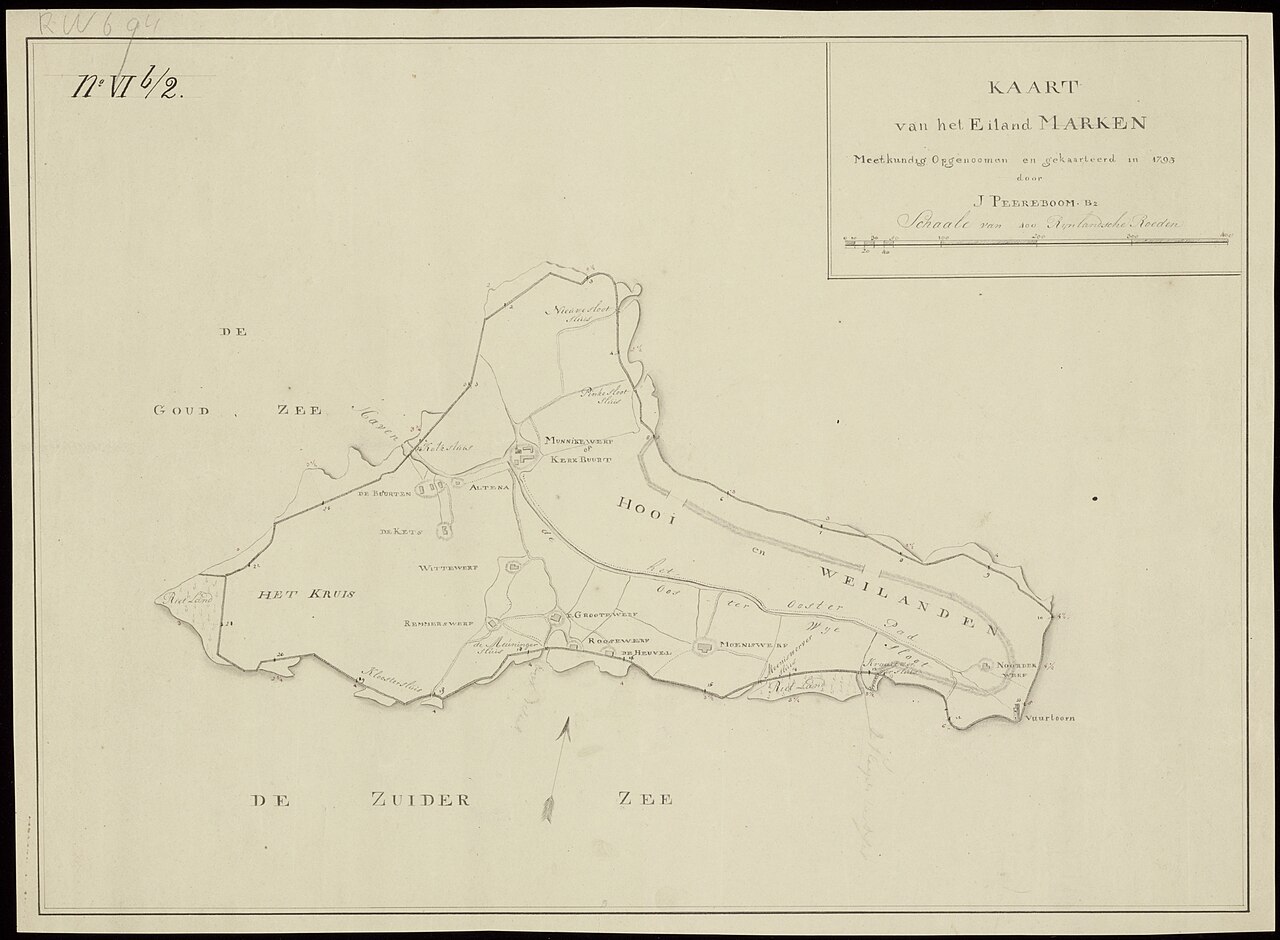
The lost neighbourhoods remained marked on maps for a long time. On the southern side of Marken, these show projecting points of land, small dykes and dwelling sites extending beyond the later shoreline. Such maps demonstrate that the present waterfront is not the island’s original edge. It is the outcome of repeated decisions: repairing what could be saved, retreating where the damage became too great and accepting that houses and land would be left outside the new protection.
The three dwelling mounds did not vanish without leaving traces. Remains of dykes, revetments, ditches and habitation may survive in the soil and beneath the water. Archaeological research therefore accompanied preparations for strengthening the Zuidkade. Earlier records had already identified zones where remains of the drowned mounds might survive, although drilling, radar and sonar initially produced little tangible evidence.
The vanished dwelling mounds rediscovered
That changed in 2023. During the works, an excavator lifted five pine planks and a post from the water. Tree-ring analysis showed that the timber had been cut in the autumn of 1760 or 1761 and originated in the Baltic region. Beneath the water, two parallel rows of planks and posts were found with clay between them. The structure may have formed part of a dyke, a revetment or a timber screen intended to protect the land from erosion.
Because the timbers were found within the recognised archaeological monument and the two other mounds had already disappeared before 1760, a connection with Kraaienwerf is considered likely. The exact function remains uncertain. The structure may have belonged to a dyke south of the mound or to a protective timber barrier along land already threatened by the water. That uncertainty suits a landscape from which only detached elements survive below the surface.
The coastline as a boundary of loss
Nothing from the three inhabited sites is clearly recognisable above ground along the Zuidkade. There is no ruin and no abandoned foundation protrudes from the water. Yet the lost land can still be read in the shape of Marken. The present dyke lies farther inland than earlier defences. The island stops abruptly where fields, ditches and houses once continued. The water in front of the dyke is therefore not empty, but covers an older layer of the island.
The open space becomes legible when the present landscape is compared with historical maps. From the dyke, look southward and follow not only the waterline but also the bends and retreating outline of the shore. No large town or stone monument stood here, but small neighbourhoods whose survival depended on low dykes and raised yards. The water off Marken now marks their position. Where only waves, birds and a distant horizon are visible, the island once continued.