
The story of this place
A ring around the old land
The West Frisian Ring Dyke is older than the province of North Holland itself. When large parts of present-day North Holland still consisted of separate islands, lakes and marshland, this dyke already formed one continuous water defence around West Friesland.
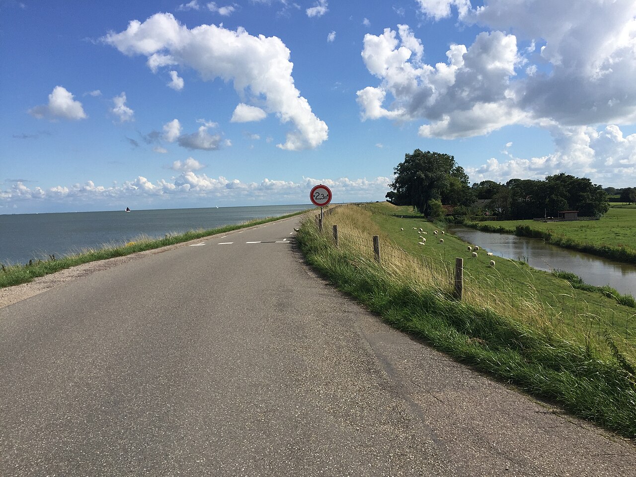
The West Frisian Ring Dyke is one of the great historical lines in the landscape of North Holland. Over a distance of more than 126 kilometres, it forms a ring around old West Friesland. The dyke passes towns, villages, polders, former coastlines and land reclaimed at a later date. In some places it rises clearly above the surrounding fields. Elsewhere it has become part of roads, cycle paths, village streets and grassland. Its original meaning remains recognisable: for centuries it marked the boundary between habitable land and threatening water.
West Friesland was naturally vulnerable. The Zuiderzee lay to the east, while sea inlets, lakes, peat streams and wet lowlands surrounded other parts of the region. Storm surges, erosion and flooding threatened villages, fields and pastures. Settlement was possible only by continuously protecting the land with embankments, dykes and drainage. Safety was not a given here, but the result of maintenance and cooperation.
The Ring Dyke did not begin as a single large construction project. During the early Middle Ages, separate water defences surrounded settlements and agricultural land. Local communities protected their own areas against water from the sea, lakes and inland waterways. As the threat increased and water management became more complex, those separate sections gradually grew together. By the thirteenth century they had formed a continuous ring around West Friesland.
Dyke, route and landscape boundary
That ring determined more than where water was held back. Inside the dyke lay the land people wanted to preserve and cultivate. Outside lay open water, mudflats and land beyond the dyke. Reclaimed lakes and new polders were added later. The dyke therefore became a boundary between old and new land, between safety and uncertainty and between possession and possible loss.
Roads, villages and towns developed along the Ring Dyke. Hoorn, Enkhuizen, Medemblik, Schagen and Alkmaar all belong to its wider story. Farms, mills, ditches and field patterns took shape within the system of protection and drainage. The dyke was not only a water defence, but also a route and an organising line in the landscape. It influenced where people lived and how they travelled.
Breaches and collective water management
Its safety nevertheless remained fragile. Storm surges and high water returned repeatedly. The dyke had to be raised, strengthened, repaired and sometimes moved. Old bends, breach ponds and hollows recall places where the water broke through. One of the best-known breach sites lies near Scharwoude, south of Hoorn. In November and December 1675 the dyke failed severely there. Large parts of eastern West Friesland were flooded. A monument recalls the disaster and the repairs that followed.
The image of the water wolf fits this history. Water was not a peaceful background, but a force that could devour land, threaten villages and disrupt communities. The Ring Dyke was the answer to that danger. At the same time, it showed how close the threat always remained. Every raised section, bend and repair records something of the continuing tension between water and settlement.
The dyke also tells an administrative story. A water defence of this scale could not be maintained by a single farmer, village or town. Costs, labour and responsibilities had to be shared. This led to agreements, obligations, conflicts and the development of governing bodies. Water safety forced residents, landowners, towns and water boards to cooperate. The dyke is therefore not only a monument to engineering, but also to collective government.
A living historical line
The surrounding landscape changed dramatically. The Beemster and Schermer were drained. After the construction of the Afsluitdijk, the Zuiderzee became an enclosed inland water. As a result, the Ring Dyke lost its role as a direct sea defence in many places. Its value as a historical structure remained. The medieval ring continued to serve as a recognisable boundary, route and backbone of the West Frisian landscape.
Its protection as a provincial monument underlines that importance. The Ring Dyke has remained exceptionally recognisable, yet it is still part of everyday life. Cars travel along it, cyclists follow its course and villages and farms stand beside it. That interweaving is precisely what makes the dyke remarkable. History is found here not only in buildings or archaeological remains, but also in a change of height, a bend in the road, an old breach pond or a long grassy slope.
The West Frisian Ring Dyke preserves the shape of a cultural landscape that could not have survived without protection from the water. It is more than an old embankment. The ring forms a spatial memory of storm floods, repairs, administrative cooperation and centuries of living on vulnerable land. Anyone following its course is not simply travelling along a dyke, but along the boundary where West Friesland was repeatedly created and preserved.