
The story of this place
From peatland to island
Marken is now a peninsula in Markermeer, but its landscape and buildings were shaped during the centuries in which it was completely surrounded by the Zuiderzee. Its low meadows, narrow dyke and raised residential areas show that living here was always connected to the level of the water.
During the early Middle Ages, the area still formed part of the peat landscape of Waterland. Drainage caused the ground to subside, while storm surges and erosion enlarged the surrounding water. Marken was probably separated from the mainland during the twelfth century. From then on, a vulnerable island lay within an expanding Zuiderzee.
Frisian monks from Mariëngaarde Abbey owned farmland and farms on Marken during the thirteenth and fourteenth centuries. They constructed low dykes and attempted to maintain agriculture and livestock farming. The ground nevertheless remained low and the defences offered no complete security. Flooding formed part of life on the island.
Living on raised dwelling mounds
Residents sought safety by raising their dwelling places. On Marken, these artificial residential mounds are known not as terpen but as werven. Kerkbuurt and Kloosterwerf were among the earliest larger settlements. New mounds later developed along connecting routes and at other suitable locations, including Rozewerf, Witte Werf and Grotewerf.
Over the centuries, dozens of werven developed on Marken. Some disappeared through coastal erosion, while others were abandoned or absorbed by later development. The Grote Kloosterwerf vanished entirely beneath the water south of the island.
Houses stood close together on the highest parts of the residential mounds. Safe building land was scarce and every usable square metre mattered. Narrow paths, small yards and the irregular arrangement of buildings did not result from a planned street pattern, but from repeated adaptation, expansion and increasing density.
Wooden houses and building on piles
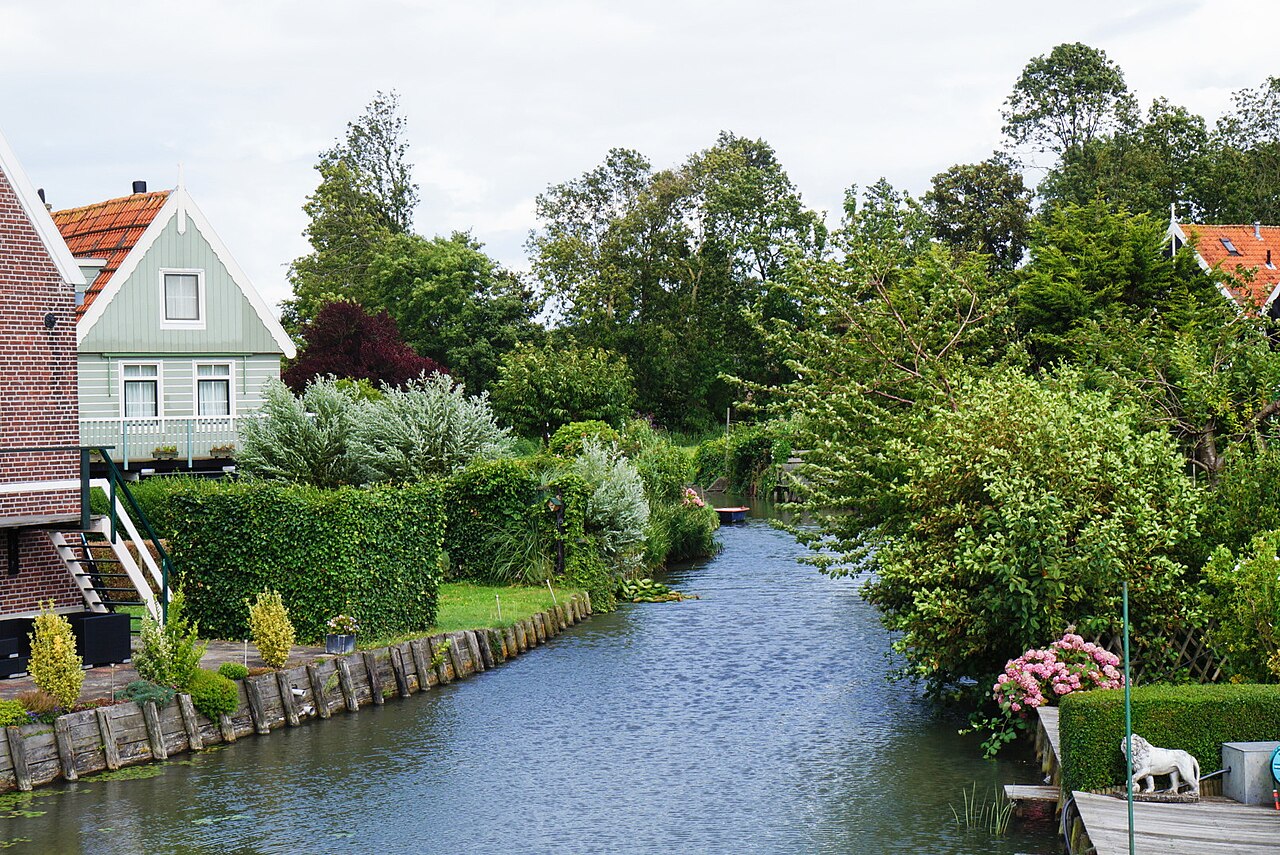
When the mounds became fully built up during the nineteenth century, new houses were constructed along their slopes. Parts of these buildings rested on wooden piles so that living floors remained above flood water. The space below was initially left open or enclosed later. This created the characteristic combination of timber façades, differences in level, narrow passages and houses that do not stand directly on the surrounding ground everywhere.
Timber was relatively light and therefore suitable for construction on soft peat and along the edges of the mounds. Many façades were painted green or dark and received white details. The houses appear simple individually, but together form compact neighbourhoods in which safe habitation mattered more than broad streets, large yards or a regular layout.
Lower land beyond the residential mounds remained in use mainly as meadow and hayfield. Agriculture became increasingly difficult because of salt and recurring floods. Fishing consequently gained importance. Men sailed from the harbour onto the Zuiderzee, while families and craftspeople lived and worked on the densely occupied mounds.
The storm surge of 1916
The dyke surrounding Marken remained vulnerable. Strong north-westerly storms could push water high against the island. During the night of 13 to 14 January 1916, a storm surge crossed the dykes and entered the residential areas. Sixteen people died on Marken. Houses were damaged and residents sought safety on the mounds, upper floors and in attics.
The disaster of 1916 increased political pressure to close the Zuiderzee. The Afsluitdijk was completed in 1932. The salty tidal water around Marken gradually became the fresher and calmer IJsselmeer. The immediate danger of storm surges from the sea decreased sharply, while traditional Zuiderzee fishing lost much of its economic basis.
From island to peninsula
Plans intended Marken eventually to become part of the Markerwaard, a large new polder. Dykes were constructed that were meant to connect the former island world with new land and the mainland. The Bukdijk towards Volendam remained unfinished, but the western connection with Waterland was completed.
On 17 October 1957, the causeway between Marken and Waterland was closed, making Marken geographically no longer an island. The road across the causeway was completed later; from 1959, Marken could actually be reached by road and centuries of dependence on boat connections began to diminish. The former island boundary nevertheless remained visible: the narrow causeway crosses the water in a long line before reaching the settlement.
The werven did not disappear from the landscape after the Zuiderzee was closed. Although their role as refuges above storm-surge water diminished, they continued to determine the form of the village. During the twentieth century, the green timber houses, enclosed paths and differences in height were increasingly valued as exceptional heritage.
Marken became an early destination for artists, photographers, researchers and tourists. They came for the traditional dress, fishing culture, harbour and wooden houses. This image made Marken famous, but could obscure the fact that the buildings were not designed as picturesque scenery. The mounds and pile-supported houses were practical responses to a low, wet and dangerous environment.
A large part of Marken is designated as a protected village conservation area. Its protection does not centre on a single monument. Its value lies in the relationship between raised mounds, timber houses, narrow paths, open meadows, the dyke and the former island form. Their combination makes the history of water and habitation visible.
Walk from the harbour towards Kerkbuurt and notice how the paths gradually rise. Then look at the transition between the higher residential area and the low grassland near Rozewerf or Grotewerf. Marken therefore tells not primarily a story of creating new land, but of continuing to live on land that was constantly threatened by water. Its residents did not reshape the entire lake. They adapted their houses, neighbourhoods, building materials and livelihoods until, in the twentieth century, the island itself became part of the great transformations around the former Zuiderzee.