
The story of this place
A canal across Holland
By the middle of the nineteenth century, Amsterdam possessed a major harbour, warehouses, trading houses and international ambitions, but lacked a good direct connection with the North Sea. Large vessels had to cross the shallow Zuiderzee or follow the long Noordhollandsch Canal. That almost eighty-kilometre detour through Den Helder took several days even under favourable conditions.
A canal directly through the dunes near Velsen appeared to be the obvious solution, but it was an exceptional technical undertaking. Polders, sections of the former IJ and a broad belt of high dunes lay between the IJ and the North Sea. The area through which the opening had to be cut was known as the Breesaap, an extensive dune valley containing only a few farms and little other development.
Definitive planning began in 1863. Construction was undertaken not directly by the state, but by the Amsterdamsche Kanaal-Maatschappij. British engineers and contractors became involved because Britain possessed greater experience with large-scale excavation, harbour construction and modern dredging techniques.
The first spade entered the ground near Velsen on 8 March 1865. Thousands of labourers dug, dredged and moved enormous quantities of sand, peat and clay. Much of the existing IJ could be incorporated into the route, but the opening towards the North Sea required a deep cutting through several kilometres of dunes.
The works transformed the landscape. The Breesaap was divided and later largely disappeared beneath canal widening, harbour basins and industry. Elsewhere along the route, sections of the former IJ were reclaimed. The sale of this new land helped finance the expensive construction of the waterway.
Locks were required at the seaward end of the canal. Without this barrier, tides, storm surges and salt North Sea water could have entered the canal and hinterland freely. The locks had to admit seagoing vessels while controlling the canal level and closing the new opening in the dune coast as a flood defence.
A settlement for labourers, supervisors, boatmen, shopkeepers and their families developed around the construction site at the canal entrance. It became known as IJmuiden: the mouth of the IJ. The town did not exist before construction of the canal, but grew directly from the hydraulic project.
King William III opened the Noordzeekanaal and its first locks on 1 November 1876. The route between Amsterdam and the open sea was reduced to just over twenty kilometres. Seagoing vessels no longer had to cross the Zuiderzee or make the detour through Den Helder. Amsterdam had gained the direct maritime connection it had sought for decades.
Ever larger ships
The original lock complex consisted of the Kleine Sluis and the considerably larger Zuidersluis. These chambers were spacious for the ships of 1876, but vessels rapidly increased in size. The Middensluis opened as early as 1896. A new and larger passage was therefore required within twenty years.
The same development repeated itself during the twentieth century. Steamships, liners and cargo vessels became longer, wider and deeper. The Noordersluis opened in 1929. With a chamber approximately four hundred metres long and fifty metres wide, it ranked among the largest sea locks in the world for many years.
The Noordzeekanaal itself was also repeatedly widened and deepened. Bridges disappeared and were replaced by tunnels, so large vessels were no longer dependent on raised crossings. Harbour basins, storage areas, shipyards, energy plants and heavy industry developed along the waterway. IJmuiden also grew into a fishing port and gateway to the Amsterdam port region.
Holding back and discharging water
From the outset, the lock complex performed more tasks than merely passing vessels. It closed the opening in the dune coast and prevented storm surges from entering the Noordzeekanaal region. At the same time, excess fresh water from a large part of the western Netherlands had to be discharged through the canal to the sea.
A separate discharge sluice was completed in 1940. When sea levels were low enough, canal water could flow out under gravity. A large pumping station opened beside the discharge complex in 1975. This allowed water to be pumped out even when sea levels were unfavourable. The discharge and pumping complex thus became an essential element in the water management of polders, towns and rivers far inland.
The Second World War revealed the strategic importance of the canal entrance. In May 1940, the passenger liner J.P. Coen was sunk in the channel to obstruct access. During the German occupation, IJmuiden was developed into a heavily defended coastal area. Despite damage, military threats and surveillance, the locks had to remain operational and water levels had to be managed.
A sea lock on an enormous scale
Merchantmen, cargo vessels and passenger ships returned after the war. Oil, grain, ores and other goods entered the port region through the canal. The Noordersluis increasingly became a bottleneck. Large ships had to wait, and some modern vessels could pass through the existing chamber only under favourable conditions.
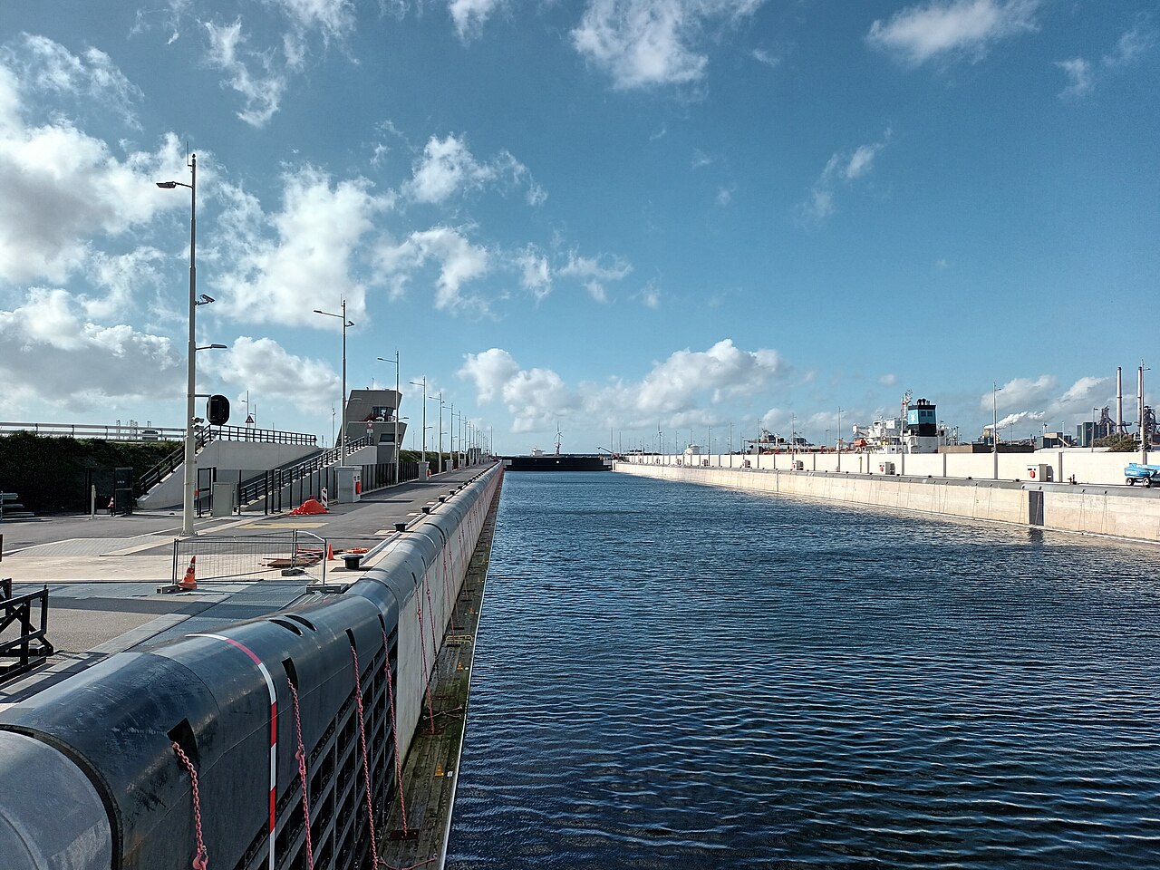
Construction of the new Sea Locks IJmuiden complex therefore began in 2016 between the Middensluis and Noordersluis. The building site lay within a complex that had to remain operational throughout the work. Huge lock gates, deep construction pits and massive concrete structures were created while vessels continued to pass through the surrounding locks.
The new sea lock officially opened on 26 January 2022. Its chamber is approximately 500 metres long, 70 metres wide and 18 metres deep. Very large seagoing vessels can therefore reach the Amsterdam port region and passage is less dependent on the tide. The new lock took over the main role of the Noordersluis, which is approaching the end of its technical life.
The increase in scale created a new water problem. Every lock operation introduces salt North Sea water into the fresher Noordzeekanaal. Because salt water is heavier, it sinks and can travel farther inland as a deep saltwater tongue. This creates risks for habitats, agriculture and drinking-water production.
A salt barrier was built in the inner discharge canal to limit this salinisation. A deep opening in the structure allows the heavier salt water to flow towards the discharge and pumping complex, from where it is removed to sea. The lighter fresh water is held back as far as possible and remains in the Noordzeekanaal. The complex thus gained another function that would have been unimaginable when it opened in 1876.
The present landscape displays almost 150 years of increasing scale and adaptation. The small nineteenth-century locks stand beside the Middensluis, Noordersluis and the enormous Sea Locks IJmuiden complex. Farther away are the discharge sluice, pumping station and salt barrier. Notice the relative proportions: a lock considered spacious in 1876 appears almost modest beside the modern chambers. The complex is not a completed structure, but a system repeatedly adapted to larger vessels, greater water discharge, rising sea levels and incoming salt water.