
The story of this place
A new polder for urban wealth
The Beemster was drained in 1612. The former lake became a new polder of straight roads, ditches and rectangular plots. Much of the land passed into the hands of merchants, administrators and wealthy investors from Amsterdam and nearby towns. They earned money from agriculture and rents, but also regarded the reclaimed land as a suitable location for summer residences.
Its position made the Beemster attractive. The polder could be reached from Amsterdam and Purmerend by water and road. The air was cleaner than in the city and the open landscape provided space for extensive gardens. The geometric field pattern also allowed houses, farms, orchards and ornamental gardens to be arranged according to a clear plan.
The first estates appeared soon after reclamation. By the middle of the seventeenth century, the Beemster contained dozens of them. Most stood in the southeastern part of the polder and along the Volgerweg. This area lay close to Purmerend and was relatively easy to reach for owners from Amsterdam. The country houses therefore formed local sequences rather than being evenly scattered across the polder.
The Volgerweg as a road of pleasure
The Volgerweg became known as a road of pleasure. Bridges and ornamental gateways opened onto mansions with symmetrical façades. Avenues led towards the main houses. Clipped hedges and rows of trees bordered the gardens. Ponds, canals and basins connected with the drainage system of the polder. Orchards, kitchen gardens and farms made the estates productive as well as decorative.
Owners stayed mainly during the summer. Their permanent homes generally remained in the city. In the Beemster they received relatives and business contacts. They walked through the gardens, travelled by boat along the waterways and supervised their agricultural property. The estate served simultaneously as retreat, investment and expression of social position.
Leeuwenplaats, Vredenburg and Beemsterlust
Leeuwenplaats was among the earliest estates. The residence was built between 1612 and 1622 for Jan Fransz van der Straten, a merchant originally from Antwerp. Archaeological research uncovered timber foundations from successive buildings, remains of bridges, filled perimeter ditches and the substantial foundation of a garden wall more than one hundred metres long. Archaeologists also found remains of a hidden water feature designed to surprise visitors.
Vredenburg was one of the largest estates in the Beemster. During the 1640s, the Amsterdam merchant Frederik Alewijn commissioned designs from Pieter Post and Philips Vingboons. The house was eventually built according to Post’s design. House and garden formed a carefully planned composition of avenues, water and formal compartments.
Beemsterlust was another extensive estate. A plan dating from 1771 shows a main house, ancillary buildings, waterways and geometrically arranged gardens. It lost its function at the end of the eighteenth century. By the beginning of the nineteenth century, records mentioned only the land behind the former estate. The house had disappeared and its building materials had been sold.
How the estates disappeared
Almost all the estates met the same fate. Maintaining a large summer residence became costly and fashions changed. Families sold their land or divided it among heirs. Agricultural ground retained its value, while houses, garden pavilions and ornaments required continuing expense. Demolition allowed bricks, timber and stone to be reused.
Gardens often disappeared even faster than memories of the houses. Ponds were filled and avenues felled. Ornamental beds returned to pasture, arable land or orchards. Farms survived or were renewed because they remained economically useful. A landscape of linked country estates therefore became predominantly agricultural once again.
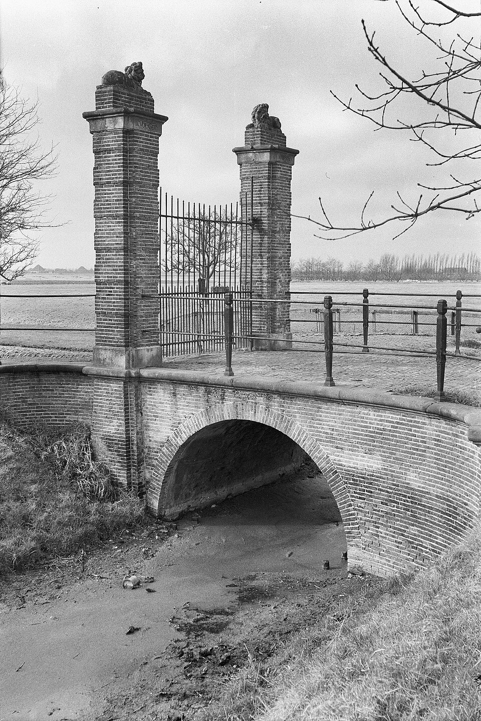
Volgerwijck is a recognisable exception. The original mansion disappeared, but its seventeenth-century arched bridge and old gateposts survived. Stone lions crown the brick pillars. Behind the gate stands a later gentleman’s farmhouse that continues the historic name. It is not the original country house, but preserves the link between urban wealth and agricultural enterprise.
Zwaansvliet stood east of Volgerwijck. Remains of its bridge and gateposts also survived for a long time. They disappeared during the twentieth century, removing another of the last visible fragments from the seventeenth-century sequence along the Volgerweg.
More survives underground than at the surface. Archaeological investigation can recover foundations, revetments, garden walls, rubbish pits and filled waterways. Fragments of tableware, bottles, tiles and building materials reveal how residents furnished their houses and which products they used.
Historical maps also reveal the country-estate landscape. Houses and gardens appear as small geometric worlds within the larger Beemster grid. The same straight lines recur at different scales. The polder was divided into rectangular plots and those plots contained further avenues, beds and waterways.
What remains visible today
Farms and open fields now dominate the Volgerweg. Yet the pattern differs in certain places. A ditch is wider than ordinary drainage requires. A drive runs directly towards a farmyard. Old trees stand at regular intervals. A gateway seems too monumental for the farm behind it. Such features belong to the vanished layer of the landscape.
That layer is clearest at Volgerwijck. From the public road, look towards the bridge, gateway and long entrance. Beyond the stone lions, imagine not a single farm but a succession of houses and gardens that made the Volgerweg one of Holland’s richest country roads. Almost every building disappeared. Their lines remain scattered through the polder.