
See something ancient
Fort near Edam
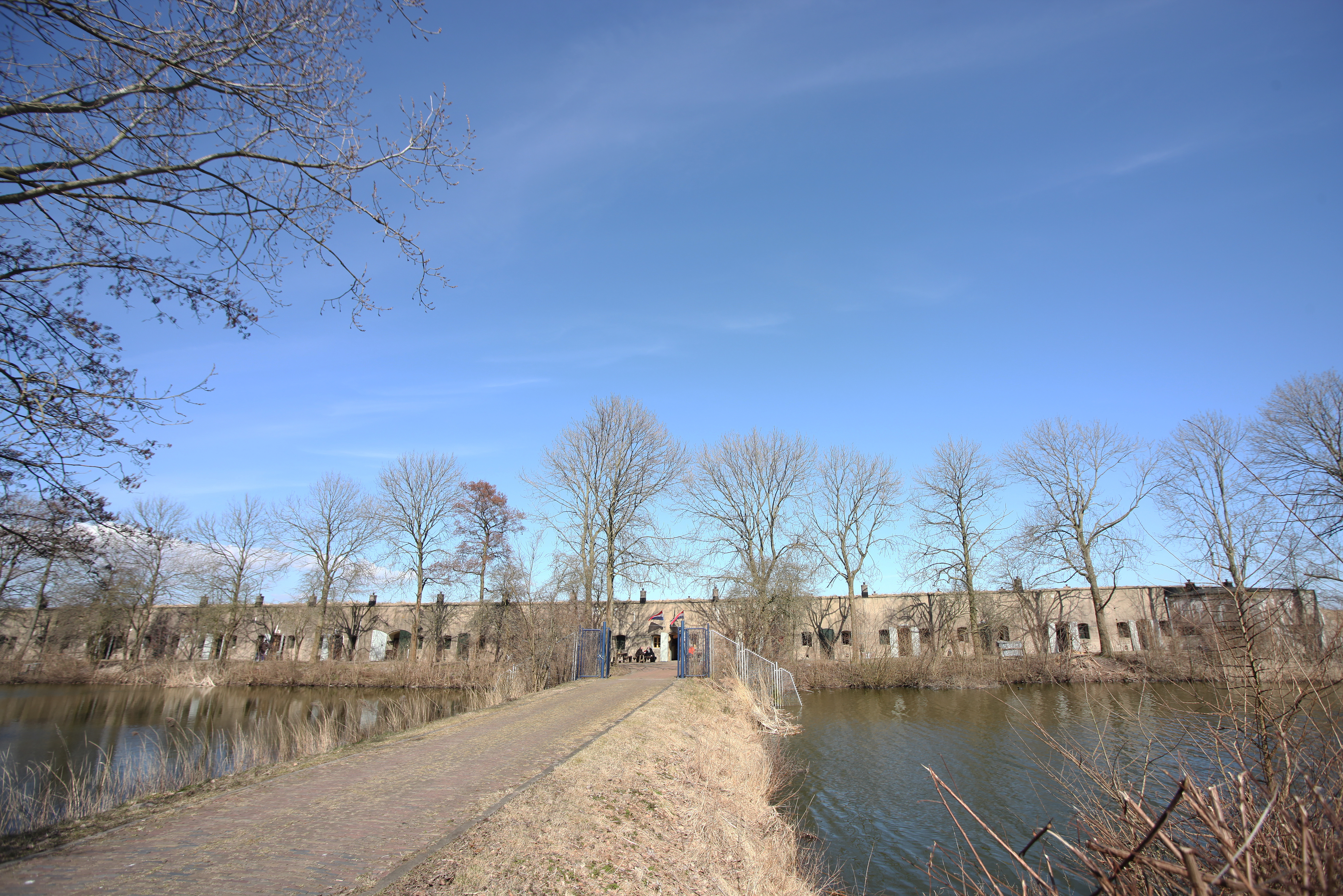
Fort near Edam lies north of the Edam sea lock, on the edge of the Zeevang polder and close to the old Zuiderzee dyke. The fort was built as a northern link in the Defence Line of Amsterdam and was meant to protect access to the capital against attacks from the north. Moat, earth cover, concrete buildings, postern, casemate and open field of fire show how water, polder and military technology were shaped here into one defensive landscape.

Why go here?
Walk along the moat, postern, main building and open ground around the fort and look at how close everything lies to water, dyke and polder. Fort near Edam makes the northern side of the Defence Line of Amsterdam easy to read: not as an isolated bunker, but as part of a landscape that could be flooded in times of threat.
What do you see?
You see a fort site with moat, earth-covered buildings, concrete elements, a postern, a casemate, a fort keeper’s house, storage shed and open polder land around it. Inside, original elements remain, including large cooking kettles and a boiler in the kitchen. Its position near the Edam sea lock, the old Zuiderzee dyke and the Zeevang polder makes clear why a fort was built here.
Why it matters
Fort near Edam shows how the Defence Line of Amsterdam worked on its northern side. It was not only the building that had to be strong; the entire landscape played a role. The Zeevang polder could be inundated, the sea dyke remained a possible dry route and the fort had to guard that passage. The place connects military technology, water management, dykes, sluices, polder land and the transition from the old Zuiderzee to the present-day Markermeer.
The deeper story
Fort near Edam lies outside the old town, beside the Oorgat and close to the coast of the Markermeer. The site is situated north of the Edam sea lock, on the edge of the Zeevang polder. Approaching the fort, you do not see a tall building dominating its surroundings, but a low defensive structure that almost disappears into earth, water and grass. The moat, earth cover and open polder landscape form the first impression.
The fort forms part of the Defence Line of Amsterdam, the great defensive ring intended to protect the capital with forts, batteries, sluices, dykes and land that could be flooded. The line did not function as a stone wall around the city. Its main defence consisted of shallow inundations. Roads, fields and low ground had to become impassable, while forts guarded the dry passages, dykes, railways and sluices.
The polders north of Amsterdam could be inundated relatively easily. Several northern forts were therefore built later than those elsewhere in the Defence Line. At Edam, construction began in 1886 with an earthwork. The site received its final military form only in the early twentieth century. The fort was completed in 1912 and belongs to the late building phase of the Defence Line.
The location was chosen carefully. The Zeevang polder could be flooded, but the old Zuiderzee dyke remained usable as a dry and raised route. The Edam sea lock was also important for water management and access to the area. An enemy seeking to bypass the inundations would use precisely such routes and passages. The fort had to guard this northern approach to the Amsterdam region.
Fort near Edam therefore defended not an isolated piece of ground, but a junction in a water landscape. The Zuiderzee, the sea dyke, the lock, the roads and the low polder all formed part of the same military calculation. The wet landscape was meant to halt an enemy. Concrete, artillery and open fields of fire closed the remaining routes.
That arrangement can still be recognised. The moat surrounds the site and the earth-covered buildings lie low in the greenery. A postern connects different parts of the fort, allowing soldiers to move under cover. A concrete casemate for artillery stands in front of the main building. The fort keeper’s house and storage shed recall that this was not only a combat position, but also a site that had to be guarded, maintained and supplied every day.
Unlike some other forts of the Defence Line, Edam did not receive retractable gun turrets. A fixed concrete casemate was built instead. This difference was related to the specific task of the location. Its guns mainly had to cover the dry route along the sea dyke and the area around the lock. The form of the fort was therefore determined not by a fixed standard model, but by the landscape it had to control.
Original features inside bring the daily military reality closer. The kitchen, with its large cooking kettles and boiler, makes clear that soldiers stayed here for extended periods. Behind the abstract plans of inundation and defence lay an everyday world of meals, heat, water, supplies, guard duty and discipline.
During the mobilisation of the First World War, the fort was actually occupied. The major attack for which the Defence Line had been designed never came, but the troops still had to remain ready. The site became a place of waiting, training, guarding and preparedness. Its military meaning was therefore not limited to drawings and theoretical defence plans.
After the war, the fort acquired other functions. For a time it served as a disciplinary unit for soldiers. After the Second World War, it was used to detain people associated with the German occupier. Military storage and training followed later. These later uses add another story to the fort: not only defence, but also control, surveillance, discipline and confinement.
The surrounding landscape remained essential. The open polders allowed clear fields of fire and inundation. The dyke formed the vulnerable dry route and the lock played a role in controlling the water. The openness around the fort is therefore not empty space. It is a preserved part of its original military function.
The closure of the Zuiderzee transformed the surroundings. Open seawater was replaced by the Markermeer. The direct threat of sea and war disappeared, but the relationship between fort, dyke, lock and polder remained recognisable. It is still possible to understand why a defensive work was built at this precise location.
The quiet and limited access later made the site attractive to birds and other wildlife. Many forts of the Defence Line unintentionally became green refuges because of their enclosed position. The present natural value is therefore not an unrelated new story, but a consequence of the military boundaries that protected the terrain from intensive use for a long time.
Fort near Edam preserves a world in which water management and military engineering were almost inseparable. Its history lies not only in concrete and artillery, but also in the moat, lock, sea dyke and low land of the Zeevang. Together they form a defensive landscape in which every difference in height and every dry passage mattered.
Look closely, and the fort is not an isolated structure. The old town, outer harbour, lock, dyke, Markermeer and polder all belong to the same story. Fort near Edam is a preserved piece of military landscape design on the boundary between land and water.
Further reading
- Fort bij EdamStichting Fort bij Edam
- Fort bij EdamHollandse Waterlinies
- Fort bij Edam: bewaker van de ZuiderzeedijkOneindig Noord-Holland