
The story of this place
A defensive landscape dating from 1800
The Beverwijk Defence Line lies on the northern edge of Beverwijk as a series of low earthen forms, remains of lunettes and a memorial obelisk leading back to 1800. After the shock of the Anglo-Russian invasion, Holland was defended here not with a massive stone fort, but with earth, ditches, artillery and carefully chosen terrain.
In August 1799, an Anglo-Russian invasion force landed on the North Holland coast. The Batavian Republic was then closely connected with France. The attack was intended to push back French influence in the Netherlands and restore the old Orange authority. The fighting around Bergen, Alkmaar and Castricum was fierce. The invasion ultimately failed, but it made clear how vulnerable North Holland was.
A narrow gateway into Holland
Beverwijk lay at a strategic narrowing of the landscape. Between the North Sea, the dunes and the former Wijkermeer, a passage remained through which an army from the north could move toward Amsterdam and the heart of Holland. East of Beverwijk, water could be used on a larger scale to flood land. On the higher sandy soils and in the dune strip, this did not work automatically. There, earthworks, ditches, sightlines and artillery were needed.
That is why the Beverwijk Defence Line had a different character from the better-known wet waterlines. The defence consisted of lunettes: low, crescent-shaped earthen fieldworks with ramparts, flanks, points and ditches. Mobile cannon could be placed on the ramparts. The earthen forms offered protection to soldiers and artillery. The points faced north, the direction from which the danger had come in 1799.
Cornelis Rudolphus Theodorus Kraijenhoff and Claude Gilet are among the names connected with the design. The line was built quickly, in response to a threat that was no longer theoretical. Sources differ on the exact number of lunettes. Some counts arrive at 26, while others describe a double, curved series of around thirty earthen works. Their shared purpose is clear: to close the passage between sea and inland water.
A short-lived military role
The military function lasted only a short time. The lunettes were occupied until around 1804. The troops were then withdrawn and the line lost its immediate necessity. Earthen fieldworks without a continuing military role are vulnerable. They are dug away, levelled, overgrown, built over or absorbed into parks, cemeteries and road verges. That is exactly what happened here in the nineteenth and twentieth centuries.
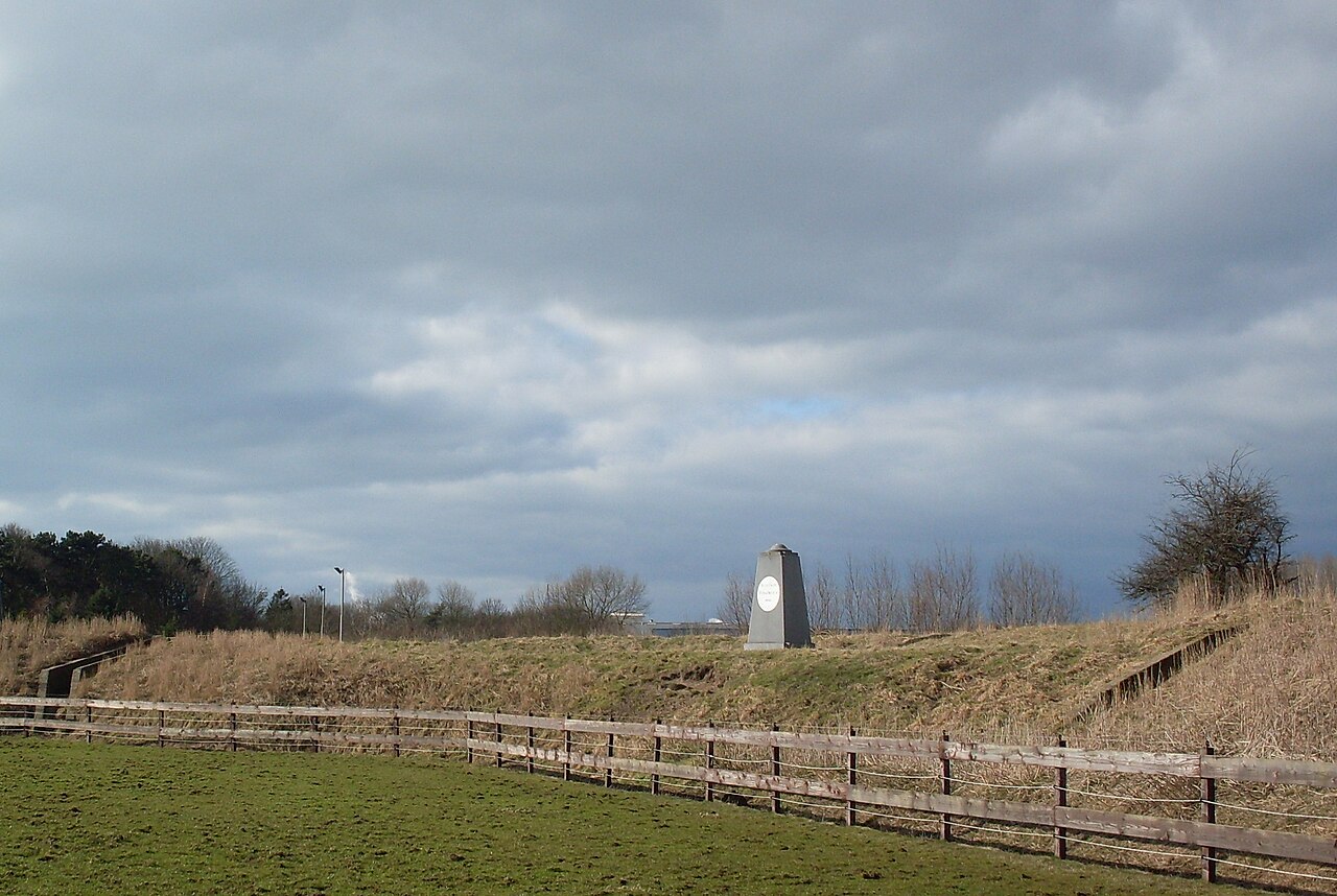
One of the clearest traces is the memorial obelisk on the Creutzberglaan. The monument bears the motto “Si vis pacem, para bellum”: if peace is desired, war must be prepared for. The obelisk originally stood on lunette 15. When that lunette was excavated in 1932 to make room for the expansion of the Duinrust general cemetery, the monument was moved to lunette 14. The column therefore tells not only of the construction of the line, but also of loss, relocation and the slow disappearance of the original defensive landscape.
Fragments in a changed landscape
Only part of the original series remains visible. Lunette 26 near Wijk aan Zee and lunettes 8 to 14 near Beverwijk are often mentioned as surviving elements. Not every remnant is equally accessible or recognisable. Some lie on private land, while others have been restored or marked with information. The line therefore no longer exists as a closed military system, but as a series of fragments in a changed landscape.
A lunette is not a building with walls, windows and a clear entrance. Without explanation, it may look like a green embankment, a raised verge or an ordinary edge of terrain. Its meaning lies in the curve, the differences in height, the orientation, the position and the distance to other remains. The Beverwijk Defence Line therefore consists of more than separate objects. Here, the landscape itself forms the old military plan.
Later, the terrain acquired new military layers. During the Second World War, some lunettes were again used as defensive spaces, including through the construction of trenches or other military traces by the German occupier. A defensive landscape from 1800 was thus used again in wartime. Old forms temporarily gained new meaning, even though their original function had long disappeared.
An almost forgotten gateway
The value of the Beverwijk Defence Line lies precisely in its modesty. It is not a spectacular castle, a large fort or a bunker complex that immediately impresses. It is a military layer on a changed urban edge, among roads, greenery, cemetery, dune fringe and industry. The remaining ramparts, slopes and obelisk show how a narrow passage into Holland was once closed with earth and artillery.
The Beverwijk Defence Line thus preserves a defensive story that has largely sunk into the landscape. A green edge turns out to be a defensive work. An obelisk becomes a warning from 1800. An urban fringe becomes an old gateway to Holland. Between Beverwijk and Wijk aan Zee, a hastily built defensive landscape still glimmers through, created after an invasion that had nearly threatened Amsterdam.