
The story of this place
A village on the beach ridge
Sint Pancras occupies an elongated coastal ridge between Alkmaar and the former lake district around Heerhugowaard. The Bovenweg follows the raised spine through the village. Houses, gardens and side streets conceal a much older landscape. Vronen stood on this safe ground, a settlement that existed from the Early Middle Ages and was violently destroyed in 1297.
Vronen was connected with an extensive estate. The settlement occupied dry sandy ground beside wide peatlands. Farmers could live and cultivate fields here without settling in the wettest parts of the landscape. The surroundings to the east later changed dramatically. Peat disappeared through reclamation, subsidence and water erosion. The Heerhugowaard and other lakes expanded, while the coastal ridge remained as a narrow habitable spine.
From the twelfth century onward, Vronen lay in a region where the counts of Holland sought to extend their power. The West Frisians defended their independence and had no strong central authority. They used the wet landscape to their advantage. Armies from Holland struggled with narrow dykes, ditches, lakes and marshy ground. Attacks and counterattacks continued for more than a century.
Vronen stood close to Alkmaar and to routes through the borderland. This gave the village a strategic position. West Frisian fighters could move south from this area. Holland’s forces used Alkmaar and the newly built castles of Middelburg and Nieuwburg to control the surrounding land. The village lay between two power zones that increasingly confronted one another.
The struggle for West Friesland
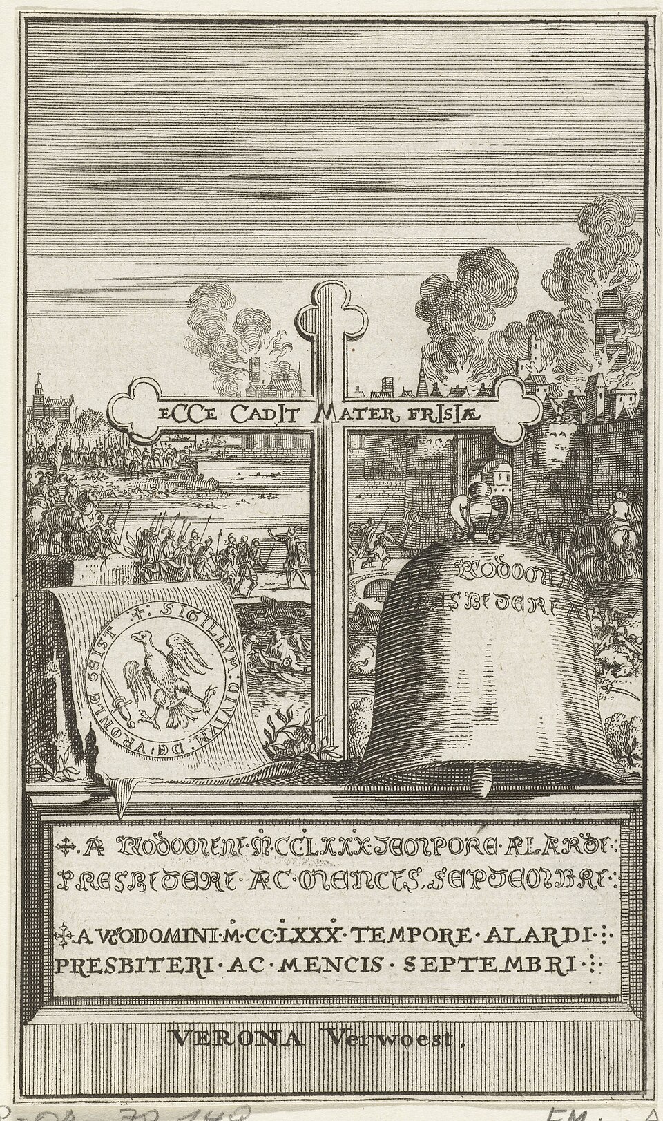
Count Floris V largely subdued West Friesland during the 1280s. His death in 1296 caused renewed unrest. The West Frisians again resisted comital rule. The conflict culminated in a major battle near Vronen on 27 March 1297.
The West Frisians chose an open confrontation on this occasion. The Holland army could therefore deploy mounted and organised troops. According to historical reconstructions, part of the comital force was transported by ship and blocked the West Frisian retreat. The battle ended in a severe defeat. The exact death toll is unknown. Medieval chronicles describe heavy losses, but their figures cannot be established reliably.
The violence did not stop immediately when the West Frisian lines broke. Wounded and fleeing fighters were pursued. Some victims may have reached the village or cemetery. Examination of excavated skeletons revealed broken skulls, cut marks and other weapon injuries. Some of these wounds may be connected with the battle, although not every injured skeleton can automatically be assigned to the events of 1297.
Destruction and forced departure
After the victory, Vronen was punished for supporting the uprising. The village was destroyed and its surviving inhabitants were forced to leave. Some may have settled beside the Rekeredijk, where Koedijk emerged or expanded. Farms, yards and roads lost their occupants. An inhabited coastal ridge became abandoned ground.
The church disappeared as well. It probably stood near the cemetery beside the road then known as the Bredeweg. The building was damaged during or after the destruction and did not survive. Building material was removed and reused. Remaining foundations were broken out in later centuries. The cemetery remained below ground.
The burial ground was centuries older than the battle. It had been used from the eleventh century and covered an estimated area of more than three thousand square metres. Adults and children were buried in wooden coffins, hollowed tree trunks and graves lined with turf. These different grave forms show how several generations placed their dead in the same location.
The dead beneath Sint Pancras
Human bones were uncovered during work in a front garden on the Bovenweg in 1991. The subsequent excavation covered only about thirty-five square metres. It nevertheless recorded remains from 132 individuals. Some graves belonged to ordinary inhabitants from the eleventh to thirteenth centuries. Other skeletons carried injuries that may fit the violence of the late thirteenth century.
The dead had not been thrown together in a single mass grave. Many people lay in separate burials among earlier inhabitants of the village. This indicates that the cemetery was used over a long period and that bodies could still be carefully buried after violent events. That care for the dead forms a sharp contrast with the later destruction of the village.
Vronen survived for centuries in stories. Writers sometimes turned it into a great city with walls, officials and heroes. Some tales speak of betrayal or a powerful mayor. Archaeology presents a more restrained picture. Vronen was an important village with an old estate and a large cemetery, but it was not a lost metropolis.
What Vronen left behind
Settlement returned to the coastal ridge during the fourteenth century. The later Sint Pancras gradually grew over and beside the site of Vronen. Roads continued to follow the same raised ground. Plots, houses and gardens covered the former village. Vronen therefore did not disappear beneath open water or deserted fields, but beneath a new settlement.
Follow the Bovenweg and notice the slight rise of the ground. Imagine a medieval village of farms, church, yards and a large cemetery between the present houses. Near Bovenweg 201, dozens of former inhabitants lay just beneath a modern garden. Nothing from Vronen remains standing, but the village is still present beneath Sint Pancras.