
The story of this place
An island core from the Ice Age
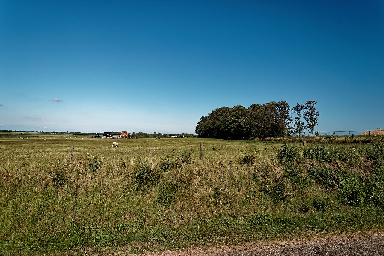
De Hoge Berg lies between Den Burg and Oudeschild and forms one of the oldest recognisable landscapes on Texel. Its name sounds grander than its height suggests: the highest point reaches only about fifteen metres above sea level. On Texel, however, that is enough to create a distinctly different landscape. De Hoge Berg is neither a dune nor ordinary farmland, but an ancient rise of boulder clay formed during the penultimate Ice Age.
During that Ice Age, Scandinavian ice masses reached this part of the Netherlands. Under the pressure of ice, stones, sand and boulder clay, a low but firm elevation developed. While sea, wind and people later continued to reshape the island, this old core remained recognisable as higher and more stable ground. Its gentle slopes and open position therefore show a different origin from that of the younger dunes, polders and accreted land around it.
The higher and firmer soil made the area attractive for settlement, farming and routes. Human history built upon the geological foundation. Farms, fields, roads and settlements developed in relation to height, soil, water and accessibility rather than at random. De Hoge Berg is therefore ancient both because of its ground and because centuries of use remain visible in the landscape.
Its most characteristic features are the tuunwallen. These low boundaries of stacked turf sods divide the fields. They arose from practical necessity. Ditches were less useful as boundaries on the rolling ground, while timber for fences was scarce. Farmers therefore used turf, earth and manual labour to divide their land.
Turf walls as old field boundaries
The walls give the area its distinctive pattern. They draw low lines across the grassland, enclose small plots and reveal the scale of the old farming landscape. Unlike modern boundaries of wire, posts or ditches, tuunwallen have a physical mass of their own. They show how agriculture adapted to the soil and conditions of the island.
Sheep barns are scattered across the landscape as another recognisable element. These small, often asymmetrical buildings belonged to sheep farming and were used mainly for storage and shelter. Their form reflects wind, location and use. The sloping roof, closed side and position in the field show that they are not isolated monuments, but parts of a wider agricultural system.
Sheep sheds and drinking ponds as a farming system
Drinking ponds formed another necessary component. These pools supplied livestock with water where suitable ditches were absent. Tuunwallen, sheep barns and ponds therefore belong together. They reveal how farmers organised the landscape around soil, livestock, water and field boundaries.
De Hoge Berg contains several historical layers. The oldest is geological: the Ice Age rise of boulder clay. Over it lies the agricultural landscape of plots, walls, ponds, sheep and barns. A third layer consists of protection and restoration. The present appearance did not survive automatically, but is actively maintained so that the old coherence remains visible.
A landscape that remains recognisable only through care
That maintenance is necessary. Tuunwallen may disappear when fields are enlarged. Sheep barns can lose their original use and ponds may become overgrown. Because the landscape looks peaceful and self-evident, it is easy to underestimate how much care is needed to preserve its historic pattern.
Nature and culture can hardly be separated here. The walls were made by people, yet provide habitats for plants and animals. The ponds were intended for livestock, but also form small ecological sites. The grassland has been used for farming and at the same time possesses natural value. The significance of De Hoge Berg lies in this long interaction between soil, people and nature.
Within Texel, the area forms an ancient core. It lies between Den Burg, Oudeschild, De Waal and Oosterend, beside roads and routes that have crossed the landscape for centuries. De Hoge Berg shows that Texel was shaped not only by sea, dunes and reclamation, but also rests upon a much older and firmer foundation.
Small forms with a large story
Walking or cycling through the area reveals no dramatic changes in height. Its strength lies in small forms: a road rising gently, a turf wall crossing the grass, a sheep barn on the horizon and a pond between the fields. Only by looking slowly does it become clear how little is accidental. Every line and object refers to soil, use and history.
De Hoge Berg is therefore not a collection of separate sights. Boulder clay, tuunwallen, sheep barns, ponds, roads and farmsteads form one historical landscape. The area shows how an Ice Age remnant developed into an inhabited and cultivated island landscape, how farmers shaped the land and how later generations came to recognise that coherence as heritage.
The meaning of De Hoge Berg ultimately lies in that whole. It is at once a geological monument, an agricultural cultural landscape and a tangible reminder of Texel’s history. Its history does not stand in one building or monument, but is spread across slopes, grasslands, walls, ponds and barns.