
The story of this place
A village behind the sea defence
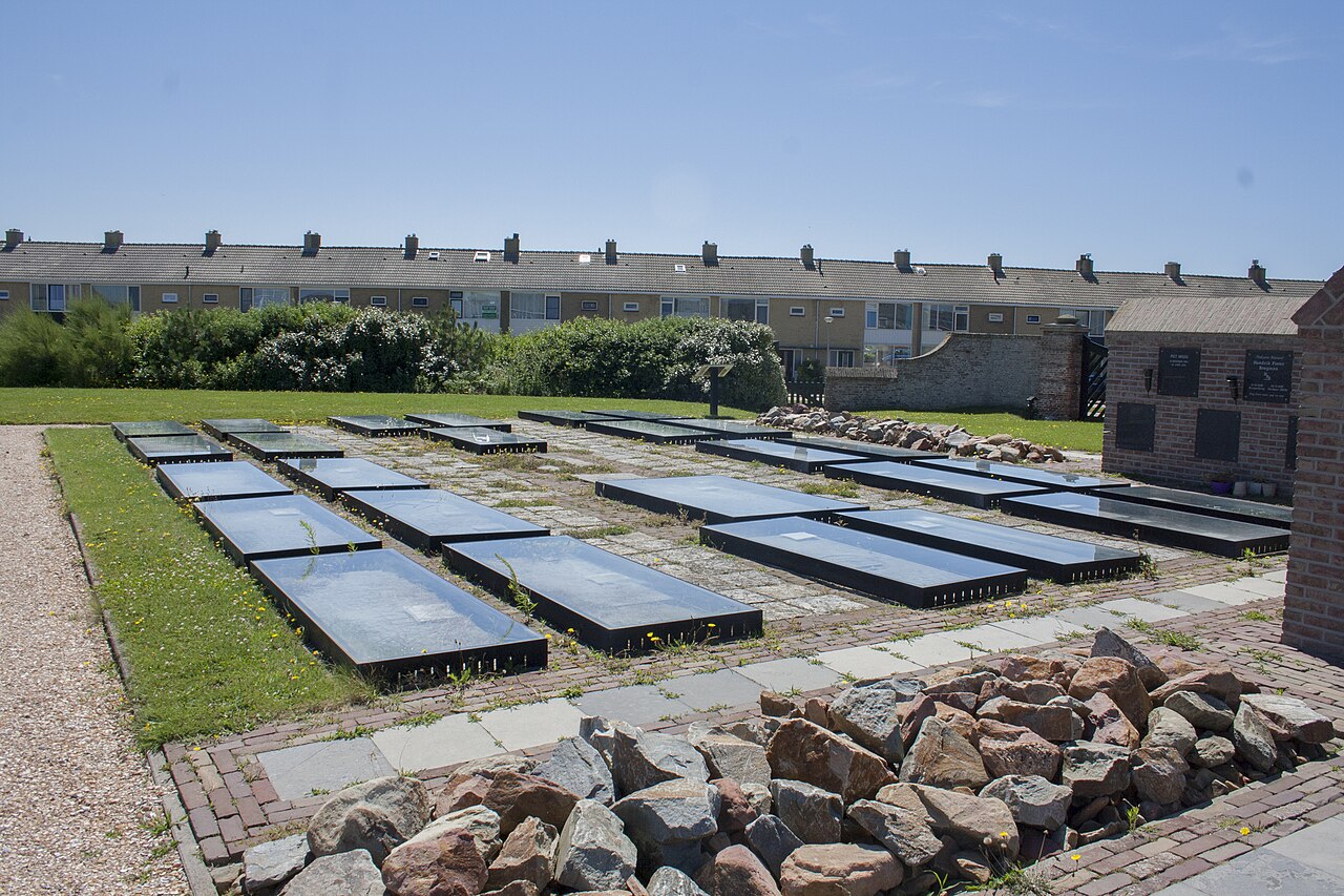
On the western side of present-day Petten, a small cemetery lies among reconstruction-era houses. Its low wall, old graves and historical ledger stones initially appear to be no more than remnants of an earlier burial ground. Until the Second World War, however, this was the heart of a village. The church, houses, streets and public buildings of the third Petten stood around the cemetery.
This Petten was itself the result of earlier losses and relocations. Older settlements had disappeared through storm floods, coastal erosion and the retreat of sea defences. A new village developed behind the Hondsbossche and Pettemer sea barriers. It no longer stood on the earliest shoreline, but remained closely connected with the sea, dyke maintenance, fishing and the open coastal landscape.
Most buildings were low houses along simple village streets. There were a church, town hall, shops, schools, farms and small businesses. The community was compact and the church formed its recognisable centre. The village was not large, but houses, yards, streets and public buildings together formed a structure that had developed over a long period.
The Atlantic Wall reaches Petten
During the German occupation, the coastal location became a military problem. From 1942 onward, work began along the western European coast on the Atlantic Wall, a defensive zone intended to prevent an Allied landing. Villages and buildings that obstructed fields of fire or occupied military ground could be evacuated and demolished.
For Petten, the consequences were exceptionally severe. The inhabitants had to leave their homes and find accommodation elsewhere. Between June 1943 and May 1944, houses, farms, shops and public buildings were systematically demolished. Only a few buildings outside the main village centre were allowed to remain. Almost nothing of the old village survived above ground.
The Dutch Reformed church also had to disappear. After earlier coastal relocations, it had become the fixed centre of the village, but it was demolished in 1944 on German orders. Its loss removed not only a building but also the spatial anchor of the streets, cemetery and daily village life.
What remained of church and churchyard
Ledger stones from inside the church were preserved and later gathered on the cemetery grounds. They bear the names of people originally buried inside the building. A physical part of the church therefore remains, although its walls, roof and tower have disappeared.
The old cemetery and small mortuary building also survived. After the demolition, they stood isolated within a military coastal landscape. Bunkers, obstacles and other defensive works had replaced the houses. The Allied invasion for which the village was removed did not take place on this stretch of coast.
A new village in a different place
After liberation, Petten could not simply be restored in its former form. The buildings were gone, the ground had changed and construction materials were scarce. Reconstruction began in 1946. A different plan was prepared for the new village, with wider streets, new housing and amenities based on post-war planning principles.
The new Petten was built slightly farther north. Between 1946 and 1957, a new centre with more than one hundred homes emerged. Village life returned, but the pre-war layout was not restored. The new streets followed different lines and the former relationship between church, cemetery, town hall and houses had disappeared.
The position of the cemetery also changed. Before the war, it surrounded the church amid the houses. In the new plan, it initially lay near the edge. Later development enclosed it once more. The burial ground remained fixed while the village around it completely changed shape.
Where old and new Petten meet
Little else from the third Petten can be recognised above ground. Historical photographs show narrow streets, timber and brick houses, yards, fences and the church as a fixed landmark. Reconstruction-era housing and modern streets now occupy the same area. Continuity between the two periods lies mainly in the preserved cemetery.
The third Petten disappeared differently from the older settlements. The sea did not take it and no storm flood was the direct cause. Its destruction was decided in advance, the population was evacuated and the buildings were dismantled one by one. Many houses were still usable when they disappeared.
Reconstruction restored village life but could not restore the vanished landscape. New houses provided homes again, but the former network of streets, neighbours, yards and landmarks had been broken. Present-day Petten is therefore both the successor to the third village and a visible product of occupation and reconstruction.
The cemetery remained in place, but everything that gave it meaning changed. The church, town hall, streets and houses disappeared between 1943 and 1944. What now lies as a quiet place among post-war homes was once the heart of the third Petten.