
The story of this place
Why IJmuiden became a Festung
The importance of IJmuiden began with the North Sea Canal. Since its opening in 1876, the canal entrance had formed Amsterdam’s direct route to the sea. Fishing, shipping and heavy industry developed around the locks and harbours. The arrival of the Hoogovens steelworks at Velsen made the area even more important. Whoever controlled IJmuiden controlled not only a harbour, but also the approach to Amsterdam and a major industrial complex.
The Dutch state had already fortified that position before the Second World War. An armoured fort was built on the Forteiland from the 1880s onward as part of the Defence Line of Amsterdam. It was intended to keep enemy warships out of the North Sea Canal. By 1940 it was militarily outdated, but its location remained strategic.
After the German invasion in May 1940, the occupying forces took over the Dutch defences. Guard posts, anti-aircraft guns and coastal artillery appeared around IJmuiden. The harbour could be used by the German navy, while the locks, steel industry and shipping route required protection against air raids and a possible attack from the sea.
From 1942 onward, the Atlantic Wall was developed along the western European coast. It was not a continuous wall, but a network of fortified harbours, batteries, radar stations, minefields and strongpoints. Because of its harbour and canal entrance, IJmuiden received the status of Festung.
This meant the area had to be defended in every direction. An attack from the sea was not the only concern. Allied troops landing elsewhere and approaching overland also had to be stopped. An extensive system of bunkers, artillery, anti-tank obstacles, ditches and barriers was therefore built on both sides of the North Sea Canal.
Core position, coastal batteries and bunker landscape
The central stronghold stood on the Forteiland. The Germans constructed 28 bunkers around the Dutch armoured fort. The island controlled the direct entrance to the canal and became a heavily fortified position within the wider Festung. Dutch nineteenth-century fortification and German wartime concrete construction were literally layered on top of one another.
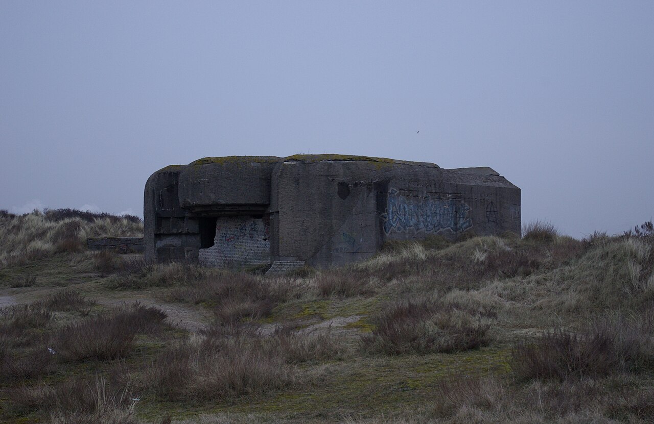
Marine Coastal Battery Heerenduin stood south of IJmuiden. It consisted of four heavy M 272 gun bunkers and an M 178 fire-control post. Distance and direction to targets were calculated from this higher command position. The information was then passed to the individual gun bunkers.
The arrangement followed a strict military logic. Embrasures faced the sea, while entrances were placed as safely as possible on the landward side. Thick walls and concrete roofs were intended to resist shellfire and aerial bombing.
Many smaller structures stood around the major combat bunkers. Soldiers needed accommodation, ammunition stores, observation posts and facilities for communication, electricity and water. Trenches and light field positions connected the different elements.
An estimated two thousand defensive structures were built in and around Festung IJmuiden. These included heavy reinforced-concrete bunkers, but also simple shelters, foundations and field fortifications. The lighter structures disappeared quickly after the war. The surviving bunkers therefore represent only part of the original system.
Fast attack boats, forced labour and evacuation
The harbour bunkers served a different purpose from the coastal batteries. German Schnellboote operated from IJmuiden. These fast, heavily armed vessels attacked Allied shipping and laid mines in busy waters.
Schnellbootbunker II was built to protect the boats from air raids. Several vessels could be sheltered beneath its massive concrete roof. Its scale makes it one of the largest bunkers in the Netherlands. A separate torpedo bunker was used to store and prepare weapons.
The construction of the Festung required enormous amounts of material and labour. Organisation Todt coordinated much of the work. Dutch companies and workers were employed alongside foreign workers and forced labourers. Conditions differed, but freedom of choice became increasingly restricted under occupation.
The fortification of IJmuiden also transformed daily life. Parts of the coast became restricted military zones. Homes and streets were removed to make way for defences or open fields of fire. Dunes once used for recreation or passage became guarded ground.
A large part of the population had to leave IJmuiden. The harbour and industry were bombed, while the occupiers demolished residential areas. Families were dispersed and returned after liberation to a town that was heavily damaged and partly erased.
No battle, but destruction and disappearance
The Allied invasion eventually took place in Normandy rather than at IJmuiden. Even so, the Festung remained occupied until the end of the war. Fear of fighting around the harbour and locks continued, but a major battle never occurred.
After May 1945, bunkers, minefields and barriers remained. Mine-clearance units reopened the area and removed weapons and ammunition. Many German concrete structures were blown up, sealed or covered with sand. Others survived because demolition was too expensive or dangerous.
Reconstruction took priority over preservation. Harbours, industry and roads cut through the former defensive system. Expansion of the Hoogovens steelworks and other companies absorbed parts of the military landscape. Some bunkers disappeared inside restricted industrial sites.
In the dunes, many remains vanished in another way. Wind and sand buried entrances and walls. Marram grass and shrubs spread across concrete roofs. A conspicuous bunker could gradually become a low mound with only a dark opening visible at the side.
Interest in the Atlantic Wall as connected heritage increased from the late twentieth century onward. Volunteers investigated bunkers, reopened entrances and collected documents and personal stories. The Bunker Museum IJmuiden was established in former personnel bunkers belonging to the Heerenduin battery.
Learning to read a scattered system again
Festung IJmuiden nevertheless remains difficult to recognise as a whole. The original fields of fire have disappeared and the surviving elements lie far apart. Harbours, roads, wind turbines, industry and recreation now dominate the landscape. A solitary bunker can therefore resemble an isolated block of concrete.
The relationship becomes clearer by examining position and direction. The fire-control post stood higher than the gun bunkers. The embrasures faced the sea and canal entrance. Further inland, obstacles and smaller posts were intended to prevent an attack from the rear.
The Schnellboot bunker also reveals the importance of IJmuiden. It was not designed merely to shelter a few soldiers, but to keep complete Schnellboote operational. Its scale shows how much material, labour and military attention were invested in this harbour.
Different periods meet on the Forteiland. The Dutch armoured fort recalls the defence of the North Sea Canal in the nineteenth century. The German bunkers show how the same entrance was fortified again during the Second World War. The modern harbours and locks explain why this narrow connection between sea and canal remained strategically important.
Many of the approximately two thousand structures have disappeared. Festung IJmuiden is therefore no longer a complete defensive system, but a scattered landscape of heavy remains. Roads, trenches, barracks and command lines have largely vanished. The bunkers survived without the network that once explained their purpose.
At the Heerenduin battery, look beyond the concrete itself. Notice the direction of the embrasures, the protected position of the entrances and the difference in height between the fire-control post and gun bunkers. These relationships make the former system readable again. What now lies scattered among sand, shrubs, harbour companies and recreation once formed one of the most heavily defended gateways in the Netherlands.