
The story of this place
A village on the bed of the Haarlemmermeer
Rijk stood in the eastern part of the Haarlemmermeer polder. The village developed after the Haarlemmermeer was drained in the mid-nineteenth century. New roads and ditches divided the former lakebed into long straight plots. Farms, houses and small businesses appeared along the Aalsmeerderweg, Vijfhuizerweg and several side roads.
The name Rijk was older than the nineteenth-century village. A settlement with that name had existed in the area before the Haarlemmermeer expanded. This medieval place disappeared centuries earlier as the water advanced. After drainage, the name returned for the new polder community. The later village therefore already carried the memory of an earlier vanished landscape.
The new Rijk developed into a recognisable village community. Farms lined the straight polder roads. Workers’ houses, shops, workshops and cafés stood between them. There were schools, religious buildings and local associations. Residents lived from agriculture, crafts and work in the surrounding area. The village was small but possessed its own social life.
The Aalsmeerderweg formed an important line through the settlement. Houses and facilities clustered around its connections with other polder roads. Children walked and played beside the road. Churchgoers met at buildings including the Maranatha Church. Farmers travelled between farmyards and fields. Rijk resembled many other young settlements established in the Haarlemmermeer after drainage.
Schiphol draws ever closer
Schiphol lay nearby. The airfield began modestly but expanded throughout the first half of the twentieth century. New runways, military interests, increasing air traffic and technical installations required growing amounts of land. After the Second World War, Schiphol was designated for further development as a major international airport.
Rijk lay within an area considered necessary for that expansion. Roads were closed or diverted. Agricultural land entered plans for runways, safety zones and other airport facilities. Residents saw their village increasingly enclosed. The airport did not take over the area in a single movement but came closer step by step.
Uncertainty lasted for years. Residents knew that expropriation threatened but did not always know when they would have to leave or where they could go. Farmers had to search for other land. Families sought new homes. Business owners faced the loss of a customer base that would disappear with the village. Every departure left Rijk emptier and weakened the remaining community.
A community without a new home
Residents and the municipal authorities sought a collective solution. Plans considered a new residential centre near Rozenburg where the inhabitants of Rijk could be rehoused together. They wanted not only replacement homes but also facilities through which community life could continue. The proposal was ultimately not implemented, partly because of objections to the location and expected aircraft noise.
The possibility of moving the village as a single community consequently disappeared. Residents became scattered among different places. Many families moved to Aalsmeerderbuurt-Zuid, later known as Rijsenhout. Others found homes or businesses elsewhere in the Haarlemmermeer or outside the polder.
Large-scale demolition of the village centre began in the spring of 1959. Houses were emptied and pulled down. Farms vanished together with barns, yards and orchards. Workshops, shops and other facilities were demolished. Where village life had continued shortly before, empty plots, rubble and working areas remained.
The demolition of Rijk
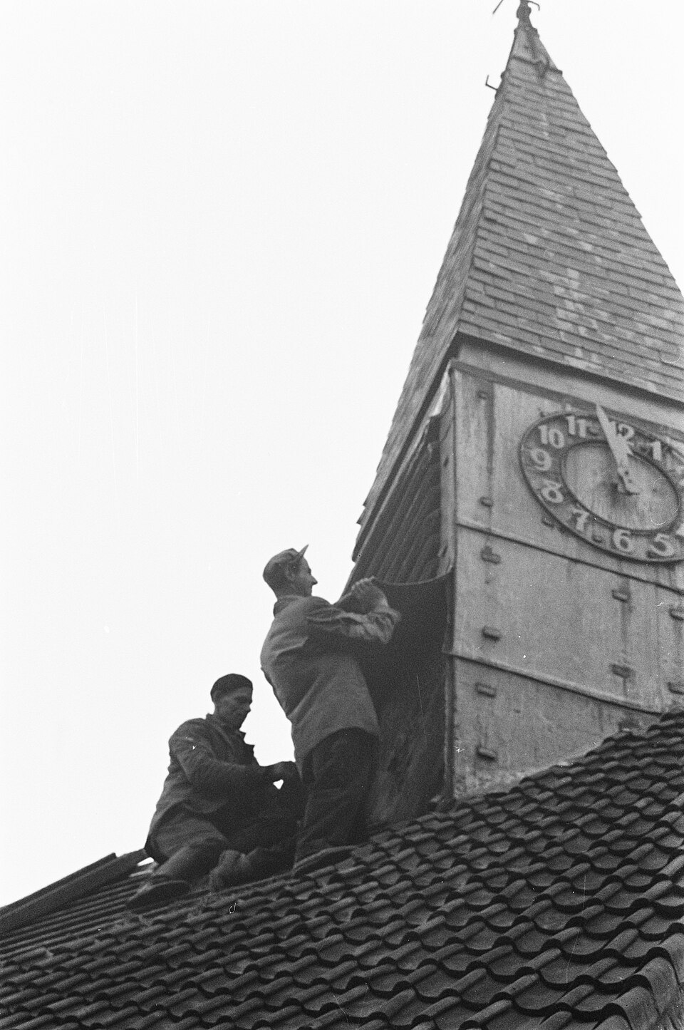
The Dutch Reformed Maranatha Church became a powerful symbol of the end. The building dated from 1929 and had stood for only a few decades. The final service was held on 22 November 1959. Many houses and farms had already disappeared. On 27 November, the church tower was also demolished to clear land for the further development of Schiphol.
Demolition destroyed more than buildings. Neighbours were scattered and associations lost their meeting places. Children attended other schools. Church members joined congregations elsewhere. Farmers who started again had to do so on different land. A community that had grown along the polder roads was broken apart within a few years.
Parts of the airport landscape appeared on and around the cleared ground. Runways, taxiways, safety strips, service roads and other facilities replaced homes, farmyards and fields. The former pattern of plots was interrupted or completely erased. Parts of the landscape remained open but acquired an entirely different purpose.
What the name still preserves
The Schiphol-Rijk business park later appeared south of the airport. Its name suggests that the vanished village continues there. The business park, however, does not precisely coincide with the complete former village centre. The historical name became attached to offices, logistics and aviation businesses. Rijk therefore survived on signs and addresses while the settlement itself became almost invisible.
Historical photographs make the transformation tangible. They show houses beside narrow roads, children in the street, farms, churches and residents among rubble or close to aircraft. Other images show façades being pulled down and the church tower disappearing. They are not remains in the present landscape, but they demonstrate how completely the surroundings changed.
Almost nothing can be recovered at the former village site. A substantial part of the area lies behind fences, within the airport grounds or among roads and business premises. Traffic and aircraft dominate the surroundings. The former village must be reconstructed from maps, photographs and memories. The land now occupied by airport infrastructure was not an empty polder, but a community with its own centre.
Rijk disappeared through decisions taken at the time to make the further growth of Schiphol possible. Schiphol developed into an airport of international importance. At the same time, residents lost their homes and shared place. These two realities belong to the same landscape. Among runways, fences and commercial buildings, the name Rijk still recalls the village that had to make way for the airport.