
The story of this place
A gap in the line of dunes
For centuries, something apparently natural along almost the entire North Holland North Sea coast was absent between Camperduin and Petten: a broad ridge of dunes. The hinterland was exposed to the sea precisely at this point. Where sand, wind and vegetation formed a dune system elsewhere, a man-made sea barrier had to hold back the waves.
The shoreline once lay farther to the west. During the Middle Ages, dunes, beaches and inhabited land stood seaward of the present coast. Storm surges, wave action and continuous erosion pushed the boundary between land and sea progressively eastwards. Settlements disappeared or were moved inland. Petten itself was forced to retreat from the water several times.
A system of dykes and reinforced dunes gradually developed at this vulnerable point. Management was entrusted to the Hoogheemraadschap van de Hondsbossche en Duinen tot Petten. Dyke reeves, board members, supervisors and labourers were responsible for a section of coast whose survival could never be taken for granted. The name Hondsbossche referred to the vanished area known as Hondsbos or Hondsbosch. The sea barrier therefore preserved the name of land already taken by the sea.
The defences became progressively heavier. Wooden piles, brushwood, clay and stone were used to prevent waves from damaging the dyke. Basalt revetments and groynes were later added to influence currents and the movement of sand. Every severe storm was followed by inspection, repair and often another increase in height or width.
Six kilometres of hard sea defence
The Hondsbossche and Pettemer sea dyke eventually formed a hard interruption approximately six kilometres long between the dunes of Schoorl and those north of Petten. The dyke faced the sea almost directly. There was little beach, and during storms waves struck the stone covering of the seaward slope. The straight and heavy embankment contrasted sharply with the mobile dunes at either end.
The storm surge of 1 February 1953 demonstrated that even a high and heavily armoured dyke remained vulnerable. Its crest stood approximately 8.5 metres above NAP, yet waves still passed over it. Sections of the maintenance railway were swept away, and around 1,500 square metres of basalt revetment disappeared near Camperduin. Deep erosion developed around Second World War bunkers.
The dyke was strengthened again after 1953. Particular attention was paid to the transition between the hard sea barrier and the adjoining dunes at Camperduin. The dyke projected farther into the sea than the sandy coast beside it. Such transitions can be especially vulnerable to currents and wave erosion. Nevertheless, the sea dyke remained the primary protection of the hinterland for several more decades.
From weak link to sandy coast
At the beginning of the twenty-first century, the Hondsbossche and Pettemer sea dyke no longer met new statutory safety standards. It was identified as a weak link in the Dutch coast. A traditional solution appeared obvious: raise and widen the existing dyke and reinforce it with more stone and asphalt. This would have made the hard barrier even larger while leaving the abrupt transition between dyke and dune in place.
Instead, an intervention on the seaward side was selected. An entirely new beach and dune area was to be created in front of the old dyke. Rather than a still higher wall of clay, stone and asphalt, an enormous quantity of sand would absorb the first impact of waves and storm surges. The defensive line consequently shifted hundreds of metres westwards.
In 2014 and 2015, dredgers brought approximately 35 million cubic metres of sand from the North Sea to the coast. Trailing suction hopper dredgers collected the material from designated offshore extraction areas. Pipes and spraying systems distributed the sand across the seabed, beach and new dunes. Where the sea had once struck the dyke directly, a broad foreshore, a long beach and new dune ridges appeared.
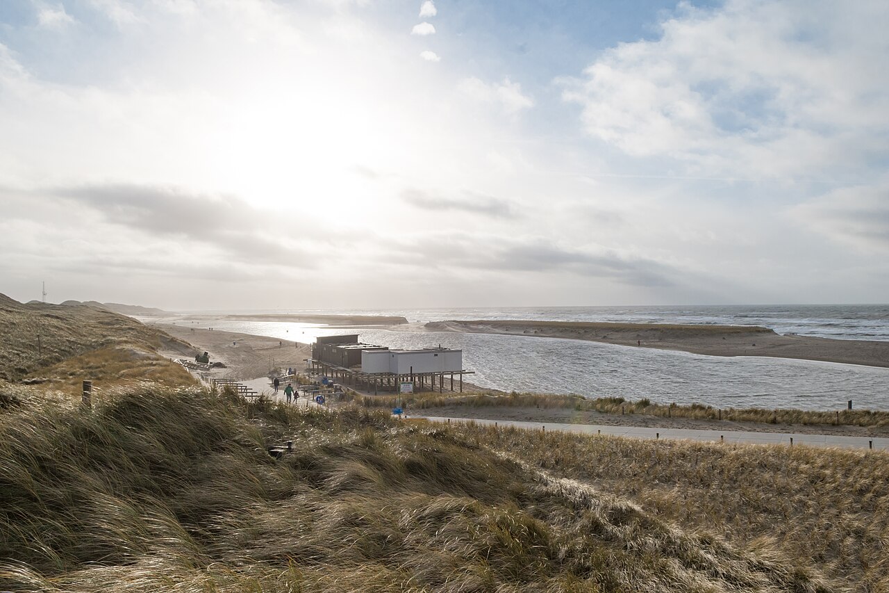
The project served more than flood safety. The new landscape was given several forms and functions. A lagoon developed behind a sand spit at Camperduin. Elsewhere, broad beaches, damp dune valleys, high ridges and quiet nature zones were created. Walking, cycling and riding paths made the area accessible. A section of coast that had previously consisted mainly of a dyke was transformed into an extensive landscape.
New nature in front of the old dyke
Marram grass and other pioneer plants help stabilise the loose sand. At the same time, room remains for natural drifting. Wind blows sand from the beach towards the dunes, where it is trapped by the vegetation. Water temporarily collects in lower areas, creating damp habitats. On higher ridges, drought, salt and drifting sand determine which plants can establish themselves.
The former Hondsbossche sea dyke remained behind the new dune area. The dyke did not disappear, but lost its primary flood-defence function in 2016. On the landward side, its line is still recognisable as a long, straight grass-covered dyke. Two generations of coastal defence therefore lie side by side: a fixed hard boundary and a broad sandy zone that is allowed to move.
The new coast does not maintain itself entirely without assistance. Since its construction, the beach and foreshore have changed more quickly than expected in some places. Currents and waves move large quantities of sand, particularly around Camperduin and Petten. Rijkswaterstaat therefore periodically supplements the coastal foundation with new nourishment. Sand is deposited either on the beach or on the seabed in front of the coast.
A coast that continues to require maintenance
Foreshore nourishment works differently from simply raising a dyke. The sand is deposited underwater and then redistributed by waves and currents. Some of it moves towards the beach and dunes. The defence is therefore not a finished object that only needs to be inspected afterwards, but a coastal system that is regularly supplied with new material.
At Camperduin, the sequence of old and new is easy to read. The North Sea lies in front. Behind it follow the beach, young dunes, lagoon and damp hollows. Farther inland runs the straight former sea dyke. Within only a few hundred metres, open sea, a coastline dating from 2015 and a dyke history extending back many centuries stand behind one another.
Pay particular attention to the position of that old dyke. Anyone walking only across the beach and through the young dunes could easily assume that this coast had always looked this way. Only when the straight grass dyke becomes visible behind the sand does it become clear how far the shoreline was moved seaward. The Hondsbossche Dunes therefore do not represent a choice between engineering and nature. The entire landscape is designed hydraulic engineering, but wind, sea, sand and vegetation are allowed to keep moving within that design.