
The story of this place
Farmers who divided the landscape
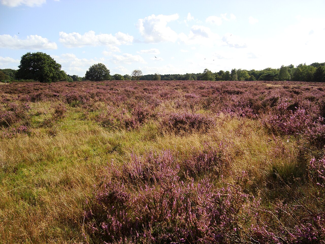
The Hoorneboegse Heath lies south of Hilversum, where open heath, woodland edges and the higher sandy grounds of the Gooi meet. A walk here reveals sandy paths, gentle undulations, scattered pines, grazing animals and purple heath in bloom. Yet beneath this peaceful natural landscape lies a much older history of use. The prehistoric Celtic fields are among its most subtle traces.
Celtic fields are small, roughly square plots arranged in connected patterns. The name does not mean that they must be directly associated with Celtic peoples. Low banks surrounded the fields and together formed a honeycomb or chessboard-like structure. Such agricultural systems occurred across large parts of north-western Europe.
The Hoorneboegse Heath preserves remains of a prehistoric field complex. Use probably began in the Bronze Age, around 1200 BC, and in some regions continued into the Roman period. Crops such as emmer wheat and spelt were grown on the small plots. What is now experienced as open nature was once a landscape of labour, food production and repeated use.
Centuries of grazing, turf cutting, paths and erosion flattened the relief. The pattern therefore remained difficult to recognise for a long time. Modern elevation data changed that: maps based on the Dutch national elevation model revealed a coherent network of slight ridges. Field research subsequently confirmed that soil, relief and pattern together point to a prehistoric field complex.
A field pattern that remained for centuries
These remains are unusual for North Holland. Celtic fields are better known from the Veluwe, Drenthe and other sandy regions in the east and north of the Netherlands. The Hoorneboegse Heath proves that the Gooi also contains an agricultural layer reaching back thousands of years. It was not an empty heath, but a landscape where people laid out fields, cultivated crops and organised their surroundings.
The site was well suited to this use. The Gooi lies on a push moraine with relatively high and dry sandy soils. In a wet landscape, such ground offered dry footing, visibility and soil that could be worked. It was attractive for settlement, routes and agriculture. The Celtic fields belong to this long relationship between people and higher sandy land.
The low banks around the plots probably developed gradually. During cultivation, stones, roots, turf and soil were moved towards the edges. Repetition created raised boundaries while the small plots continued to be worked. The pattern therefore reveals not only where people farmed, but also how labour, soil use, manuring and maintenance slowly transformed the landscape.
Why so much survived precisely here
Standing on the heath today, you do not automatically see where every field once lay. Its age lies in faint differences in height and lines that gain meaning only when the larger pattern is understood. Here you are not looking for one imposing monument, but for a structure almost absorbed by the landscape.
They are also part of a wider archaeological landscape. The heaths of the Gooi contain burial mounds, urnfields, old cart tracks and other remains. Together they show that the region was inhabited, used and crossed for a long time. People buried their dead, established routes, cultivated the soil and repeatedly reshaped their surroundings.
The Hoorneboegse Heath is therefore a layered landscape. Prehistoric fields, burial mounds, later cart tracks, heathland management, grazing and more recent traces lie beside and over one another. No period completely erased what came before. The heath preserves not a single historical moment, but an accumulation of uses.
Archaeology without walls or display cases
This layering also complicates present-day management. Turf cutting, grazing and path construction can keep the relief visible, but may also damage archaeological remains. Work carried out too deeply can harm old banks, while dense vegetation may conceal them. Nature management and archaeological protection are therefore closely linked here.
The Celtic fields change the way the heath is understood. What now suggests tranquillity and open nature was also working land for centuries. Beneath the present vegetation lies an older pattern of fields created by people whose names and written stories have not survived. Someone had to clear the soil, cultivate it, manure it, harvest crops and maintain the low boundaries. The chessboard pattern did not appear at once, but grew through years of repeated use.
A landscape you must learn to read again
The Hoorneboegse Heath shows that the oldest past does not always rise visibly above the landscape. Sometimes it survives in barely perceptible ridges, in a pattern on an elevation map and in the relationship between soil and use. Look closely, and the heath reveals more than nature. Beneath its gentle undulations lies an agricultural landscape shaped by people thousands of years ago.