Skip to content
The Netherlands Beneath Your Feet

The Netherlands and Water

The Netherlands and Water in North Holland

The Netherlands does not merely live beside water, but depends on a continuous system of measuring, pumping, draining, retaining and protecting against it. In North Holland, that system is exceptionally visible. Major national works and small local structures together form a landscape in which dry land has never been self-evident. This page brings together places where you can see how water management, flooding and land reclamation shaped the province. Dykes, pumping stations and locks are not simply historic structures, but remain parts of an active network.

View the water landscapes ↓

How water shaped North Holland

North Holland consists of islands, former seabeds, peatland, dunes and reclaimed polders. Water determined where people could live, which routes could be used and how much farmland remained available. Every dyke, lock and canal therefore changed not only the water level, but also the economy and organisation of the landscape.

The province shows almost every form of Dutch water management side by side. Medieval dykes lie close to nineteenth-century canals, steam pumping stations, modern sea locks and newly created islands. Together they show that the struggle with water has never been a single completed project.

Water management as everyday work

A dyke or pumping station may appear motionless, but it forms part of an active network. Water levels change, locks open, pumps start and water managers respond to rain, drought, river discharge and sea level. Many historic waterworks have gained new technology while their old locations still determine how the system functions.

History and present-day safety therefore often occupy the same place. An old lock complex may still be used every day and a historic dyke may form part of modern coastal defence. Look closely and you can see old masonry, new installations and current monitoring equipment side by side.

The other side: flooding and loss of land

The history of water management also includes failures and disasters. Dyke breaches created deep scour holes, storm surges swallowed settlements and military inundations deliberately put land under water. Such places show that engineering can reduce risk, but never remove it entirely.

Sometimes the landscape was restored after a disaster; sometimes the change became permanent. A new dyke line, an unusual field pattern or a rebuilt farmhouse can reveal how great the consequences were. These places make the vulnerability of low-lying land tangible.

Reclaimed lakes, polders and new land

Water management was not only about defence, but also about making land. Lakes were pumped dry, ditches and canals were dug and new plots were laid out. This created rational landscapes of straight roads, farms and carefully controlled water levels.

When you visit a reclaimed polder, you are looking at a landscape designed as an engineering project. Its scale often becomes clear only from a higher point or along a long sightline. Small pumping stations, windmills and locks also reveal how the new land was kept dry.

From closing off water to making room for it

Approaches to water are constantly changing. Earlier generations mainly raised dykes, closed off seas and drained land; today, water management also seeks room for water and ecological recovery. Marker Wadden and Hondsbossche Duinen show how safety, recreation and ecology are increasingly designed together.

This theme therefore tells more than a story of technical control. It is also about choices, sacrifices and adaptation. Behind every waterwork lies the question of which land is protected, where water is allowed to go and what that means for residents, shipping and nature. The selection focuses on places where the relationship between people and water can still be read on site in a structure, the landscape, water levels, continued use or visible traces of flooding and land reclamation.

Waterworks and landscapes to discover

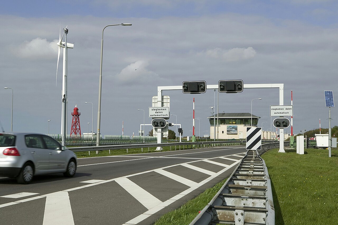
The Stevin Locks and the beginning of the Afsluitdijk near Den Oever

Photo: Paul van Galen

Credit: Photo: Paul van Galen / Cultural Heritage Agency of the Netherlands, via Wikimedia Commons, CC BY-SA 4.0

Licence: CC BY-SA 4.0

Changes: No changes.

Source β†—

The Netherlands and Water

The Afsluitdijk

Hollands Kroon / Súdwest-Fryslân

The Afsluitdijk is a monumental flood barrier between North Holland and Friesland. It closed the Zuiderzee off from the Wadden Sea and gradually transformed the salt water into the IJsselmeer. Over more than thirty kilometres, the Afsluitdijk brings flood protection, land reclamation and their consequences for fishing communities and nature together in a single landscape.

View this place
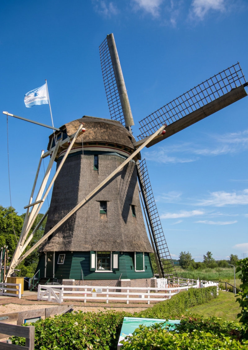
The Gemeenschapsmolen beside the Gaasp near Driemond

Photo: Willem Reinier de Jong

Credit: Photo: Willem Reinier de Jong / Nederland Onder Je Voeten

Licence: All rights reserved

Changes: Cropped and optimised for the website.

The Netherlands and Water

Driemond and the Gaaspermolen

Amsterdam

Driemond is a village at the confluence of the Gaasp, the Gein and the Smal Weesp. The historic Gemeenschapsmolen, better known as the Gaaspermolen, stands on the Lange Stammerdijk.

View this place
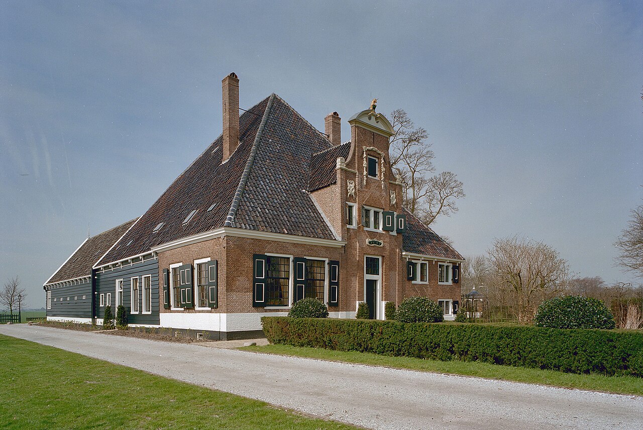
De Eenhoorn bell-jar farm beside the straight Middenweg in the De Beemster polder

Photo: A. J. van der Wal (Ton van der Wal)

Credit: Photo: A. J. van der Wal. Source: Rijksdienst voor het Cultureel Erfgoed, via Wikimedia Commons, CC BY-SA 4.0

Licence: CC BY-SA 4.0

Changes: No changes.

Source β†—

The Netherlands and Water

De Beemster Reclamation

De Beemster

De Beemster Reclamation is a seventeenth-century geometric polder landscape in North Holland. Roads, canals, plots, the ring dyke and farms together form a UNESCO World Heritage Site.

View this place
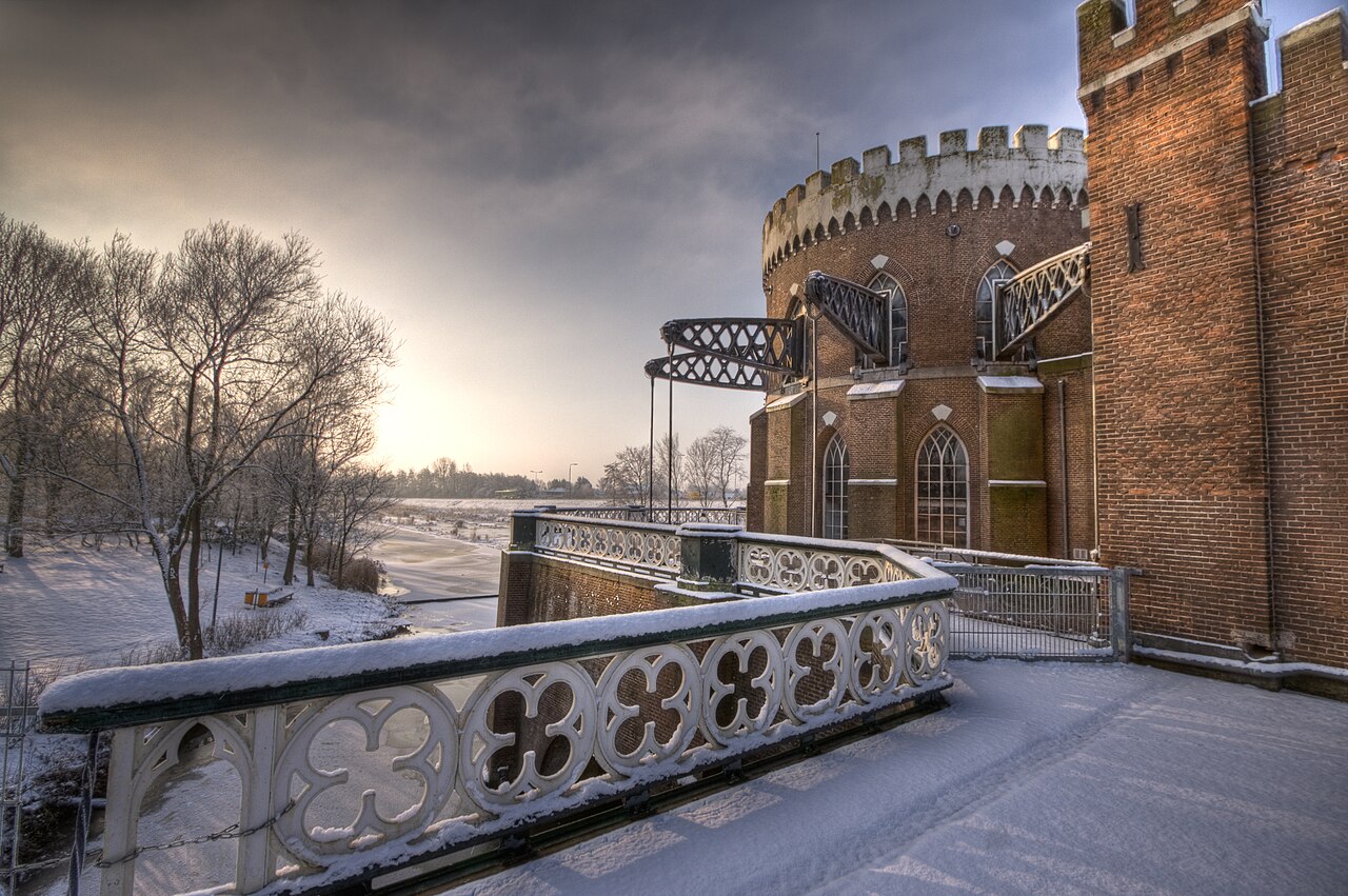
De Cruquius Pumping Station with its circular Gothic Revival engine house, chimney and projecting balance beams

Photo: Bas

Credit: Photo: Bas, via Wikimedia Commons, CC BY 2.0

Licence: CC BY 2.0

Changes: No changes.

Source β†—

The Netherlands and Water

De Cruquius Pumping Station

Haarlemmermeer

Where fields, housing estates, motorways and Schiphol now lie, the Haarlemmermeer still covered this landscape until 1852. The expanding lake was pumped dry by three enormous steam pumping stations. De Cruquius, dating from 1849, survives almost intact with its circular engine room, eight balance arms and colossal Cornish steam engine. The pumping station marks the transition from wind-powered drainage to industrial water engineering.

View this place
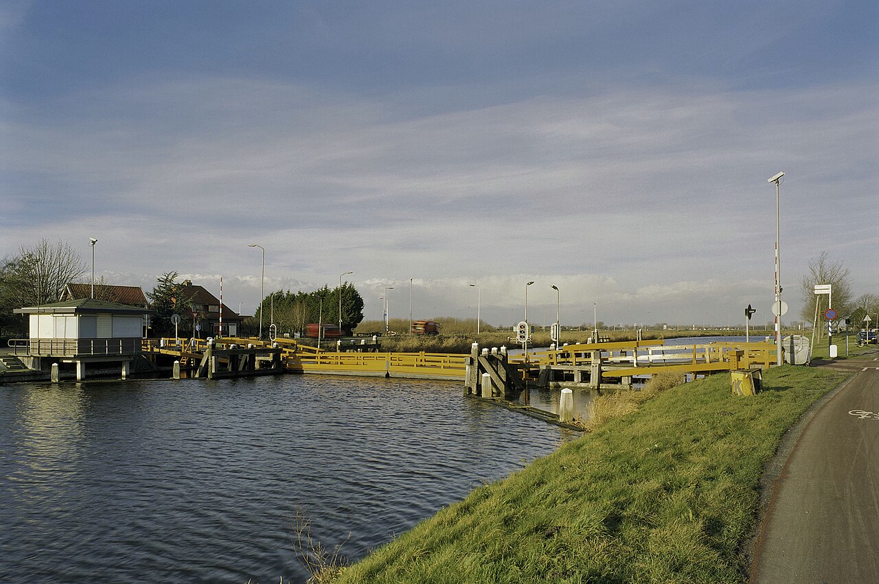
The Noordhollandsch Canal seen from the floating bridge at Koedijk

Photo: A.J. van der Wal

Credit: Photo: A.J. van der Wal / Cultural Heritage Agency of the Netherlands, via Wikimedia Commons, CC BY-SA 4.0

Licence: CC BY-SA 4.0

Changes: Cropped, resized and optimised for this website.

Source β†—

The Netherlands and Water

The Noordhollandsch Canal

Alkmaar

An almost eighty-kilometre nineteenth-century waterway between Amsterdam and Den Helder, built to provide large seagoing vessels with a reliable route.

View this place
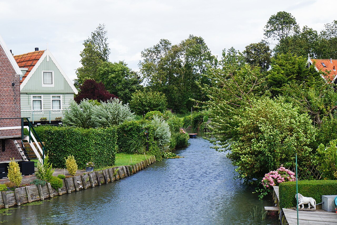
Green wooden houses in a densely built historic residential area in Marken

Photo: Rene Cortin

Credit: Photo: Rene Cortin, via Wikimedia Commons, CC BY-SA 4.0

Licence: CC BY-SA 4.0

Changes: No changes.

Source β†—

The Netherlands and Water

Marken and the Zuiderzee

Waterland

Discover how Marken lived with the Zuiderzee for centuries. Walk across raised dwelling mounds past wooden houses, narrow paths and the historic island landscape.

View this place
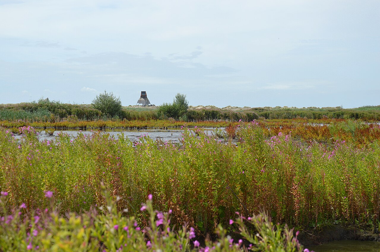
Observation tower Steltloper amid reeds, water and low vegetation on Marker Wadden

Photo: DimiTalen

Credit: Photo: DimiTalen, via Wikimedia Commons, CC0 1.0

Licence: CC0 1.0

Changes: No substantive changes; the image may be cropped and optimised for the website.

Source β†—

The Netherlands and Water

Marker Wadden

Markermeer

Marker Wadden is a young group of islands in the Markermeer, created with sand, clay and silt to form shallow water, mudflats, reed marshes and habitat for fish and birds.

View this place
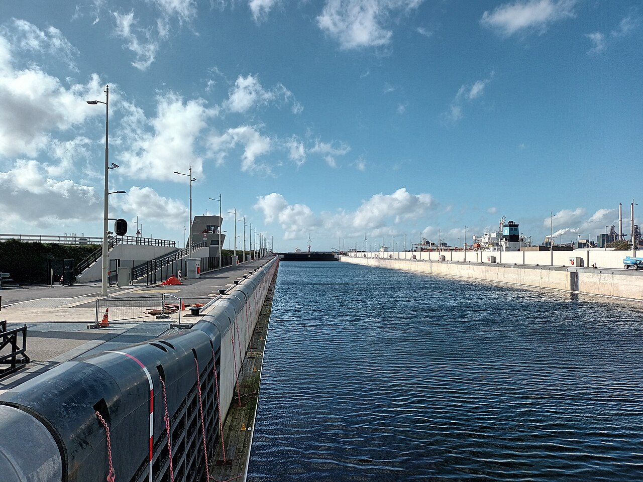
IJmuiden Sea Lock on the Noordzeekanaal in North Holland

Photo: Dronewar79

Credit: Photo: Dronewar79, via Wikimedia Commons, CC BY-SA 4.0

Licence: CC BY-SA 4.0

Changes: No changes.

Source β†—

The Netherlands and Water

Noordzeekanaal and the IJmuiden Sea Locks

Velsen

The Noordzeekanaal connects Amsterdam’s port with the North Sea. At IJmuiden in the municipality of Velsen lies one of the largest sea-lock complexes in the Netherlands, with the new sea lock serving as the gateway for large seagoing vessels bound for Amsterdam.

View this place
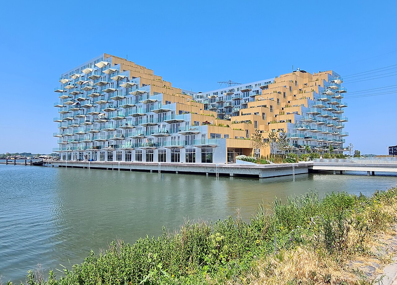
Sluishuis beside Lake IJmeer on IJburg

Photo: Kleon3

Credit: Photo: Kleon3, via Wikimedia Commons, CC BY-SA 4.0

Licence: CC BY-SA 4.0

Changes: No changes.

Source β†—

The Netherlands and Water

Sluishuis and the reclaimed land of IJburg

Amsterdam

Sluishuis stands at the western entrance to IJburg, an Amsterdam district developed from 1999 onwards on artificial islands in the IJmeer. The residential building partly rises above the water and embraces a small inner harbour. Here you can see how Amsterdam expanded not only along the water, but by creating new urban land within it.

View this place
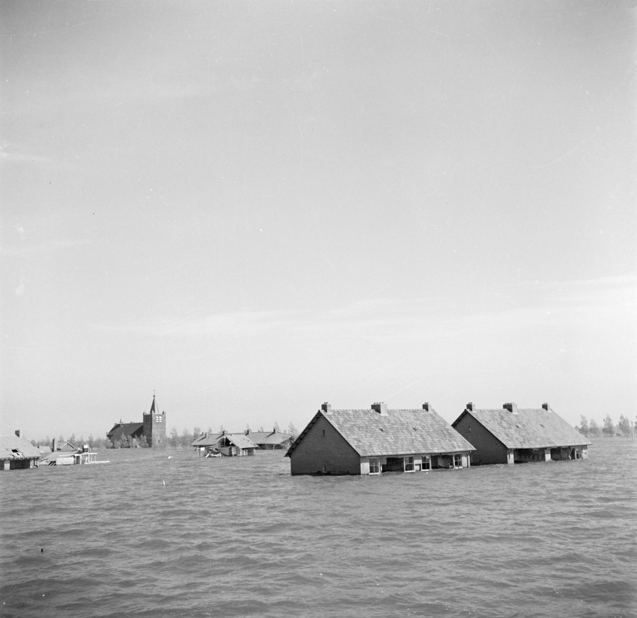
Flooded streets and houses in Wieringerwerf after the April 1945 inundation

Photo: Willem van de Poll

Credit: Photo: Willem van de Poll / Nationaal Archief, via Wikimedia Commons, CC0 1.0

Licence: CC0 1.0

Changes: No changes.

Source β†—

The Netherlands and Water

Wieringermeer and the 1945 dyke breach

Hollands Kroon

At Noorderdijkweg, the breach lakes, the curved repaired dyke and Dijkgatbos woodland are visible traces of the inundation of Wieringermeer in April 1945.

View this place

Look at lines, levels and flow

At a water site, look beyond the structure itself. Follow the dyke line, compare the water level with the land and look for old quays, lock chambers and drainage ditches. Often it is only from a higher point that the scale of a polder becomes clear, or why a lock was built precisely here.

Also notice the direction in which water moves. A pumping station, windmill or lock becomes fully understandable only when you know which water lies higher, where it is discharged and which area has to be protected.

Different places, one water system

The Afsluitdijk, Gemaal De Cruquius, De Beemster, the locks at IJmuiden and Wieringermeer differ greatly in scale and age. Yet they are all part of the same larger story: low-lying land that remains habitable only through continuous maintenance and new choices.

Do not visit these places as isolated monuments. Look at how dykes, canals, pumping stations, locks and polders connect. Then it becomes clear that the landscape of North Holland is not a fixed backdrop, but a water machine that every generation continues to modify.

More to discover

Explore the other themes

Alongside waterworks, discover remarkable nature, old structures, sacred places, vanished locations and stories that remain embedded in the landscape of North Holland.