
The story of this place
Amsterdam disappears behind the dyke
Anyone cycling from Amsterdam-Zuidoost towards Driemond notices how quickly the city gives way to open countryside. Flats, main roads and business parks give way to dykes, ditches and long views. Yet Driemond still lies within the municipality of Amsterdam. The village forms a small rural world on the south-eastern edge of the capital.
Its location is no coincidence. Driemond developed at a junction of waterways. The Gaasp, Gein and Smal Weesp meet here. For centuries, such waterways were the most reliable routes through the wet peat landscape. People lived, worked and travelled along their banks.
A village at three mouths
The name Driemond refers to the meeting of the three waterways. For a long time, the village was also known as Geinbrug, after the bridge across the Gein. Bridges and junctions were important landmarks in this landscape. They determined where people could cross the water and where buildings became concentrated.
The present village name also preserves the memory of a vanished country estate. In the seventeenth century, Amsterdam cloth merchant Gerbrand Anslo had a country house built here. Architect Philips Vingboons designed the estate. The house disappeared in the nineteenth century, but the name Driemond remained attached to the area.
The Gaasp and the low land
The Gaasp is an old peat river flowing from Driemond towards the Diem. During the Middle Ages, it formed a boundary in several places. After the surrounding peatland was reclaimed, the river became important for agriculture, drainage and transport.
In the seventeenth century, the Gaasp formed part of a route used by goods vessels and tow barges travelling towards Amsterdam. Existing rivers were connected to excavated canals and ring canals. What appears quiet and rural today was once part of a busy network carrying people, building materials, food and merchandise by water.
Much of the surrounding land consists of peat. Drainage and use gradually caused the soil to subside. Meanwhile, the water in rivers and main drainage channels remained at a higher level. This created the difference in height that is still clearly visible from the Lange Stammerdijk.
Rainwater and seepage collect in the polder ditches. This water cannot flow naturally into the higher Gaasp. It therefore has to be pumped up into it. Without drainage, meadows, roads and farmyards would become increasingly wet.
A mill dating from 1707
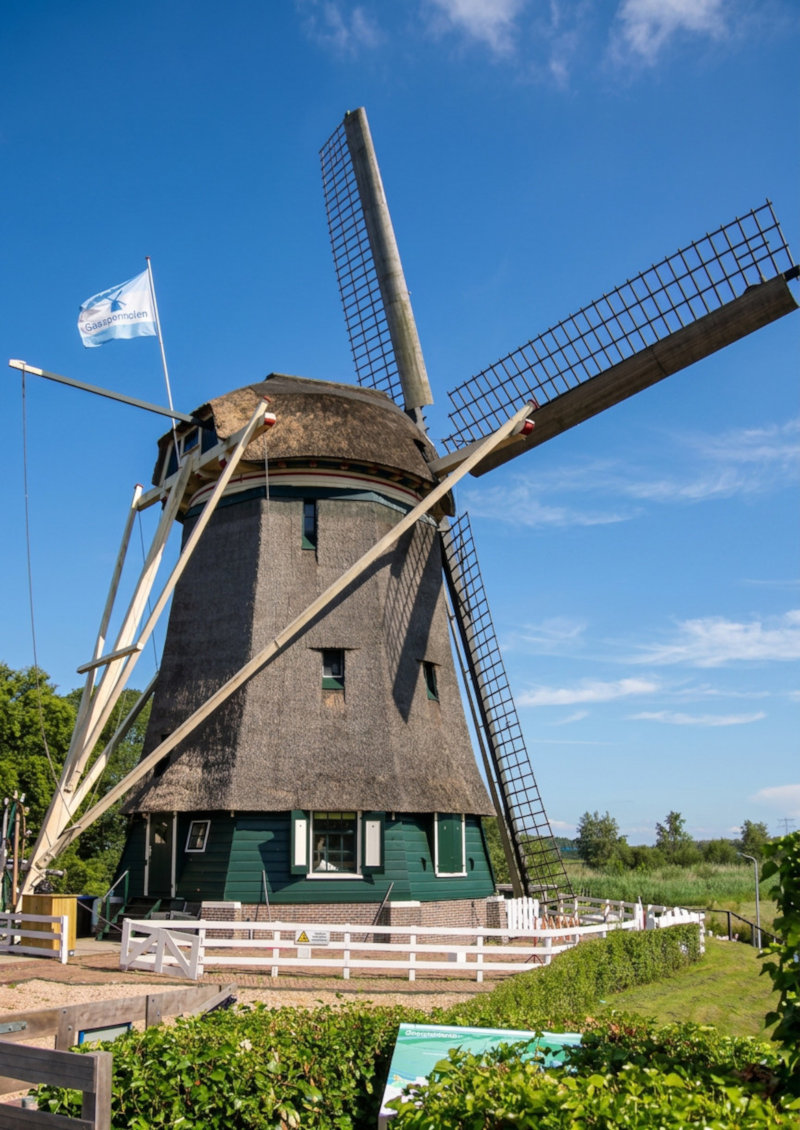
The present mill was built in 1707 to drain the Gemeenschapspolder. Its official name is Gemeenschapsmolen, although it is usually called Gaaspermolen. The mill stands directly beside the Gaasp, at the point where water from the low polder system can be raised into the higher outside water.
Originally this was done with a scoop wheel. At the end of the nineteenth century, the installation was modernised and the mill was fitted with an Archimedean screw. The sails powered the screw through a system of shafts and gears. The mill was therefore not a romantic feature in the landscape, but a large wooden machine.
From wind power to living water management
As the ground continued to subside, keeping the polder dry became increasingly difficult. In 1926, a diesel pumping station took over much of the work. The mill lost its sails, cap and machinery and remained beside the Gaasp for decades as a bare mill body.
By the 1990s, the pumping station was no longer sufficient either. Construction of the Diemerbos required the water level to be lowered further. The old pumping station was demolished and the mill was extensively restored. Reconstruction was completed in 2003. The historic body and brickwork were retained, while the cap, sails and internal machinery were rebuilt.
The mill can still lift water from the polder into the Gaasp. When there is enough wind, it operates on wind power. If the wind is insufficient, an electric drive can be used. Old and modern technology therefore do not work beside one another here, but within the same water-management system.
This is what makes the Gaaspermolen special. Many historic waterworks mainly show how things were done in the past. This mill demonstrates that the same difference in water level still exists and still has to be overcome. The technology changed, but the task remained.
Driemond owes its existence to waterways that brought people and goods together. The Gaaspermolen stands here because the land behind those same waterways continually had to be kept dry. In one short walk, you therefore see two opposing roles of water: as a connection and as a threat.
The country estate disappeared, the tow barges vanished and Amsterdam expanded almost to the edge of the village. But the Gaasp still flows beside the dyke. The polder still lies lower. And the mill still stands precisely on the boundary between the two.