
The story of this place
Between two water worlds
The Afsluitdijk runs from Den Oever in North Holland to the Frisian coast near Zurich. For more than thirty kilometres, it forms a sharp boundary between the Wadden Sea and the IJsselmeer. Tides, currents and salt water remain noticeable on its northern side. To the south lies the IJsselmeer, where water levels and discharge are much more tightly controlled. The road across the dyke turns that divide into a long, almost straight line through open water.
For centuries, the Zuiderzee was both a lifeline and a threat. Fishing communities depended on herring, anchovy, eel and other species. Trading towns used the water as a connection with the North Sea and more distant markets. At the same time, north-westerly storms could drive the water against the dykes and cause them to fail. Flooding, coastal erosion and the loss of agricultural land occurred repeatedly.
The Zuiderzee was also shallow and difficult to navigate. Sandbanks, channels and fluctuating water levels complicated access to Amsterdam for increasingly large sea-going vessels. Plans to close or reclaim parts of the sea therefore existed even before the nineteenth century. For a long time, however, they remained too expensive, technically uncertain or politically unfeasible.
From plan to construction
At the end of the nineteenth century, engineer Cornelis Lely developed a coherent plan. A closing dyke formed its essential first stage. Behind it, a more manageable freshwater lake would arise and several large polders could be constructed. The plan combined flood protection, agriculture, shipping and freshwater supply in a single intervention.
Political support increased after the storm surge of January 1916. Water entered parts of North Holland and again demonstrated the vulnerability of the region around the Zuiderzee. The Zuiderzee Act was passed in 1918. It instructed the state to close the Zuiderzee and reclaim sections of it.
Construction of the Afsluitdijk began in 1927. Work proceeded from Den Oever, from the Frisian coast and from artificial work islands such as Breezand and Kornwerderzand. Sand formed the core of the dyke. Boulder clay formed a heavy, poorly permeable layer that could withstand currents and wave action. Basalt, rubble and other materials protected the outer face.
Closure and the new IJsselmeer
The work did not simply advance as one dyke from both ends. Separate sections were constructed at several locations, after which the remaining openings were gradually reduced. Water flowed increasingly rapidly through these closing gaps as less space remained. The final phase therefore required precise planning, enormous quantities of material and continual adjustment to currents, wind and tide.
On 28 May 1932, the final opening was closed at the Vlieter. The direct connection between the Zuiderzee and the Wadden Sea had been severed. One year later, the road across the dyke opened to traffic. River inflow, rainfall and discharge through the sluices gradually freshened the water south of the dyke. The Zuiderzee became the IJsselmeer.
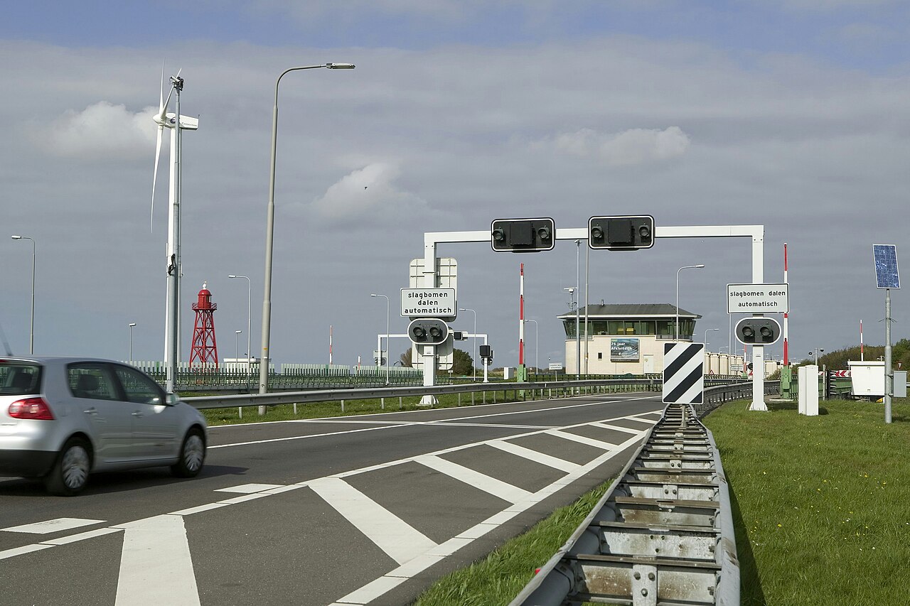
Large sluice complexes were built at Den Oever and Kornwerderzand to discharge excess water from the IJsselmeer when the water level in the Wadden Sea is sufficiently low. Navigation locks allow vessels to pass between the two bodies of water. The Afsluitdijk is therefore not merely a closed barrier, but a regulated system in which water management, shipping and safety are continually balanced.
A new landscape with new consequences
Closure made water levels easier to control and simplified the construction of new polders. Wieringermeer had already been drained shortly before the closing of the dyke. The Noordoostpolder and Eastern and Southern Flevoland followed later. Together, these works profoundly altered the shape of the Netherlands, its coastline and the division between land and water.
The consequences were not entirely beneficial. Fishing communities around the former Zuiderzee lost their direct connection with salt water. The traditional Zuiderzee fishery declined sharply or disappeared. The ecosystem changed as well. Saltwater and brackish species gave way to freshwater species, while migratory fish now had to pass locks and other barriers. The dyke brought safety and new land, but also ended an existing aquatic world.
The Afsluitdijk also acquired military significance. Casemates were built at Den Oever and Kornwerderzand to defend the locks and road connection. In May 1940, Dutch troops at Kornwerderzand resisted German attacks. The Vlieter Monument, designed by Willem Dudok, marks the area where the final gap was closed in 1932. Notice the contrast between its vertical tower and the long horizontal dyke.
The Afsluitdijk is not simply a finished work from the past: its locks, surface protection and dyke body continue to be adapted to higher water levels, greater discharge and new ecological demands. It did more than create a road across the water; it drew a boundary that still has to be maintained, adapted and rethought.