
The story of this place
Here there was only water
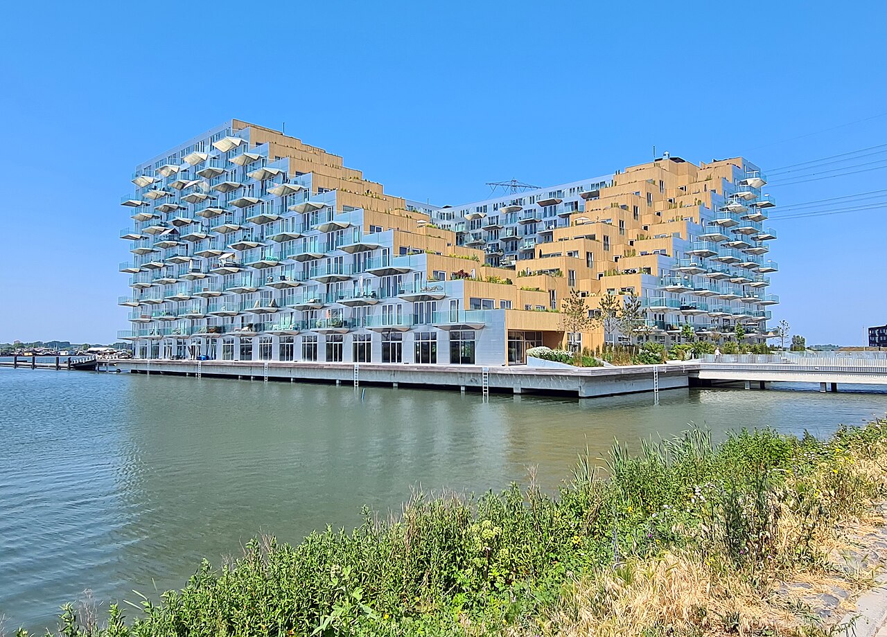
Walking around Sluishuis, it is easy to forget how recently this edge of the city came into existence. The building stands on the western side of IJburg, exactly where the developed islands meet the open waters of Lake IJmeer. From the quay, the apartment block seems to rise from the lake. Two corners are lifted, allowing light, boats and views to pass beneath the building.
This is more than an architectural gesture. It suits a district that was itself created from water. At the end of the twentieth century, Lake IJmeer still covered the site of today’s streets, gardens and apartment blocks. Amsterdam needed new homes but had less and less space on existing land. The city therefore looked not only towards the edges of the land, but towards the water itself.
A city district begins with sand
During the 1990s, Amsterdam chose to develop IJburg, then often called Nieuw-Oost. The plan consisted of a series of artificial islands between Zeeburgereiland and the open IJmeer. Homes, roads, bridges, tram lines, schools and shops all had to be designed from scratch.
Construction began in 1999. No ring dyke was built around a large body of water to pump it dry, as in a traditional reclamation project. Instead, sand was deposited, spread and compacted on the bed of Lake IJmeer. Layer by layer, the bottom rose until new land appeared above the water. Before the first house could be built, the city literally had to be constructed from the bed of the lake upwards.
Islands made of sand
This process created Steigereiland, Haveneiland and the Rieteilanden, among other islands. The new ground first had to settle sufficiently before roads, utilities and buildings could be constructed. The first residents moved in at the end of 2002. IJburg then continued to grow in phases, with different densities and forms of housing on each island.
Water remained part of the design throughout. Canals, harbours, bridges, jetties and open shorelines connect the residential areas with Lake IJmeer. Some homes stand directly beside the water, while others overlook broad inner harbours or narrow canals. IJburg therefore does not simply lie beside the water. The district uses it as a navigation route and recreational area, while also making it part of the view and public realm.
A residential building that leaves room for water
This open relationship with the water is particularly visible around Sluishuis. Designed by Bjarke Ingels Group and Barcode Architects, the building was completed in 2022. It contains hundreds of homes, shared facilities and an inner harbour. The large block matches the urban scale of IJburg, but is shaped so that water remains visible beneath and through the complex.
On the IJmeer side, the building rises in terraces. Elsewhere, parts of the structure are lifted and homes project above the water. These elevated corners create passages and views towards the inner harbour. The boundary between building, quay and water becomes less distinct. Sluishuis does not simply stand on a shoreline, but forms part of the water’s edge itself.
Between the city and the open IJmeer
Public walking routes, jetties and seating areas surround the building. From the quay, you can look across Lake IJmeer towards Durgerdam and Pampus. Turn around and you see the compact development of Steigereiland and Haveneiland. Open water, newly created land and contemporary urban architecture face one another directly in a single place.
The creation of IJburg was not without controversy. Housing, accessibility and urban growth had to be balanced against ecological values, water quality and the open landscape of Lake IJmeer. Opponents feared damage to habitats and the loss of open water. Shallow zones, nature-friendly shorelines and new habitats were therefore also created around the islands.
IJburg shows that modern land creation is never merely an engineering achievement. Every new area of reclaimed land changes currents, water depth, views and habitats. At the same time, homes and public spaces arise where there was previously only water. Amsterdam’s boundary was not simply pushed outwards here; it was redesigned.
Walk around Sluishuis once more and notice how the building responds differently to the water on each side. On one side, it forms a solid urban wall. On the other, it opens above the harbour and Lake IJmeer. It is neither a lock nor a traditional water-management structure. Yet it captures the essence of IJburg remarkably well: Amsterdam first made land here and only then built a city, without allowing the water to disappear entirely from view.